Marmare Pass, starting from Caussou

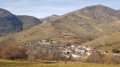
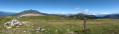
Caussou, a small, typical mountain village, is the starting point for this hike to the Col de Marmare.
Yellow markings, a lovely path. No difficulties apart from the fairly steep climb to the pass.

Details

3009018
Creation:
Last update:
Last review:
  • Walking
    Activity: Walking
  • ↔
    Distance: 6.07 mi
  • ◔
    Average duration: 4h 20 
  • ▲
    Difficulty: Moderate

  • ⚐
    Back to start: Yes
  • ↗
    Ascent: + 1,752 ft
  • ↘
    Descent: - 1,742 ft

  • ▲
    Highest point: 4,475 ft
  • ▼
    Lowest point: 2,792 ft

Photos

Description of the walk

Car park on the right as you enter the village below, just below the church.

(S/E) Return to the main street, turn right and carry on to the chapel.

(1) Take the narrow lane on the left, which leads to a path overlooking the pass road (D20).

(2) Ignore the path straight ahead and veer to the right to join the track that climbs (the IGN map is incorrect here). Follow this track to Font Morte.

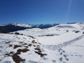
(3) Turn left onto the path that climbs to the Col de Marmare (alt. 1361 m).

(4) From the pass, return to Font Morte.

(3) Turn left onto the path leading uphill, passing a small waterfall.

(5) Leave the path on the left and follow the track on the right downhill towards the Linats stream. Cross the stream and walk a few metres.

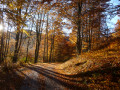
(6) Turn right onto a path through the woodland that descends to the RD20.

(7) Carefully head back up this road to the left, then turn right onto the path leading back to Caussou, which you’ll reach via Rue Charlemagne. Follow this street straight on, continuing along Rue du Breilh to reach the cemetery. Walk alongside the cemetery, then take the sharp right-hand bend to return to the car park (S/E).

Waypoints

  1. S/E : mi 0 - alt. 2,812 ft - Car park in the village of Caussou
  2. 1 : mi 0.16 - alt. 2,841 ft - Chapel
  3. 2 : mi 0.87 - alt. 3,087 ft - Turn right at the fork
  4. 3 : mi 1.79 - alt. 3,379 ft - Font Morte
  5. 4 : mi 2.78 - alt. 4,449 ft - Col de Marmare (1361m)
  6. 5 : mi 3.98 - alt. 3,491 ft - Track on the right
  7. 6 : mi 4.27 - alt. 3,455 ft - Path on the right
  8. 7 : mi 5.19 - alt. 2,999 ft - RD20, turn left
  9. S/E : mi 6.07 - alt. 2,812 ft - Car park in the village of Caussou

Notes

Sturdy shoes and walking poles are essential for the climb to the pass.
(2) No water along the route

Worth a visit

Luzenac.
Lordat Castle.
Beille Plateau.
Appy Lake

Reviews and comments

4.1 / 5
Based on 3 reviews

Reliability of the description
4.3 / 5
Ease of following the route
5 / 5
Route interest
3 / 5
Core In
Core In

Overall rating : 4 / 5

Date of your route : Nov 12, 2023
Reliability of the description : ★★★☆☆ Average
Ease of following the route : ★★★★★ Very good
Route interest : ★★★★☆ Good
Very busy route : No

A rather unremarkable walk, with a very steep climb up to the Col de Marmare to reach the top, leading straight onto the county road...

Machine-translated

guy.leglouet
guy.leglouet

Overall rating : 4 / 5

Date of your route : Oct 03, 2022
Reliability of the description : ★★★★★ Very good
Ease of following the route : ★★★★★ Very good
Route interest : ★★☆☆☆ Disappointing
Very busy route : No

The climb up to the Col de Marmare (from point 3 to point 4) was tough for us, and the view on reaching the pass did not make our efforts worthwhile (we arrived at the crossroads).
However, the rest of the route was pleasant. The village of Caussou was lovely.
We would like to thank the creators of these walks, which allow us to discover places we would never have dared to venture into.

Machine-translated

d85
d85
• Edited:

Overall rating : 4.3 / 5

Date of your route : Jun 25, 2020
Reliability of the description : ★★★★★ Very good
Ease of following the route : ★★★★★ Very good
Route interest : ★★★☆☆ Average
Very busy route : No

A moderate hike. The pretty village of Causou is well worth a visit for the attractions in its narrow streets
The views are obscured all the way to the Col de Marmare. On the way back, there is a much clearer view of the surrounding mountains.

Machine-translated

Other walks in the area

For more walks, use our search engine .

The GPS track and description are the property of this route's author. Please do not copy them without permission.