Country:

 City:
City:


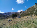
From Les Cabannes, take the D520a towards Aston, then follow signs for the Riète Dam and Étang Laparan.
The start is just before the Riète Dam. There is a car park just before the bridge, at ‘La Coudènes’. The red and white markings ofthe GR®®10, which cross the road at this point, are clearly visible. You’ll take this route on the way back.
Start from the “Coudènes” car park.
(S/E) Cross theGR®®10. Head up the road (D520a), which winds its way up through a few bends.
(1) Walk along the right bank of the dam. Cross the Ruisseau d’Aston via the road bridge and continue for a further 100 m.
(2) Leave the road and turn right onto the track. You’ll come to a small bridge crossing the Ruisseau de Quioules. Follow the path (green markings) uphill; the climb is steep at the start.
(3) Caution: do not venture under the rocky outcrops. Do not hesitate to turn back if you have gone too far. Turn right (north), then west, to continue along the path which passes over a small pass and descends towards the Pont du Pas de la Crabe.
(4) Continue along the right bank on the path, which is sometimes poorly marked, as it runs alongside the stream. Initially running alongside the stream, it then veers away before drawing close to it again. Cross two footbridges.
(5) Pass under a water-collection pipe that runs up both sides of the mountain.
Caution: do not take the paths that cross or lead up towards the water collection points.
- Continue along the Ruisseau de Quioulès.
(6) You’ll reach a dam and continue across the large flat area: the hut is at the far end of this area.
(7) The path passes close to a footbridge which you will use on the way back. Carry on straight ahead to reach the Cabane de Quioulès (alt. 1,610 m)
(8) A lovely hut, with a well-equipped open area and a small woodpile next to it.
The second part of the route is mainly off-track, sometimes following a faint track, and requires good sense of direction, or following your GPS track.
From the hut, you can see quite clearly a pass at around 1,770 m to the north, and two rocky ridges. You need to head up through the forest at this point, between these two ridges. Return to the plain towards the metal footbridge seen earlier.
(7) Cross the stream and continue northwards through a fairly damp area. A faint track leads to the foot of the rocky outcrops. Re-enter the forest and climb (steeply) between the two outcrops. You’ll come to a path, not shown on IGN maps, which climbs towards the pass (alt. 1,770 m).
(9) From the pass, continue through the scree slopes, heading slightly to the left (west). If necessary, there is a footbridge a little further west to cross the stream. You will reach the Rieutort de Gascous hut.
(10) From this hut, a track heads east, then turns northwards, still through the scree, for a long, gently ascending traverse towards a pass at an altitude of 1,800 m.
(11) Head straight down northwards, off the path, through the forest, until you reach a plain and arrive at the Orri des Ludines (alt. 1,600 m).
(12) Then cross the flat area towards the north-east and rejoin a path along the left bank of the Ruisseau de Calvière, before crossing it via a footbridge.
(13) Continue along the stream to join theGR®®10;
(14) Follow it to the right down a fairly steep descent which leads to (D:A).


 Visorando Member
 Moderate
 Easy
Easy 
 Very difficult