


Refine your search for walks in Termignon
Termignon walks


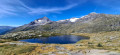
 The Bellecombe Lakes and others
 Visorando Member
 6.37 mi
 +1,417 ft
 -1,398 ft
 4h 10
 Moderate
 Departure from Termignon (Savoie)
This is a lovely, easy hike in the Vanoise.
It is also a lake circuit dominated by the Vanoise glaciers between the Dent Parrachée and the Grande Casse.
From Lac Blanc to the Plan du Lac refuge, the route is neither mapped nor marked.
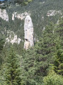
The Roc des Corneilles and the Sardière Monolith
 Tourism professional
 8.14 mi
+3,842 ft
-3,825 ft
7h 05
 Difficult
Departure from Sollières-Sardières (Savoie)
The Roc des Corneilles is a beautiful rocky outcrop formed by cargneulisation. At its base, the Trou de la Lune opens out onto the Râteau d’Aussois. On the way back, be sure to walk around the Sardière Monolith.
Refuge de l'Arpont - The lakes and the Arpont Glacier (alternative route)
 3.98 mi
+1,742 ft
-1,729 ft
3h 20
Moderate
Departure from Termignon (Savoie)
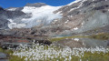
This6th stage is a variation on the route starting from the Refuge de l'Arpont. We decided to spend two days on this hike to explore the Lacs de l'Arpont and its magnificent glacier. An exceptional hike that will allow you to get as close as possible to this glacier. The lakes are splendid. If you’re feeling brave, don’t hesitate to take a very refreshing dip.
Refuge de l'Arpont - Refuge de la Fournache
 10.62 mi
+2,533 ft
-2,365 ft
7h 05
Difficult
Departure from Termignon (Savoie)
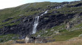
Stage7 of this journey takes you from the Refuge de l’Arpont to the very welcoming Refuge de la Fournache. This stage skirts around the Dent Parrachée. This is the last time you will see the Vanoise glaciers. This trail, which is at times technical and challenging due to its elevation gain, overlooks the Maurienne Valley, Val Cénis and, on the other side, Italy. You will also catch a glimpse of the Thabor, before arriving at the bottom of Aussois, with its two lakes and the Aussois dam.
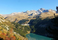
From the Refuge de l'Arpont to the Refuge de l'Orgère
 17.46 mi
+3,816 ft
-5,043 ft
11h 20
Difficult
Departure from Termignon (Savoie)
This tenth stage completes the crossing of the Vanoise massif. From the Refuge de l’Arpont, the GR®5 descends to the hamlet of Le Mont, crosses the Combe d’Enfer, climbs the flank of the Crête de Belle Place and crosses the valley of the Ruisseau de Bonne Nuit to reach the ruins of the hamlet of La Loza. It follows the contour of a rocky ridge like a balcony and descends via a few hairpin bends towards a ravine, then continues almost level through the Bellecôte valley. The path passes beneath the chairlifts of the Aussois ski resort and runs alongside the Plan Sec and La Fournache mountain huts. It skirts around Lac du Plan d’Amont and runs along the upper edge of Lac du Plan d’Aval before crossing the Col du Barbier. It climbs towards the Barbier chalets and descends to the hamlet of l’Orgère to reach the Refuge de l’Orgère.
Pointe du Grand Vallon and Pointe de Lanserlia circular route
 7.51 mi
+3,255 ft
-3,241 ft
7 hrs
 Very difficult
Departure from Termignon (Savoie)
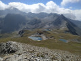
This is a wild hike where you won't encounter anyone except chamois and marmots before arriving near the three magnificent Lanserlia Lakes. It will test your sense of direction, as part of the route is off-trail.
This is ademanding hike, reserved for experienced hikers. GPS tracking is recommended.
Pointe and lakes of Lanserlia
11.72 mi
+3,323 ft
-3,307 ft
8h 15
Difficult
Departure from Termignon (Savoie)
A wild hike is possible in Vanoise: the first part, which leads to the lakes and the Pointe de Lanserlia, is well marked, even if it is not signposted. The rest of the route to the Plateau du Turc is away from the main paths that criss-cross the massif and includes a tricky section between (8) and (9), which is why it is classified as difficult.
 The Sardières Monolith at the start of the Croix d’Aussois trail
 4.53 mi
+732 ft
-751 ft
4 hrs
Moderate
Departure from Aussois (Savoie)
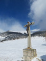
This route, known as ‘La Piste Blanche’, is clearly marked in purple. It is not groomed and more or less follows a summer path, though at times it also runs alongside cross-country ski tracks, which you should follow on the opposite side to the tracks reserved for cross-country skiers. We followed the trail left by previous walkers, which does not necessarily correspond to the summer path!
La Femma Mountain Hut – La Leisse Mountain Hut
9.10 mi
+1,654 ft
-1,230 ft
5h 35
Difficult
Departure from Termignon (Savoie)
Day3 of a two-circular route in the Vanoise National Park, from the Refuge de la Femma to the Refuge de la Leisse.
There’s nothing particularly complicated about this hike, where we’ll descend the Femma valley before climbing back up alongside the Leisse valley, which I’m particularly fond of.
Refuge de la Femma to Val d'Isère via the Col des Fours and Col de l'Iseran
11.97 mi
+4,918 ft
-4,285 ft
8 hrs
Very difficult
Departure from Termignon (Savoie)
Second day of this mini trek around Tignes-Val d'Isère, three legendary passes in the Vanoise with magnificent views of the neighbouring glaciers. A long day with a few technical sections, particularly at Tunnel 3000 (7).
Refuge de la Leisse- Refuge de Plan Sec
20.31 mi
+4,426 ft
-4,948 ft
13h 10
Difficult
Departure from Termignon (Savoie)
Étape de la Grande Traversée des Alpes traversant le Parc National de la Vanoise du Nord au Sud.
Refuge de la Leisse – Refuge de la Femma
 5.28 mi
+1,214 ft
-1,667 ft
3h 30
Moderate
Departure from Termignon (Savoie)
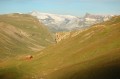
This route follows an unmarked but useful path between the Refuge de la Leisse and the Refuge de la Femma, crossing the Col de la Pierre Blanche.
La Leisse – Tignes Val-Claret
 6.01 mi
+892 ft
-2,142 ft
3h 30
Moderate
Departure from Termignon (Savoie)
A steady climb takes you to the Col de la Leisse (2,761 m), offering breathtaking views of the Grande Motte glacier, before descending to Tignes Val-Claret with, in the background, the Dôme de la Sache (3,588 m), the Pointe de la Grande Sassière and, to the left, the Col du Palet and the Pointe du Chardonnet.
More walks in Termignon
Select a point of interest below: