The Vallonbrun Refuge, starting from Lanslevillard

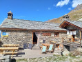
A lovely day’s hike, starting from the centre of Lanslevillard. The flora of the Vanoise, marmots, perhaps even the bearded vulture, and magnificent panoramic views await you on this hike, which includes a stop at the refuge, where the wardens are very friendly.

Details

11274430
Creation:
Last update:
Last review:
  • Walking
    Activity: Walking
  • ↔
    Distance: 7.62 mi
  • ◔
    Average duration: 6h 00 
  • ▲
    Difficulty: Difficult

  • ⚐
    Back to start: Yes
  • ↗
    Ascent: + 2,854 ft
  • ↘
    Descent: - 2,825 ft

  • ▲
    Highest point: 7,530 ft
  • ▼
    Lowest point: 4,797 ft

Photos

Description of the walk

Park in the car park at the Lanslevillard Tourist Office. The start is opposite.

(S/E) Take the road (Grand Rue) which goes straight up to a fork.

(1) At the top of the road, take the path on the left and go round the chalet to turn right, then continue uphill along the path through the fields. Signs for the Vanoise National Park are on the right.

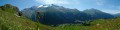
(2) Begin a fairly steep climb with panoramic views of the village and the valley. Cross the Ruisseau du Pichet and arrive at a wide track.

(3) Turn onto the path leading down to the right. Pass the Grattais car park and the park’s information boards.

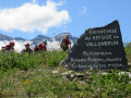
(4) Cross the Ruisseau de Burel and turn left onto a path that winds its way uphill until you reach the sign for the Refuge de Vallonbrun on the left. Take a moment to admire the flora and butterflies along the streams. And don’t miss the view of the peaks.

(5) Take this mountain pasture track, which is an easy and very pleasant climb. The refuge is 20 minutes away. Pass La Fesse d’en Bas. Watch the marmots scampering about in the fields. The refuge will be on your right; make the most of this opportunity to top up your water supplies.

(6) Continue along this mountain pasture track to reach the Chapelle Saint-Antoine and head down the path on the right. Cross the Ruisseau des Granges and continue south-west. Take care not to miss the path branching off to the left into the alpine meadows, which are full of flowers in early summer. Climb the steps at the foot of the cliff. You’ll arrive at Le Petit Pass, a village at the foot of the Col de la Madeleine.

(7) Continue along the road to the right which runs alongside the Col de la Madeleine via ferrata. Carry on until you reach the departmental road.

(8) Take the Route Forestière des Grattais, which climbs gently to the right, until you reach the path leading down to the left towards the Chapelle Saint-Laurent (Lanslevillard is signposted there).

(9) At the Saint-Laurent Chapel, cross the stream and head slightly uphill to reach the village of Lanslevillard via a path that is occasionally exposed.

(10) Walk alongside the access paths to the Via Ferrata and, when you reach a bench, take the path on the left which leads back to the chalets at the top of Lanslevillard. Return to the junction you passed on the way out.

(1) Follow the route back in the opposite direction to reach the car park at the Lanslevillard Tourist Information Centre (S/E).

Waypoints

  1. S/E : mi 0 - alt. 4,797 ft - Lanslevillard Tourist Information Centre car park - Arc (rivière) - Affluent de l'Isère
  2. 1 : mi 0.08 - alt. 4,849 ft - Crossroads at the end of the circular loop
  3. 2 : mi 0.37 - alt. 5,089 ft - Start of the ascent
  4. 3 : mi 0.96 - alt. 6,053 ft - Junction with wide track
  5. 4 : mi 1.44 - alt. 5,942 ft - Burel Stream
  6. 5 : mi 2.81 - alt. 7,175 ft - Alpine road.
  7. 6 : mi 3.38 - alt. 7,454 ft - Return via the St Antoine Chapel
  8. 7 : mi 5.28 - alt. 5,755 ft - Arrival at the small pass
  9. 8 : mi 5.98 - alt. 5,558 ft - Ascent via the Grattais forest road
  10. 9 : mi 6.45 - alt. 5,410 ft - St Laurent Chapel
  11. 10 : mi 7.07 - alt. 5,039 ft - Lanslevillard Via Ferrata.
  12. S/E : mi 7.62 - alt. 4,806 ft - Lanslevillard Tourist Information Centre car park

Reviews and comments

4.6 / 5
Based on 3 reviews

Reliability of the description
4.7 / 5
Ease of following the route
4.3 / 5
Route interest
4.7 / 5
User 21987085

Overall rating : 4.7 / 5

Date of your route : Jul 10, 2025
Reliability of the description : ★★★★★ Very good
Ease of following the route : ★★★★★ Very good
Route interest : ★★★★☆ Good
Very busy route : No

A beautiful hike to see marmots with magnificent views of the valley and mountains. The climb is a little steep in places to reach the lovely Vallonbrun refuge, where you will receive a very warm welcome and delicious homemade herbal tea (bring cash). The descent is easy.

Machine-translated

Gene5644
Gene5644
• Edited:

Overall rating : 4.7 / 5

Date of your route : Jan 07, 2023
Reliability of the description : ★★★★★ Very good
Ease of following the route : ★★★★☆ Good
Route interest : ★★★★★ Very good
Very busy route : No

Hello. We did this route in January when there wasn’t much snow. It’s doable, but we should have taken snowshoes as they would have come in handy from point 5 onwards.
At the small pass, we put on our crampons to reach the hunters’ path; after that, it was plain sailing all the way to Lanslevillards.
It was superb and we were lucky enough to have a sunny, cloudless day.
Please note that the main room of the refuge is open, but there is no warden in winter.
Make sure you check the conditions thoroughly before tackling this route in winter, as it’s rarely accessible.

Machine-translated

bernard951
bernard951

Overall rating : 4.3 / 5

Date of your route : Aug 08, 2021
Reliability of the description : ★★★★☆ Good
Ease of following the route : ★★★★☆ Good
Route interest : ★★★★★ Very good
Very busy route : No

A superb walk starting from Lanslevillard. A warm welcome at the mountain hut and some tarts… mmm!
The start is a bit steep, but once past the Grattais car park it’s a real treat; we returned via the chapels. A lovely day, with a few rare sightings of marmots.

Machine-translated

Other walks in the area

For more walks, use our search engine .

The GPS track and description are the property of this route's author. Please do not copy them without permission.