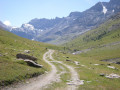
Refuge de la Femma to Val d'Isère via the Col des Fours and Col de l'Iseran

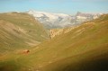
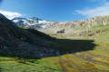
Second day of this mini trek around Tignes-Val d'Isère, three legendary passes in the Vanoise with magnificent views of the neighbouring glaciers. A long day with a few technical sections, particularly at Tunnel 3000 (7).

This walk is part of a multi-day hike: Boucle en Vanoise autour de Tignes/Val d'isère

Details

78942074
Creation:
Last update:
Last review:
  • Walking
    Activity: Walking
  • ↔
    Distance: 11.97 mi
  • ◔
    Duration according to the author: 8 hrs 
  • ▲
    Difficulty: Very difficult

  • ⚐
    Back to start: No
  • ↗
    Ascent: + 4,918 ft
  • ↘
    Descent: - 4,285 ft

  • ▲
    Highest point: 9,764 ft
  • ▼
    Lowest point: 7,726 ft

Description of the walk

(S) Set off from the Refuge de la Femma towards the Col de la Rochure by taking the path on the left as you leave the refuge.

(1) At the pass, head towards the Refuge du Fond des Fours, first due east then north-east.

(2) 300 m before the refuge, the path up to the Col des Fours is on your right, but I recommend carrying on to the refuge to top up your water and take a short break before the climb.

(3) Retrace your steps to the fork.

(2) Continue left towards the Col des Fours.

(4) Continue north-east along the path towards the Pont de la Neige. (You can also carry on to the Pointe des Fours on your right: please note that the path is unmarked but clearly defined, with some slightly exposed sections).

(5) At Pont de la Neige, head up towards Col de l'Iseran by taking the GR®5 path on the left.

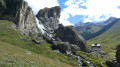
(6) Once at the pass, take the path on the left after the Notre-Dame de l'Iseran Chapel. Please note that from this point onwards you will be on an unmarked but fairly well-defined path, with some exposed sections that are, however, equipped with fixed ropes. You can find the route of this section on the 35 km High Trail Vanoise course.) Follow the path to the 3000m tunnel, taking care of the snowfields which may persist until August.
(If you do not feel confident enough to tackle this section, you can easily follow the GR®5 to Val d’Isère.)

(7) At the tunnel exit, take the track down towards the Lessières chairlift.

(8) At the chairlift station, join the ski run of the same name and follow it down to the track.

(9) Follow it to the left, pass in front of the La Datcha restaurant and continue along the track to Lac de l'Ouillette.

(10) To reach the Solaise Gondola station (E), take the path on the right shortly after the restaurant by the lake. The descent to Val d'Isère is free in summer and is very pleasant after a long day.

Waypoints

  1. S : mi 0 - alt. 7,726 ft - Refuge de la Femma
  2. 1 : mi 2.71 - alt. 9,557 ft - Col de la Rocheure
  3. 2 : mi 5.32 - alt. 8,353 ft - Junction towards the refuge
  4. 3 : mi 5.5 - alt. 8,323 ft - Refuge du Fond des Fours
  5. 4 : mi 6.75 - alt. 9,764 ft - Col des Fours (2976m)
  6. 5 : mi 8.32 - alt. 8,323 ft - Pont de la Neige
  7. 6 : mi 9.14 - alt. 9,065 ft - Col de l'Iseran
  8. 7 : mi 10.16 - alt. 9,190 ft - Tunnel 3000
  9. 8 : mi 10.48 - alt. 8,917 ft - Les Lessières chairlift
  10. 9 : mi 11.32 - alt. 8,228 ft - Vehicle-accessible track
  11. 10 : mi 11.76 - alt. 8,255 ft - Lac de l'Ouillette
  12. E : mi 11.97 - alt. 8,366 ft - Solaise cable car

Notes

Water at the Refuge du Fond des Fours.

(6) A fairly technical but well-maintained section towards the 3000 tunnel (7). For experienced hikers only.

Worth a visit

I recommend pushing on to Pointe des Fours from the pass of the same name: the view is magnificent.

Always be cautious and plan ahead when you're outdoors. Visorando and the author of this route cannot be held responsible for any accidents occurring on this route.

The GR® and PR® markings are the intellectual property of the Fédération Française de Randonnée Pédestre.

Other walks in the area

For more walks, use our search engine .

The GPS track and description are the property of this route's author. Please do not copy them without permission.