Refuge du Roc de la Pêche – Refuge Porte de l’Orgère

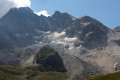
Hike between the Vanoise and Maurienne regions: from the Refuge du Roc de la Pêche to the Refuge Porte de l’Orgère via the Col de Chavière.

This walk is part of a multi-day hike: The tour of the Pointe de l’Echelle

Details

189943
Creation:
Last update:
Last review:
  • Walking
    Activity: Walking
  • ↔
    Distance: 8.90 mi
  • ◔
    Average duration: 6h 40 
  • ▲
    Difficulty: Difficult

  • ⚐
    Back to start: No
  • ↗
    Ascent: + 2,986 ft
  • ↘
    Descent: - 2,930 ft

  • ▲
    Highest point: 9,173 ft
  • ▼
    Lowest point: 6,273 ft

Photos

Description of the walk

DAY 2

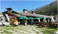
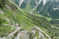
(S) After a good night’s rest at the Roc de la Pêche refuge, it’s time to set off again. Take theGR®55from the foot of the refuge (red and white markings) and climb gently in a south-south-westerly direction along the Chavière stream.

(1) Pass the Chapendu farm (1,930 m) and continue climbing along the GR®.

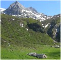
(2) Pass the Ritort farm (1,972 m); keep to the right as you follow the stream.

(3) Walk past the Mollaret d’en Bas farm and continue climbing along theGR® to the junction for the Péclet-Polset refuge.

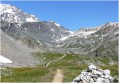
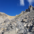
(4) Continue straight on along theGR® and, once at the summit section of the pass, follow the cairns or tracks across the snowfields until you reach the Col de Chavière.

(5) The start of the descent is similar to the end of the ascent (cairns and tracks on the snowfields up to 2,650m).

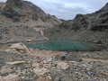
(6) You’ll come to a good path; continue down to Lac de la Partie.

(7) Pass slightly above the lake and reach a three-way junction at 2,490m.

(8) Turn left, leave theGR®55and continue descending, keeping to the right, until you reach the ruins of L’Estiva at 2,170m.

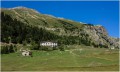
(9) Turn left and continue down, keeping to the right, until you reach the D106 and then the Refuge de l’Orgère (E).

Waypoints

  1. S : mi 0 - alt. 6,302 ft - Refuge du Roc de la Pêche
  2. 1 : mi 0.58 - alt. 6,381 ft - Chapendu summer pasture. Near the - Doron de Bozel (rivère)
  3. 2 : mi 0.97 - alt. 6,473 ft - Ritort Mountain Pasture
  4. 3 : mi 2.14 - alt. 6,955 ft - Mollaret d’en Bas summer pasture
  5. 4 : mi 3.53 - alt. 7,963 ft - Junction for > - Refuge de Peclet-Polset
  6. 5 : mi 4.99 - alt. 9,163 ft - Col de Chavière
  7. 6 : mi 5.27 - alt. 8,776 ft - End of the snowfields
  8. 7 : mi 5.89 - alt. 8,238 ft - Lac de la Partie
  9. 8 : mi 6.16 - alt. 8,222 ft - At the three-way junction, turn left
  10. 9 : mi 8.17 - alt. 7,159 ft - Ruins of L’Estiva, turn left
  11. E : mi 8.9 - alt. 6,348 ft - Refuge de l'Orgère

Notes

Overnight stay at the Porte de l'Orgère mountain refuge
Overnight stay for €17
Bookings on 04 79 05 11 65 or 04 79 05 11 29
Lodge website

N.B. The Porte de l’Ogère mountain refuge is marked as the Refuge de l’Ogère on the map.

Always be cautious and plan ahead when you're outdoors. Visorando and the author of this route cannot be held responsible for any accidents occurring on this route.

The GR® and PR® markings are the intellectual property of the Fédération Française de Randonnée Pédestre.

Reviews and comments

4.7 / 5
Based on 2 reviews

Reliability of the description
4.5 / 5
Ease of following the route
4.5 / 5
Route interest
5 / 5
L'escargot
L'escargot

Overall rating : 5 / 5

Date of your route : Jul 20, 2019
Reliability of the description : ★★★★★ Very good
Ease of following the route : ★★★★★ Very good
Route interest : ★★★★★ Very good

A lovely walk.
The end of the climb is quite steep, but the view is well worth it.
The snowfields on the other side of the pass aren’t easy to cross, but fortunately it doesn’t take very long.

Machine-translated

User 2243169

Overall rating : 4.3 / 5

Date of your route : Jul 12, 2019
Reliability of the description : ★★★★☆ Good
Ease of following the route : ★★★★☆ Good
Route interest : ★★★★★ Very good

Take a detour via Lac Blanc and the magnificent Cairn Forest before the pass; watch out for the snowfield on the descent after the pass – the descent towards L’Orgière took me a bit longer than I’d expected.

Machine-translated

Other walks in the area

For more walks, use our search engine .

The GPS track and description are the property of this route's author. Please do not copy them without permission.