Country:

 City:
City:


From the centre of Modane, head towards Aussois via the D215. Pass through Aussois, after which there are two options:
- Either via the old road, which is a bit bumpy but not very busy, near the start of the cross-country ski trails (towards the Monolithe).
- Or carry on to the entrance to Sardières and turn left onto the Route du Monolithe.
In both cases, park in the car park near the track heading due east.
(S/E) Take the track, which quickly turns into a pleasant path through the woodland, heading towards the Source de Fournette. Keep to the right at the first junction. At the junction after the stream, turn left and then right twice. Pass the spring and you’ll reach a fork in the path.
(1) Just past the spring, turn right to visit the Chappe telegraph station at Mollard Fleury – a glimpse into the history of telecommunications.
(2) Once you’ve deciphered the code, head back to the previous junction.
(1) Turn right towards La Turra. You’ll then follow a lovely track that climbs gently through the forest, taking several shortcuts along the way: keep following the path at the next two junctions. Stay on the track shortly after the second junction and you’ll reach a crossroads.
(3) Here, leave the track and take a path heading due north which, after an easy crossing of a torrent, runs alongside a cliff face affected by cargneulisation, where you can admire a magnificent orange arch and others still forming. Follow the path to the next junction on theGR®5.
(4) At the junction, head straight on and follow the winding path along the beautifully eroded cliffs. You’ll reach La Turra.
(5) Turn left onto the shortcut off the track, then left again onto the track itself, which climbs in wide hairpin bends. You’ll reach a bend with a cairn.
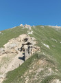
(6) At this bend, to the left of the track, a cairn marks the start of the path to the left, which leads to the Roc des Corneilles, a rock you will have already spotted further down. The slope is steep but never exposed, over a grassy ridge.
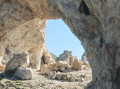
(7) It is only when you reach the rock that the Trou de la Lune comes into view. Shaped like a half-moon, it runs right through the rock. It is possible to climb onto the rock next to it. Return to the previous junction.
(6) Continue left on theGR® to the next junction towards La Loza
(8) Turn right towards the ruins of La Loza. Walk past the ruins and join the path leading down.
(9) Turn right. The descent is clear and easy but requires caution when negotiating the rocky outcrops. Keep left at the next fork, then turn right twice. Turn left onto the track and, at the next two path junctions, continue straight on to reach a third fork (alt. 1,710 m).
(10) Do not follow the sign for “Monolithe”, as this takes a longer route; instead, head for Sardières via the footpath. Turn right at the next junction and climb slightly afterwards to rejoin the Sentier des Biches. Do not descend via the track heading south-southeast.
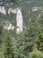
(11) Follow the path to the left back to the Monolithe. Keep left at the next junction, then turn right onto the track. Turn right when you reach the road, then right again towards the Monolithe de Sardières. Keep right, then left and finally right to go round the monolith and rejoin the road (S/E).

 Visorando Member

 Moderate
  Tourism professional
 Very difficult