Refuge de la Vallette via the Pas de l’Âne

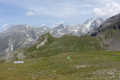
A challenging hike that passes through the Cirque du Petit Marchet, crosses the Roc du Tambour to reach the Refuge de la Vallette and ends at the hamlet of Le Prioux.
Tip: only undertake this hike when there is no snow and in dry weather.

Details

3881252
Creation:
Last update:
Last review:
  • Walking
    Activity: Walking
  • ↔
    Distance: 5.80 mi
  • ◔
    Average duration: 6h 00 
  • ▲
    Difficulty: Difficult

  • ⚐
    Back to start: No
  • ↗
    Ascent: + 3,789 ft
  • ↘
    Descent: - 2,989 ft

  • ▲
    Highest point: 8,543 ft
  • ▼
    Lowest point: 4,816 ft

Photos

Description of the walk

(S) From Prolognan-la-Vanoise, take the road leading to the municipal campsite and, at its end, turn onto the Chemin de l’Isertan to reach the start of this walk, which climbs south-east via numerous hairpin bends up a steep slope to reach the first rocks heralding the Pas de l’Âne, ignoring any cross-country paths you encounter.

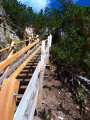
(1) Cross the Pas de l’Âne via a series of stone steps supported by low walls.
The path continues with a steep climb (south-east) via switchbacks that gradually widen.

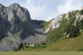
(2) Turn left to reach the Petit Marchet cirque.

(3) Retrace your steps.

(2) Keep to the left and cross the Roc du Trambour via the clearly marked west-facing path, which is easy to climb when there is no snow.

(4) Descend alongside Lac de la Valette and, via a series of gentle slopes, reach the Refuge de la Valette, situated at the pass of the same name.

(5) Descend towards the Chalet des Nants.

(6) Carry on, ignoring the path that branches off to the left, and continue north-west to reach the stream des Nants.

(7) Cross it and continue the descent to the hamlet of Les Prioux (E).

In summer, a paid shuttle service runs to Pralogna-la-Vanoise; otherwise, you’ll need to walk a further 5 km along the D124 or GR 55 to reach the village.

Waypoints

  1. S : mi 0 - alt. 4,816 ft - Start of the Isertan trail. Near the - Doron de Bozel (rivère)
  2. 1 : mi 1.07 - alt. 6,529 ft - Pas de l’Âne
  3. 2 : mi 1.83 - alt. 7,884 ft - Junction for the Cirque du Petit Marchet
  4. 3 : mi 1.94 - alt. 7,933 ft - Cirque du Petit Marchet
  5. 4 : mi 2.15 - alt. 8,012 ft - Crossing the Roc du Tambour
  6. 5 : mi 2.96 - alt. 8,520 ft - Refuge de la Valette
  7. 6 : mi 4.26 - alt. 7,185 ft - Chalet des Nants
  8. 7 : mi 4.61 - alt. 6,749 ft - Torrent des Nants
  9. E : mi 5.8 - alt. 5,617 ft - lieu dit les Prioux

Notes

Water point at the Refuge de la Vallette.

Worth a visit

From the Pas de l’Âne, you can reach the Cirque du Grand Marchet.
From the refuge, take a return walk to the ruins of the old refuge overlooking a small lake.

Reviews and comments

5 / 5
Based on 3 reviews

Reliability of the description
5 / 5
Ease of following the route
5 / 5
Route interest
5 / 5
GuyBonnet
GuyBonnet

Overall rating : 5 / 5

Date of your route : Jul 23, 2026
Reliability of the description : ★★★★★ Very good
Ease of following the route : ★★★★★ Very good
Route interest : ★★★★★ Very good
Very busy route : No

A very interesting walk with magnificent scenery. The first section up to the Pas de l’Âne is a very steep and long climb. You often have to use your hands as there are large boulders. However, it’s safe as you’re often in narrow gullies. You should therefore avoid doing this walk in the opposite direction, as the descent would be very difficult. The same applies in wet weather.
You can enjoy a tasty break at the mountain hut, with the glacier and lake in the background.
The shuttle bus that takes you back to Pralognan from Les Prioux is free in summer! It runs every half hour.

Machine-translated

DEVOUASSOUX
DEVOUASSOUX

Overall rating : 5 / 5

Date of your route : Sep 12, 2022
Reliability of the description : ★★★★★ Very good
Ease of following the route : ★★★★★ Very good
Route interest : ★★★★★ Very good
Very busy route : No

This is a route that isn’t often ridden because there are some tricky sections where you have to use your hands, and the climb is tough.

Machine-translated

Benoit Nelles
Benoit Nelles

Overall rating : 5 / 5

Date of your route : Oct 23, 2021
Reliability of the description : ★★★★★ Very good
Ease of following the route : ★★★★★ Very good
Route interest : ★★★★★ Very good
Very busy route : No

I set off from the Pont de Gerlon, to cut short the route between Pralognan and the Refuge du Repoju. A fairly easy climb through the woods, where I came across a few roe deer. A fairly steep climb up to the Pas de l’Ane. After that, it was fairly easy going, despite a bit of snow beneath the Roc du Tambour. I spotted some chamois before reaching the Refuge de la Valette. A fairly pleasant descent and a quick return to the Pont de Gerlon.

Machine-translated

Other walks in the area

For more walks, use our search engine .

The GPS track and description are the property of this route's author. Please do not copy them without permission.