Map of Amont – Roc de la Pêche mountain hut

The walk begins with a gentle, rural route to the Fond de l’Aussois mountain hut, followed by a steep climb to the Col de l’Aussois.

This walk is part of a multi-day hike: Le tour de la Pointe de l'Echelle

Details

189901
Creation:
Last update:
Last review:
  • Walking
    Activity: Walking
  • ↔
    Distance: 9.99 mi
  • ◔
    Average duration: 7h 55 
  • ▲
    Difficulty: Difficult

  • ⚐
    Back to start: No
  • ↗
    Ascent: + 3,852 ft
  • ↘
    Descent: - 4,390 ft

  • ▲
    Highest point: 9,567 ft
  • ▼
    Lowest point: 6,132 ft

Photos

Description of the walk

From Modane, head towards Aussois via the D215. In Aussois, leave the D215 and take the Route des Barrages (D108). Pass Plan d’Aval on your left and continue uphill to the Plan d’Amont car parks. Park in the car park furthest to the left of the dam.

DAY 1
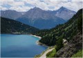
(S) Take the path that runs along the left-hand side and overlooks Lake Plan d’Amont. Continue along the ascending path to the end of the lake at the Pont de la Sétéria.

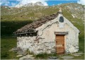
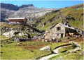
(1) Cross the bridge and take the path that climbs to the left. Pass to the left of the Sétéria mountain pasture and continue climbing, keeping to the left at all times, until you reach the Chapel of Notre-Dame des Anges. Continue climbing along the path, passing in front of the Fond de l’Aussois mountain pasture, then arrive at the foot of the Fond de l’Aussois mountain hut.

(2) Continue climbing steeply along the path beside the Saint-Benoit stream (2,625 m).

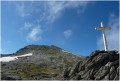
(3) Climb, following the cairns, to a wayside cross at 2,878m.

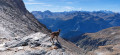
(4) Continue climbing to the Col d’Aussois, following the cairns between the snowfields (2,914 m).

(5) Begin a steep descent, following the cairns between the snowfields, to the footbridge over the Ruisseau de Rosoire (2,381m).

(6) Continue down this path, keeping to the left. Pass the Rosoire chalet on your left and continue along this path, keeping to the right, to climb up the slopes of the Crête d’Argentine.

(7) Continue along the path northwards then eastwards beneath Pointe Ariande to descend into the Vallon de la Motte until you reach a three-way junction after a footbridge.

(8) Turn left and keep left as you descend alongside the Ruisseau de Travers to a three-way junction.

(9) Turn right and continue downwards, keeping to the left, until you reach the Montaimont farms.

(10) Turn left and continue downhill to La Motte and the Roc de la Pêche refuge (E).

Waypoints

  1. S : mi 0 - alt. 6,831 ft - Car park to the left of the Plan d’Amont dam
  2. 1 : mi 0.99 - alt. 7,241 ft - After the bridge, turn left
  3. 2 : mi 2.07 - alt. 7,654 ft - Refuge du Fond d'Aussois
  4. 3 : mi 3.22 - alt. 8,675 ft - Continue uphill, following the cairns
  5. 4 : mi 3.78 - alt. 9,488 ft - Calvary before the Col de l’Aussois
  6. 5 : mi 3.94 - alt. 9,564 ft - Col d'Aussois
  7. 6 : mi 5.23 - alt. 7,769 ft - Footbridge over the Rozoire stream
  8. 7 : mi 6.63 - alt. 7,851 ft - Beneath the Argentine ridge
  9. 8 : mi 8.32 - alt. 7,628 ft - At the three-way junction in the La Motte valley, turn left
  10. 9 : mi 9.13 - alt. 6,709 ft - Three-way junction, turn right
  11. 10 : mi 9.62 - alt. 6,253 ft - At the Montaimont junction, turn left towards the - Doron de Bozel (rivère)
  12. E : mi 9.99 - alt. 6,302 ft - Refuge du Roc de la Pêche

Notes

Overnight stay at the Roc de la Pêche refuge
Overnight stay: €28. Bookings on 04 79 08 79 75
Mountain hut website

Reviews and comments

3.9 / 5
Based on 4 reviews

Reliability of the description
4 / 5
Ease of following the route
4 / 5
Route interest
3.8 / 5
F REYMANN
F REYMANN

Overall rating : 3 / 5

Date of your route : Jul 07, 2021
Reliability of the description : ★★★★☆ Good
Ease of following the route : ★★★★☆ Good
Route interest : ★☆☆☆☆ Very disappointing
Very busy route : No

Hello, I’ve just returned from a 5-day family trip, having walked around the Vanoise glaciers. I followed the various stages using VISORANDO and the IGN3534OTR map. Everything went perfectly, apart from the final stage from Plan d’Amont to the Roc de la Pêche refuge. In fact, I foolishly followed the route suggested by VISORANDO, which directs you to head up to the right from the Chalet de Rosoire towards Pointe Ariande, instead of simply joining the GR55 via Ritort. This resulted in a significant detour, a dangerous crossing of an unstable snowfield above a raging torrent (with no footbridge in place), and the CRS rescue service being contacted by the refuge as we were not arriving, given how far behind schedule we had fallen. So, a valuable lesson to learn: check in advance what VISORANDO suggests, and cross-check the information with the IGN map. The other major issue was the signposting, which could certainly have been better – though VISORANDO is, of course, in no way responsible for this.

Machine-translated

bernardino
bernardino ★
• Edited:

Hello, it’s quite true that:
after crossing the first pass and descending into the other valley, there’s a second climb to look forward to.
But:
there is a second climb to be expected. This one is much less steep, but when you only look at the waypoints, it gives the impression that the path is gently descending, whereas in reality it climbs quite a bit before descending again. When you’re not expecting it, it’s a bit of a blow to your morale...

Yes, it’s a bit tough, but if you look at the route diagram below the map, it clearly states that the path goes uphill.
Enjoy the rest of your time on the site.

Machine-translated

L'escargot
L'escargot

Overall rating : 4.7 / 5

Date of your route : Jul 19, 2019
Reliability of the description : ★★★★☆ Good
Ease of following the route : ★★★★★ Very good
Route interest : ★★★★★ Very good

A lovely hike with truly breathtaking scenery. We spotted marmots and ibex along the way.
One thing to bear in mind, though: after crossing the first pass and descending into the other valley, there’s a second climb to contend with. It’s much less steep, but if you only look at the waymarkers, you get the impression the path is sloping gently downwards, when in fact it climbs quite a bit before descending again. When you’re not expecting it, it’s a real blow to your morale… But it’s well worth it: the view of the glacier is magnificent!

Machine-translated

User 2243169

Overall rating : 4.3 / 5

Date of your route : Jul 11, 2019
Reliability of the description : ★★★★☆ Good
Ease of following the route : ★★★★☆ Good
Route interest : ★★★★★ Very good

A lovely walk, with sightings of ibex and marmots; a stunning view from the Col d’Aussois, with the option of climbing to the summit of the Pointe de l’Observatoire – an additional 200 metres of elevation gain.

Machine-translated

gazok54
gazok54 ★

Thank you, andresaura, but neither Visorando nor the author of the walk are responsible for the signposting. I’d advise you to click on the following link and you’ll understand:
https://www.visorando.com/forum-randonnee...

Machine-translated

andresaura
andresaura

Overall rating : 3.7 / 5

Date of your route : Sep 25, 2015
Reliability of the description : ★★★★☆ Good
Ease of following the route : ★★★☆☆ Average
Route interest : ★★★★☆ Good

A really lovely walk – quite long with a fair bit of elevation gain – but the signposts indicating the walking time are completely wrong!!!

Machine-translated

Other walks in the area

For more walks, use our search engine .

The GPS track and description are the property of this route's author. Please do not copy them without permission.