Lac de la Valette

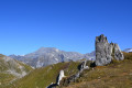
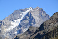
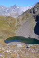
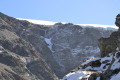
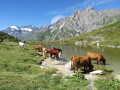
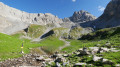
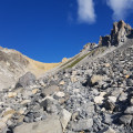
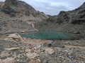
A hike beneath the Vanoise Glaciers towards the lovely Lac de la Valette, with the Grande Casse as a backdrop. The ascent follows an excellent path and includes a section off the beaten track, with magnificent views throughout.

Details

40589448
Creation:
Last update:
Last review:
  • Walking
    Activity: Walking
  • ↔
    Distance: 6.66 mi
  • ◔
    Average duration: 6h 10 
  • ▲
    Difficulty: Difficult

  • ⚐
    Back to start: Yes
  • ↗
    Ascent: + 3,606 ft
  • ↘
    Descent: - 3,589 ft

  • ▲
    Highest point: 8,960 ft
  • ▼
    Lowest point: 5,607 ft

Photos

Description of the walk

Prioux car park, easily accessible from Pralognan.

(S/E) Cross the bridge, turn right onto the road and follow it for 150 m. Cross the road and take the signposted path which branches off to the left and climbs gently, gradually approaching the Stream des Nants until it reaches a fork.

(1) Turn left and cross the footbridge. Continue the ascent along the right bank of the Stream des Nants until you reach the Chalet des Nants.

(2) Ignore the balcony path branching off to the right and take the path to the Refuge de la Valette, which climbs steeply to the left before continuing along the hillside, heading north, and reaching a fork.

(3) Take the direct path on the right which climbs to the Refuge de la Valette.

(4) Pass close to the refuge before heading south and looking out for a faint track below the Pic de la Vieille Femme.

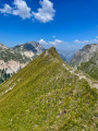
(5) Follow the ridge to the summit.

(6) After a break at the summit, retrace your steps.

(5) Turn right along a path leading to the small lake near the imposing ruins of the Refuge du Lac, with the edge of the Glacier des Sonnailles visible above.

(7) From Lac de la Vieille Femme, head down, due north and following the view, towards Lac de la Valette below.

(8) Still off the beaten track, follow the lake’s outlet north-westwards; after 200 metres, this leads to a small pool where the water disappears into the rocks. Shortly afterwards, you’ll come to a signposted path.

(9) Turn left onto this path, go round the Refuge de la Valette and rejoin the junction you passed on the way up.

(3) Continue straight ahead, retracing your steps from the outward journey, and further down you’ll rejoin the (S/E).


Waypoints

  1. S/E : mi 0 - alt. 5,614 ft - Car park - lieu dit les Prioux
  2. 1 : mi 1.08 - alt. 6,752 ft - Junction. Footbridge over the Stream des Nants
  3. 2 : mi 1.42 - alt. 7,192 ft - Chalet des Nants
  4. 3 : mi 2.33 - alt. 8,402 ft - Junction of the Circular Lakes Loop
  5. 4 : mi 2.5 - alt. 8,530 ft - Refuge de la Valette
  6. 5 : mi 2.61 - alt. 8,704 ft - Junction. Return to the - Pic de la Vieille Femme
  7. 6 : mi 2.83 - alt. 8,960 ft - Pic de la Vieille Femme
  8. 7 : mi 3.2 - alt. 8,658 ft - Lac de la Vieille Femme. Ruins of the Refuge du Lac
  9. 8 : mi 3.58 - alt. 8,153 ft - Lac de la Valette
  10. 9 : mi 3.82 - alt. 8,189 ft - Junction with marked path
  11. S/E : mi 6.66 - alt. 5,614 ft - Car park - Doron de Bozel (rivère)

Notes

The Refuge de la Valette is staffed until around 15 September.

From the Pic de la Vieille Femme, there are several ways to descend to the lake. As we undertook the hike after a light snowfall, the route described avoids the more direct passages and goes round the rocks.

Worth a visit

In September, there are very few walkers, but plenty of large marmots, as well as a few chamois.

Reviews and comments

4.4 / 5
Based on 3 reviews

Reliability of the description
4.3 / 5
Ease of following the route
4.3 / 5
Route interest
4.7 / 5
User 29538155

Overall rating : 4 / 5

Date of your route : Jun 21, 2026
Reliability of the description : ★★★★☆ Good
Ease of following the route : ★★★★☆ Good
Route interest : ★★★★☆ Good
Very busy route : No

A challenging route, finishing at the Valette mountain hut, which offers a brilliant 280° view!!! It wasn’t very busy that day; in fact, we didn’t see a soul between the hut and the lake. Yet the lake, still half-frozen, is well worth a detour.
The only downside is the path up to the Pic de la Vieille Femme: don’t follow the ridge at the start of the climb, but keep further to the left.

Machine-translated

Fabien C.
Fabien C.

Overall rating : 4.3 / 5

Date of your route : Jun 28, 2025
Reliability of the description : ★★★★☆ Good
Ease of following the route : ★★★★☆ Good
Route interest : ★★★★★ Very good
Very busy route : No

Very popular route to the refuge, no one above the old refuge.
The only downside is the route to climb the Vieille Femme peak: do not follow the ridge at the start of the climb. Take a path further to the left in the scree, which is easier to follow and a little marked, although it is more visible from above where there is a cairn that showed me the way down. Route available at https://www.visorando.com/randonnee-pic-...

Machine-translated

EMrando
EMrando
• Edited:

Overall rating : 5 / 5

Date of your route : Aug 21, 2024
Reliability of the description : ★★★★★ Very good
Ease of following the route : ★★★★★ Very good
Route interest : ★★★★★ Very good
Very busy route : No

A really lovely walk, which gets off to a steep start but has the advantage of quickly gaining altitude so you can admire the beauty of the landscape. You can even catch a glimpse of Lac de Chalet Clou on the right. What’s more, if you set off around 8 or 9 in the morning, the slope is in the shade for the first 700 metres of ascent, which is perfect on summer days. There aren’t many people about, as this route does require you to be reasonably fit. From the La Valette mountain hut, I headed to the old lakeside hut overlooking Lac de la Vieille Femme (a small lake), but I didn’t want to push on all the way to the Pic de la Vieille Femme (I needed to save my energy for all my hikes that week!) I naturally finished up at the magnificent Lac de Valette, though I didn’t actually go down to the water’s edge; instead, I stayed on the rocks to admire the view whilst having my picnic. The route isn’t signposted from the refuge, so thank you to the author of this Visorando for marking it out so clearly on the map. I even spotted a lovely marmot on the way down!

Machine-translated

Other walks in the area

For more walks, use our search engine .

The GPS track and description are the property of this route's author. Please do not copy them without permission.