


Refine your search for walks in Solterre
Solterre walks

 Suburban walking route from Villemandeur to Saint-Maurice-sur-Fessard
 Visorando Member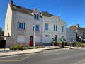
 6.48 mi
 +20 ft
 -26 ft
 3h 00
3h 00
 Moderate
 Departure from Villemandeur (Loiret)
Starting from Saint-Didier Church in the welcoming village of Villemandeur, with its many shops, this route will take you due west towards the peaceful village of Saint-Maurice-sur-Fessard, following the old towpath of the Canal d’Orléans, which has been converted into a cycle route. The route passes Machot Lock and follows various paths through the countryside, offering magnificent scenery that alternates between farmland and wooded areas.
Passing through the locks and mills via Lac des Closiers
 6.57 mi
+125 ft
-69 ft
3h 10
6.57 mi
+125 ft
-69 ft
3h 10
 Easy
Departure from Montargis (Loiret)
Easy
Departure from Montargis (Loiret)
A walk to explore the Loing, along the Briare Canal via the GR®13, starting from the Marolle Footbridge, passing through the Lac des Closiers peninsula – an ideal spot for a picnic. Discover the mills, ponds and locks at La Tuilerie and La Marolle, then pass through the old village of Amilly.
Discover the mills starting from Montargis
6.99 mi
+82 ft
-82 ft
3h 15
Moderate
Departure from Montargis (Loiret)
A route taking you along the Loing, past ponds, castles, mills and the old village of Amilly, then on to Lac des Closiers, the perfect spot for a picnic. The two locks: the Passerelle de la Marolles lock, followed by the Écluse de la Tuilerie lock.
The Briare Canal between Montargis and the Moulin Bardin
 4.79 mi
+30 ft
-30 ft
2h 15
Easy
Departure from Montargis (Loiret)
4.79 mi
+30 ft
-30 ft
2h 15
Easy
Departure from Montargis (Loiret)
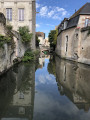
A stroll along the Briare Canal, passing through the lakes area of the Savoies and Népruns Nature Reserve, ending at Lac des Closiers and a circular route through the beautifully restored Pêcherie district.
Peace and quiet, nature, barges, birds and a few beautiful old houses – this is what awaits you.
Montargis, the Venice of Gâtinais
 4.79 mi
+89 ft
-89 ft
2h 15
Easy
Departure from Montargis (Loiret)
4.79 mi
+89 ft
-89 ft
2h 15
Easy
Departure from Montargis (Loiret)
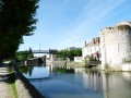
Ranked among the most beautiful sites in France, explore Montargis through its streets on the water with 131 bridges and footbridges. A gastronomic and lakeside town nicknamed the Venice of Gâtinais.
The Canal d’Orléans, starting from Chevillon-sur-Huillard
 10.32 mi
+66 ft
-66 ft
4h 50
Moderate
Departure from Chevillon-sur-Huillard (Loiret)
10.32 mi
+66 ft
-66 ft
4h 50
Moderate
Departure from Chevillon-sur-Huillard (Loiret)
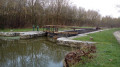
A walk that follows the Canal d’Orléans towpath for a third of its length. The remaining two-thirds follow quiet country lanes and paths through fields or woods, in peaceful countryside.
Between rivers and canals in the heart of the Montargis conurbation.
 12.14 mi
+92 ft
-92 ft
5h 40
12.14 mi
+92 ft
-92 ft
5h 40
 Difficult
Departure from Montargis (Loiret)
Difficult
Departure from Montargis (Loiret)
Circular starting from the lakeside town of Montargis, known as the Venice of Gatinais. The junctions of the Briare, Orléans and Loing canals made it a veritable river crossroads between the Loire and Seine basins until the Orléans canal was decommissioned in 1954. Follow the waterways through the Loing valley, passing rivers, canals and lakes.
A tour around Paucourt
 7.89 mi
+131 ft
-121 ft
3h 45
Moderate
Departure from Paucourt (Loiret)
7.89 mi
+131 ft
-121 ft
3h 45
Moderate
Departure from Paucourt (Loiret)
Discover the village of Paucourt and its forest, a veritable green lung in the heart of the Montargis national forest.
The Canal d’Orléans and a few ponds starting from Chailly
 9.04 mi
+72 ft
-72 ft
4h 15
Moderate
Departure from Chailly-en-Gâtinais (Loiret)
9.04 mi
+72 ft
-72 ft
4h 15
Moderate
Departure from Chailly-en-Gâtinais (Loiret)
A walk that follows the towpath of the Canal d’Orléans for a third of its route. The remaining two-thirds alternate between stretches through fields or meadows and through woodland, passing a few ponds hidden in the shade.
The Rigole de Courpalet trail from Lorris
 10.11 mi
+52 ft
-52 ft
4h 40
Moderate
Departure from Lorris (Loiret)
10.11 mi
+52 ft
-52 ft
4h 40
Moderate
Departure from Lorris (Loiret)
This idyllic walk follows the Rigole de Courpalet, which was dug at the end of the 17th century to feed the Canal d’Orléans. Abandoned after a few decades of use, it has for three centuries been home to numerous wild animals that come to drink there, as well as a wide variety of birds. The route ends in the old town of Lorris with its market hall, church and town hall.
Courpalet ditch, Gué l’Évêque circular loop
 9.31 mi
+33 ft
-33 ft
4h 20
Moderate
Departure from Montereau (Loiret)
9.31 mi
+33 ft
-33 ft
4h 20
Moderate
Departure from Montereau (Loiret)
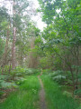
A largely shaded circular walk along the water’s edge. This walk follows the Rigole de Courpalet for nearly 5km before entering the Forest of Orléans and skirting the Étang du Gué l’Évêque.
The Rigole de Courpalet, 32.8 km long, was dug to feed the Canal d’Orléans.
Le Grand Chaloy
6.81 mi
+95 ft
-89 ft
3h 15
Moderate
Departure from Rogny-les-Sept-Écluses (Yonne)
From the old canal to the new one, from the old locks to the new ones, a whole world of greenery and water!
The Pont Plat
4.44 mi
+69 ft
-66 ft
2h 05
Easy
Departure from Rogny-les-Sept-Écluses (Yonne)
This family hike is historically very interesting.
Between the shaded first part and the canal-side second part, the route has a total elevation gain of 28 metres, mainly at the beginning.
In terms of history, from Henri IV to Charles de Freycinet, the size of boats has increased, imposing new standards. Today, we talk about the amount of water consumed that needs to be saved.
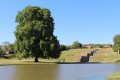
The Seven Locks of Henri IV.
 Tourist office
 6.08 mi
+82 ft
-82 ft
2h 50
Easy
Departure from Rogny-les-Sept-Écluses (Yonne)
6.08 mi
+82 ft
-82 ft
2h 50
Easy
Departure from Rogny-les-Sept-Écluses (Yonne)
Marked hike N°71.
A whole new way to discover the story of the construction of the Canal de Briare! With this hike you can follow a part of its water supply system and come back along the old route to the incredible monument that we today know as the Seven Locks.
Along the Cléry from Saint-Loup-de-Gonois
 6.14 mi
+138 ft
-167 ft
2h 55
Easy
Departure from Saint-Loup-de-Gonois (Loiret)
6.14 mi
+138 ft
-167 ft
2h 55
Easy
Departure from Saint-Loup-de-Gonois (Loiret)
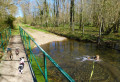
Enjoy the sight of several watermills along the route as you follow the right bank of the Cléry to the village of Chantecoq, then take the left bank, passing through the village of Courtemaux
Dampierre-en-Burly and its ponds
 8.46 mi
+102 ft
-102 ft
4h 00
Moderate
Departure from Dampierre-en-Burly (Loiret)
8.46 mi
+102 ft
-102 ft
4h 00
Moderate
Departure from Dampierre-en-Burly (Loiret)
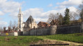
In the Orléans Forest, the route runs alongside the vast Étang de Corcambon, ending around the Étang du Bourg which borders the flower-filled village of Dampierre-en-Burly, at the foot of its fortifications.