Around Bazoches-sur-le-Betz

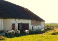
The walk begins with a tour of hamlets where donkeys and horses live and ends in the tranquillity of the woodland in the Betz Valley.

Details

1429666
Creation:
Last update:
Last review:
  • Walking
    Activity: Walking
  • ↔
    Distance: 4.84 mi
  • ◔
    Average duration: 2h 15 
  • ▲
    Difficulty: Easy

  • ⚐
    Back to start: Yes
  • ↗
    Ascent: + 39 ft
  • ↘
    Descent: - 39 ft

  • ▲
    Highest point: 495 ft
  • ▼
    Lowest point: 433 ft

Photos

Description of the walk

Car park on the square behind the town hall.

(S/E) From the car park, head towards Rue du Midi and walk down it to the D36. Cross the road and follow Rue de la Croix opposite.

(1) At the Sainte-Brigitte stone cross (1778), turn right onto Rue du Parc and continue straight on to the Masures farm. Then take the road on the left and pass through Les Frémis.

(2) Turn left, then right, and pass Les Morisseaux.

(3) Before the Baslin farm (elevation 138), turn left onto the dirt track for about 300 metres. Turn right, then left, and head towards the hamlet of Les Grais.

(4) Cross the D36 and continue along the small road. At the next junction, take the road on the right for 80 metres and turn onto the dirt track on the left.

(5) At the crossroads, carry on straight ahead, then walk along the left-hand side of the Étang de Bailly. Take the road on the left, pass through the hamlet of La Bigauderie and emerge onto the D147.

(6) Turn right for 150m (take care), then head left onto the dirt track towards the Betz.

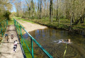
(7) Use the footbridge to the left of the ford to cross the Betz and follow the path. At the T-junction, turn left and follow the Betz valley; the dirt track becomes a road. Continue to the D36.

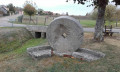
(8) Turn left onto the D36. Note the wash house on your left – this is where the village cows used to come to drink – and, after the bridge on your right, the gates and the chestnut-lined avenue leading to the château, as well as the magnificent half-timbered building of the château farm.

Opposite the library, turn left to return to the car park at the starting point (S/E).

Waypoints

  1. S/E : mi 0 - alt. 456 ft - Car park behind the town hall
  2. 1 : mi 0.22 - alt. 466 ft - Stone cross, on the right
  3. 2 : mi 0.91 - alt. 463 ft - Les Frémis, on the left
  4. 3 : mi 1.32 - alt. 463 ft - Crossroads, on the left
  5. 4 : mi 2.23 - alt. 492 ft - D36
  6. 5 : mi 2.86 - alt. 456 ft - Crossroads, go straight on
  7. 6 : mi 3.56 - alt. 472 ft - D147
  8. 7 : mi 3.84 - alt. 433 ft - Footbridge over the - Betz 'rivière) - Affluent du Loing
  9. 8 : mi 4.56 - alt. 440 ft - D36
  10. S/E : mi 4.84 - alt. 459 ft - Car park behind the town hall

Worth a visit

Reviews and comments

4.7 / 5
Based on 3 reviews

Reliability of the description
5 / 5
Ease of following the route
4.7 / 5
Route interest
4.3 / 5
User 28767857

Overall rating : 4.3 / 5

Date of your route : Mar 22, 2026
Reliability of the description : ★★★★★ Very good
Ease of following the route : ★★★★☆ Good
Route interest : ★★★★☆ Good
Very busy route : No

A pleasant walk in the sunshine. As the name suggests, donkeys, horses, sheep and lambs add to the charm of this walk. There is a lack of signposting at some junctions.

Machine-translated

boucles d'or
boucles d'or

Overall rating : 4.5 / 5

Date of your route : Mar 02, 2026
Reliability of the description : Not used / Not applicable
Ease of following the route : ★★★★★ Very good
Route interest : ★★★★☆ Good
Very busy route : No

Simple and peaceful walk - Perfect for me

Machine-translated

45visiorando
45visiorando

Overall rating : 5 / 5

Date of your route : Jan 14, 2019
Reliability of the description : ★★★★★ Very good
Ease of following the route : ★★★★★ Very good
Route interest : ★★★★★ Very good

Perfect. Thank you!

Machine-translated

Other walks in the area

For more walks, use our search engine .

The GPS track and description are the property of this route's author. Please do not copy them without permission.