Suburban walking route from Villemandeur to Saint-Maurice-sur-Fessard

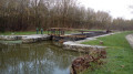
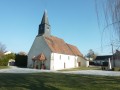
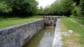
Starting from Saint-Didier Church in the welcoming village of Villemandeur, with its many shops, this route will take you due west towards the peaceful village of Saint-Maurice-sur-Fessard, following the old towpath of the Canal d’Orléans, which has been converted into a cycle route. The route passes Machot Lock and follows various paths through the countryside, offering magnificent scenery that alternates between farmland and wooded areas.

Details

19518603
Creation:
Last update:
Last review:
  • Walking
    Activity: Walking
  • ↔
    Distance: 6.48 mi
  • ◔
    Average duration: 3h 00 
  • ▲
    Difficulty: Moderate

  • ⚐
    Back to start: No
  • ↗
    Ascent: + 20 ft
  • ↘
    Descent: - 26 ft

  • ▲
    Highest point: 308 ft
  • ▼
    Lowest point: 279 ft
  • ⚐ Country: France
  • ⚐ City: Villemandeur (45700)
  • ⚑
    Start: N 47.990499° / E 2.707945°
  • ⚑
    End: N 47.991771° / E 2.618616°
  • ❏
    IGN map(s): Ref. 2419E, 2419O
  • Hour-by-hour weather

Photos

Description of the walk

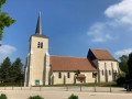
Start from the car park at Saint-Didier Church.

(S) With your back to the church, turn left onto Avenue de la Libération. Turn right onto Rue Aristide Briand before the roundabout.

(1) Cut across Rue du Parc and cross the River Solin. At the next junction with Rue de Gaudry, turn left, then continue straight ahead along the path by Ferme de Platteville. Leave the edge of the woods via a short left-right detour.

(2) At the hamlet of La Manche, turn right onto Rue de la Manche, then left onto Rue du Pont Feuillet. Follow the edge of the paper mill site, pass under the A77 motorway then Rue des Charmes, and reach the Canal d’Orléans.

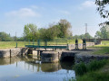
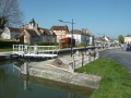
(3) Do not cross the Pont Feuillet bridge but turn left onto the towpath towards the Écluse de Machot.

(4) Cross the canal via the bridge and head up the other bank to the right for 300 m. Turn left to leave the towpath. Cross the River Bezonde and go straight on towards the hamlet of Machot.

(5) At the junction with Rue de La Varenne, turn left. Continue along this road, passing Rue du Fousseau.

(6) At the fork in the road in the hamlet of Les Sablons, veer right after the house.

(7) Turn right to cross the old railway line and take the path on the left. Pass the side paths. At the end of the path, continue to the left.

(8) At the next junction, turn left. After 200 m, turn onto the path on the right at the edge of the woods. Cross the railway line and take Rue de la Varenne on the left, then the first right.

(9) Cross Route d’Orléans (the old N60). Continue straight on along the path behind the houses. Pass the path leading to the sewage treatment plant.

(10) Turn right into the wooded area towards the sports ground and the school. Continue straight on to Rue de la Mairie.

(11) Turn right towards the town hall, then take the path between the houses opposite (pedestrian crossing). Follow the path to the left to the church. Cross Rue de l'Huilerie to reach the car park of the community hall opposite (E).

Waypoints

  1. S : mi 0 - alt. 305 ft - Car park at the - Église Saint-Didier (Villemandeur - 45)
  2. 1 : mi 0.71 - alt. 299 ft - Crossroads at Rue du Parc - Solin (rivière - affluent du Loing)
  3. 2 : mi 1.29 - alt. 295 ft - The hamlet of La Manche
  4. 3 : mi 1.95 - alt. 289 ft - Feuillet Bridge. Towards the - Limetin (ruisseau) - Affluent de la Bezonde
  5. 4 : mi 3.51 - alt. 295 ft - Machot lock on the - Canal d'Orléans
  6. 5 : mi 3.89 - alt. 289 ft - Crossroads at Rue de Varennes. After the - Bezonde (rivière) - Affluent du Loing
  7. 6 : mi 4.11 - alt. 295 ft - The hamlet of Les Sablons
  8. 7 : mi 4.27 - alt. 295 ft - Old railway line
  9. 8 : mi 5.08 - alt. 295 ft - Head towards Le Chatelet on the left
  10. 9 : mi 5.77 - alt. 292 ft - Former Route Nationale 60
  11. 10 : mi 6.16 - alt. 289 ft - Towards the sports ground and school on the right
  12. 11 : mi 6.33 - alt. 295 ft - Town hall and - Église Saint-Maurice (Saint-Maurice-sur-Fessard)
  13. E : mi 6.48 - alt. 299 ft - Car park at the community hall

Notes

Bakery, butcher’s, chemist’s and restaurant in Villemandeur.
Grocery shop and bakery in Saint-Maurice-sur-Fessard.
Trout fishing in Saint-Maurice-sur-Fessard.

Worth a visit

Tourist Office, 35 Rue Renée de France, Montargis.

Villemandeur:
Saint-Didier Church.
Puiseaux and Vernisson Departmental Park.
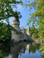
Lisledon Castle (not open to visitors, grounds open to the public).
Platteville Castle (private property).

Saint-Maurice-sur-Fessard:
Saint-Maurice Church.
Marker for the former Méridienne de France in Chevry, the highest point in the commune at 123 m.

Other walks in the area

For more walks, use our search engine .

The GPS track and description are the property of this route's author. Please do not copy them without permission.