Country:
 City:
City:


The start is in the car park of the community hall in Vieilles-Maisons-sur-Joudry.
(S/E) With your back to the hall, turn left. At the Stop sign, take Route de Grignon on the right, then, at the bend, take the path opposite, heading north-west. At the hamlet of Les Quinières, go behind the shed and then turn left.
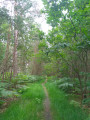
(1) At the T-junction, first turn right then left onto the tree-lined path, heading north-west. You’ll reach a wood; head straight into it. Make your way through the low grass for about a hundred metres until you come to a much clearer path. Take this path on the right. (There is a path on the left-hand side of the woodland. It is difficult to make your way through.)
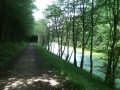
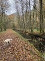
(2) At the X-junction (hard to see), facing a pond, turn left and take the path, which is clearly marked. Leave the woodland and continue along the Rigole de Courpalet, which flows on your left, until it joins the Canal d’Orléans at Point de Partage.
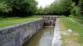
(3) Then turn left and follow the canal northwards. Pass the two bends to the left and, on the left, before the bend to the right, you will see a wide clearing in the trees leading to a path.
(4) Take the path, cleared by a wood chipper, which then leads into the forest. Follow the Étang de La Noue Mazone on your right.
Red-and-white markings
(5) At the junction with two paths coming from the left, including the GR®3B, continue straight ahead along this path alongside the pond until you reach a road. Follow this road for 300 m to the right until you reach the three-way junction.
(6) At the junction, turn left and then take Route Feuillue on the right for 100 m.
(7) Then take the path on the right through the woodland. At the T-junction, turn left and stay on the path until you reach the crossroads (where there are houses).
No further signposting
(8) Leave the GR®3B and turn left onto Route de la Bénardière. Leave the path on the right and rejoin Route Feuillue. Turn right and continue to Carrefour des Fourmis.
(9) Take the first road on the left (Route de Vitry-aux-Loges to Vieilles-Maisons). Pass two junctions, then, as you approach the bend, take the path on the left and cross the Rigole de Courpalet.
(10) Turn right and follow the Rigole de Courpalet on your right. Cross a first tarmac road (access to La Pitazière) then a second road (Route de la Petite Forêt). Continue along the Rigole de Courpalet until you reach a limestone path and a small pond.
(11) Turn left and continue along the Rigole de Courpalet. You will come to a tarmac road. Take it on the right and, 150 m further on, at the bend, continue straight ahead along the Chemin calcaire de Platteville until you reach the Route de la Noue.
(12) Take the road on the left, then at the junction with Rue du Petit Étang, turn right. Cross the Route d’Orléans with care(D88) and head into the forest opposite along the Route du Pont Neuf until you reach the Carrefour du Pont Neuf.
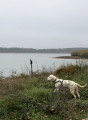
(13) Take the first left (Route de la Fontenelle) to reach the Étang d’Orléans.
Red and white markings
(14) Climb onto the embankment and rejoin the GR®3B. The GR®3B may in future follow different paths. The area is currently under construction and the GR®3B may return to its original route along the Rigole de la Fontenelle.
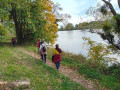
With the Étang d'Orléans on your left, continue to the Étang d'Orléans junction on the road of the same name. Then turn left onto the Route du Chaumontois and walk for 700 m.
(14) Leave the Route du Chaumontois and turn left to follow the GR®3B, which then runs above the Rigole de la Fontenelle as a path through the woodland. Cross the Route des Charretiers and then the Route de Corcambon in turn. About 50 m from the Les Bordes–Lorris road (D961), you’ll come to a path (an old railway line).
No further signposting
(15) Leave the GR®3B and turn left to follow the D961 on your right. Cross the Route des Hongrois and continue to the Route de la Fontenelle. Turn left.
This final section is more difficult. You will need to find your own way. You can take the Route des Hongrois on the left, then the Route des Charretiers on the right to rejoin the Route de la Fontenelle on the left.
(16) At the junction with the Route des Charretiers, continue straight ahead to the Étang d’Orléans. Head towards the dyke on the right.
Red and white markings
(17) Take the Route de l'Étang des Bois on the right for 20 m and rejoin, on the left, the Rigole de la Fontenelle and the GR®3B. (Stay on this path until you reach the village of Vieilles-Maisons).
(18) Ignore a path on your right and continue straight ahead on the GR®3B. Walk alongside the Étang des Bois on your left. Cross the Route d'Orléans with care and continue for 250 m on the Route de Vieilles-Maisons (D488).
(19) At the T-junction, turn left onto Rue du Petit Étang. After 130 m, take the footbridge on the right to follow the Rigole de Courpalet on your right once more. Continue to the village.
No further signposting
(20) Follow the road (Rue du Bourg) to the left and return to the car park of the community hall (S/E).

 Visorando Member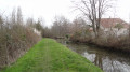
 Moderate
 Easy
Easy