Refine your search for walks in Racquinghem
Racquinghem walks


 Hugo Trail in Racquinghem
 Local authority
 6.53 mi
 +197 ft
 -187 ft
 3h 10
3h 10
 Easy
Easy
 Departure from Racquinghem (Pas-de-Calais)
This route will take you through several different types of landscape: the Plateau des Landes regional nature reserve, the plain and the Neuffossé Canal. The latter separates the Pas-de-Calais department from the Nord department.
It is a marked trail maintained by the Pays de Saint-Omer Urban Community.
Mont d’Hiver and the Neufossé Canal in Blaringhem
 Visorando Member6.96 mi
+180 ft
-177 ft
3h 20
Visorando Member6.96 mi
+180 ft
-177 ft
3h 20
 Moderate
Departure from Blaringhem (Nord)
Moderate
Departure from Blaringhem (Nord)
A pleasant walk around the Brasserie du Pays Flamand in Blaringhem. With views over the Lys valley. Discover local agriculture and the hedgerow landscape.
La Melde from Wittes
5.94 mi
+43 ft
-43 ft
2h 45
Easy
Departure from Wittes (Pas-de-Calais)
This route will allow you to discover the diversity of water in Wittes and Aire-sur-la-Lys. In Wittes, you will find the Melde, a tributary of the Lys. In Aire-sur-la-Lys, you will walk along the Lys, the Bassin des Quatre-Faces, the Ballastière ponds and the Canal de Neuffossé. This is a signposted trail maintained by the Communauté d'Agglomération du Pays de Saint-Omer.
Circuit d'Ecques par les landes
14.19 mi
+407 ft
-407 ft
6h 50
 Difficult
Departure from Ecques (Pas-de-Calais)
Difficult
Departure from Ecques (Pas-de-Calais)
Leave Ecques via the same route, then take a long, flat walk through the fields to reach Heuringhem. Continue across the moors of Blendecques, Rietz de l'Église and Bibrou before reaching Quiestède via Les Bruyères. Return via the Bois d'Ecques.
The route is relatively flat, but there are a few wet areas (more depending on the weather). During hunting season, avoid Sundays, as some communal woods are rented to hunting clubs!
Route modified and improved in September 2024 to avoid the D 190.
The Bietz tour in Aire-sur-Lys
4.89 mi
+59 ft
-59 ft
2h 20
Easy
Departure from Aire-sur-la-Lys (Pas-de-Calais)
A pleasant and very easy hike around Le Bietz. You will pass through two hamlets in Aire-sur-la-Lys before returning to Moulin le Comte, following the Lys at the end of the route.
The Fontinettes boat lift
 5.86 mi
+49 ft
-49 ft
2h 45
Easy
Departure from Arques (Pas-de-Calais) (Pas-de-Calais)
5.86 mi
+49 ft
-49 ft
2h 45
Easy
Departure from Arques (Pas-de-Calais) (Pas-de-Calais)
The Sentier des Fontinettes invites you to discover the sometimes unexpected natural treasures of Arques: from the Étang de Beauséjour to the Étang de Malhôve, via the Rihoult Forest and the canal towpath, not forgetting the water sports centre and the boat lift.
A bucolic escape between Aire and Mametz
6.47 mi
+62 ft
-62 ft
3h 00
Easy
Departure from Aire-sur-la-Lys (Pas-de-Calais)
This route follows the path known as the Bruveau d’Aire-sur-la-Lys, with a few variations. It takes you to the Church of Saint-Vaast in Mametz via the Glomenghem marshes, then back to the hamlet of Moulin-le-Comte via the Chemin de Fauquenthun in the hamlet of Rincq.
The Ponds Trail
 3.99 mi
+23 ft
-23 ft
1h 50
Easy
Departure from Mametz (Pas-de-Calais)
3.99 mi
+23 ft
-23 ft
1h 50
Easy
Departure from Mametz (Pas-de-Calais)
A short 6 km walk to explore the Étangs de la Sauvagine in Mametz and the Étangs de Rebecques.
Le Bruveau
6.95 mi
+52 ft
-52 ft
3h 15
Moderate
Departure from Aire-sur-la-Lys (Pas-de-Calais)
During this walk, you will discover the Lys valley. On the way back, you will follow the course of the Lys before it is channelled in the eastern part of Aire. This is a signposted trail maintained by the Pays de Saint-Omer Urban Community.
Between Lys and the Canal
6.64 mi
+13 ft
-13 ft
3h 05
Moderate
Departure from Aire-sur-la-Lys (Pas-de-Calais)
The town of Aire-sur-la-Lys is crossed by the Lys river. It is bordered by the Neuffossé Canal, which takes the name Canal d'Aire at La Bassée, from this town onwards. The Bassin des Quatre Faces (Four Faces Basin) once allowed boats to turn around and sail in the desired direction: towards the town, the Lys, the canal towards Saint-Omer or Béthune. It is a signposted trail in the Pays de Saint-Omer urban community.
The Arbre Hardi from Blendecques
9.14 mi
+315 ft
-315 ft
4h 30
Moderate
Departure from Blendecques (Pas-de-Calais)
This route will take you through a variety of landscapes: the Plateau des Landes Regional Nature Reserve and the plain. It is a signposted trail maintained by the Pays de Saint-Omer Urban Community. This trail shares a few kilometres with the Longatte de Blendecques route.
Val de Lys and woods
 13.79 mi
+282 ft
-299 ft
6h 35
Difficult
Departure from Mametz (Pas-de-Calais)
13.79 mi
+282 ft
-299 ft
6h 35
Difficult
Departure from Mametz (Pas-de-Calais)
After following the River Lys and passing near the Étangs de Crecques, you’ll cross through two woods before finishing the walk along the paths and small roads of the plain.
A route without any major difficulties, apart from its length. Best undertaken in dry weather.
In wet weather, the two woods are quite tricky and, this winter, the path between Glomenghem and Mametz was flooded (it was fine on 25 April 2024, but the ditches are full to the brim and are just waiting to overflow).
Yellow River Trail
 2.20 mi
+213 ft
-213 ft
1h 10
Easy
Departure from Helfaut (Pas-de-Calais)
2.20 mi
+213 ft
-213 ft
1h 10
Easy
Departure from Helfaut (Pas-de-Calais)
A short walk around the La Coupole blockhouse, where forest and magnificent ponds come together.
Exploring the orchards from Wallon-Cappel
5.94 mi
+98 ft
-98 ft
2h 50
Easy
Departure from Wallon-Cappel (Nord)
A walk combining dirt tracks and small tarmac roads, taking in a chapel. Magnificent views of Mont Cassel.
La Cuvette from Clamarais
10.60 mi
+49 ft
-49 ft
4h 55
Moderate
Departure from Clairmarais (Pas-de-Calais)
This route is divided between marshland, bocage and forest. It crosses Flanders before returning to the Audomarois region. In the first part of this itinerary, walkers will see street names in Flemish. This is a signposted trail of the Communauté d'Agglomération du Pays de Saint-Omer.
Route des Batailles in Thérouanne
5.65 mi
+197 ft
-197 ft
2h 45
Easy
Departure from Thérouanne (Pas-de-Calais)
Thérouanne was the capital of the Gallic tribe known as the ‘Morins’. The town was conquered by Julius Caesar. In the Middle Ages, it was the seat of an important bishopric stretching from the Canche to the Yser. It was completely destroyed following the siege by Charles V’s imperial army in 1553, as it was a French enclave.
This trail pays tribute to the three battles that took place at Enguinegatte during the capture of Thérouanne. It is a signposted trail managed by the Pays de Saint-Omer Urban Community.
Discovering the Audomarois marshlands
 4.26 mi
+7 ft
-10 ft
2h 00
Easy
Departure from Clairmarais (Pas-de-Calais)
4.26 mi
+7 ft
-10 ft
2h 00
Easy
Departure from Clairmarais (Pas-de-Calais)
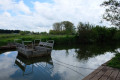
A walk that combines crossing the Clairmarais market garden marsh with the Romelaëre Nature Reserve.Lots of birdwatching: ash herons, coots, storks... And the star attraction of this walk: crossing the canals on the chain ferries, which will appeal to young and old alike!Please note: chain ferries and drawbridges only operate from March 15 to September 5.