Laprée Trail

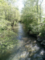
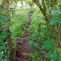
During this walk, you will see some old watercress beds. These are located just past the church. You will pass close to Laprée Castle. It was built in 1740 on the ruins of a feudal castle. This is a signposted trail maintained by the Pays de Saint-Omer Urban Community.

Details

n°41913882
Creation:
Last update:
Last review:
  • Walking
    Activity: Walking
  • ↔
    Distance: 5.20 mi
  • ◔
    Average duration: 2h 25 
  • ▲
    Difficulty: Easy

  • ⚐
    Back to start: Yes
  • ↗
    Ascent: + 33 ft
  • ↘
    Descent: - 33 ft

  • ▲
    Highest point: 121 ft
  • ▼
    Lowest point: 85 ft
  • ⚐ Country: France
  • ⚐ City: Quiestède (62120)
  • ⚑
    Start/End: N 50.678581° / E 2.338242°
  • ❏
    IGN map(s): Ref. 2304E, 2304O
  • Hour-by-hour weather

Description of the walk

The route starts in Quiestède, at 5 Rue de la Morande, where parking is available.

(S/E) Opposite the starting sign, turn right to reach the ‘Stop’ sign on Rue du Marais.

(1) Turn right and follow this street until you reach the junction with Rue des Bruyères; turn left here and continue until you reach the junction with a dirt track.

(2) Keep left onto a dirt track running between the fields. Cross a road and continue straight ahead along the grassy path to reach the roundabout. Cross carefully, then turn left, then immediately right to reach the church.

(3) Turn left. At the first junction, turn right, cross a bridge and continue to the right.

(4) Cross a second bridge over the Lauborne and carry on straight ahead to reach the hamlet known as Le Rons. There, turn right to join the D195.

(5) Follow it to the right and leave it at the first bend. Carry on straight ahead along Rue de la Sablonnière to reach the bus stop: do not take the streets on the left or right.

(6) After the bus stop, turn right into Rue du Blamart and carry on until you reach the bend.

(7) In front of the plaque commemorating an aviator, turn right onto a grassy path.

(8) Pass the confluence of the Lauborne and the Melde rivers. Walk past Laprée Castle and, at the end of this path, you’ll come out onto the D190.

(9) Cross the D190 carefully at the pedestrian crossing and turn right. At the Fork in the road, turn left, then immediately left again onto the Chemin d’en Bas, which joins the Rue des Bruyères.

(2) Turn right to return to the starting point, following the route in reverse to the one taken on the way there (S/E).

Waypoints

  1. S/E : mi 0 - alt. 89 ft - 5, Rue de la Morande - Becque (cours d'eau) - Affluent de la Melde du Pas-de-Calais
  2. 1 : mi 0.11 - alt. 92 ft - Bus stop on Rue du Marais
  3. 2 : mi 0.58 - alt. 92 ft - Junction of the circular loop
  4. 3 : mi 1.76 - alt. 118 ft - Church
  5. 4 : mi 2.33 - alt. 95 ft - Lauborne (cours d'eau) - Affluent de la Melde du Pas de Calais
  6. 5 : mi 2.74 - alt. 108 ft - D195
  7. 6 : mi 3.32 - alt. 108 ft - Rue Blamart
  8. 7 : mi 3.52 - alt. 89 ft - Bend
  9. 8 : mi 3.81 - alt. 89 ft - Confluence of the Lauborne and - Melde du Pas de Calais - Alimente le Bras de décharge de la Lys Oduel
  10. 9 : mi 4.02 - alt. 92 ft - D190. After the - château de Laprée
  11. S/E : mi 5.2 - alt. 89 ft - 5, Rue de la Morande - Becque (cours d'eau) - Affluent de la Melde du Pas-de-Calais

Worth a visit

Reviews and comments

3.8 / 5
Based on 2 reviews

Reliability of the description
4 / 5
Ease of following the route
4 / 5
Route interest
3.5 / 5
CROGIEZ Caty
CROGIEZ Caty

Overall rating : 4.7 / 5

Date of your route : Dec 07, 2025
Reliability of the description : ★★★★★ Very good
Ease of following the route : ★★★★★ Very good
Route interest : ★★★★☆ Good
Very busy route : Yes

very beautiful, easy hike

Machine-translated

capso
capso

Hello,

Thank you for your message.

After the castle, the directional arrow in front of the road (the D190) and the safety barrier point to the left, as access from the right is not possible. About 40 metres to the left, when the walker is facing the Departmental Road, there is a yellow sticker marked ‘wrong way’. It has been noted that a sign has gone missing: it will be replaced.

Machine-translated

ID81360
ID81360

Overall rating : 3 / 5

Date of your route : Feb 07, 2025
Reliability of the description : ★★★☆☆ Average
Ease of following the route : ★★★☆☆ Average
Route interest : ★★★☆☆ Average
Very busy route : No

A bit too much tarmac on this walk. Fortunately, the highlights are the watercress beds and the view of the castle. The problem is that, after the castle, when you come out onto the road, the sign is upside down and the next one isn’t visible. It’s a good thing we had the GPX track, otherwise we’d have gone off in the wrong direction. A walk just for the sake of walking, but not particularly interesting.

Machine-translated

Other walks in the area

For more walks, use our search engine .

The GPS track and description are the property of this route's author. Please do not copy them without permission.