The Arbre Hardi from Blendecques

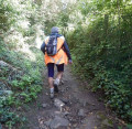
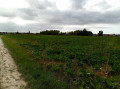
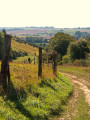
This route will take you through a variety of landscapes: the Plateau des Landes Regional Nature Reserve and the plain. It is a signposted trail maintained by the Pays de Saint-Omer Urban Community. This trail shares a few kilometres with the Longatte de Blendecques route.

Details

67286339
Creation:
Last update:
Last review:
  • Walking
    Activity: Walking
  • ↔
    Distance: 9.14 mi
  • ◔
    Average duration: 4h 30 
  • ▲
    Difficulty: Moderate

  • ⚐
    Back to start: Yes
  • ↗
    Ascent: + 315 ft
  • ↘
    Descent: - 315 ft

  • ▲
    Highest point: 262 ft
  • ▼
    Lowest point: 52 ft

Description of the walk

The starting point is in front of the gate to the Château de Westhove grounds: 146, Rue Jean Jaurès. Parking is available nearby.

(S/E) With your back to the entrance gate of the Château de Westhove grounds, head up the road opposite, Rue Jules Guesde (towards Helfaut). After the railway line, ignore the road on your left. When you reach the Fork in the road, turn left. Continue up Rue Jules Guesde until you reach the sign for Rue du Fort Mahon on your left, near the no-entry sign.

(1) Turn left. At the end of this street, turn left and then immediately right, carefully crossing Rue George Sand (D477) to join Rue de l’Arbre Hardi. At the end of this street, carefully cross the D77 to reach a Fork in the road.

(2) Ignore the path on the right. When you reach the junction, turn right. Then, at the crossroads, turn right until you reach 995 Rue du Hocquet.

(3) Turn right. As you leave Rietz de l’Église, go straight on until you reach number 515 Sous le Bois, which is on the right.

(4) Go down the path on the left and follow it to 251 Rue des Tilleuls.

(5) Turn left. At the bottom of the street, turn left, then, at the next junction, left again. At the Fork in the road, turn right, join the road and turn right to reach 24 Rue des Quenelets.

(6) At the crossroads, turn left (D600) for 120 m, then leave the D600 and continue straight on until you reach the stop sign.

(7) From there, carry on straight ahead. Pass the wooden staircase on your left which leads to the Regional Nature Reserve.

(8) At the junction, turn right. Pass the path on your left, then take the one on your right. Carry on straight ahead until you reach a Fork in the road.

(9) Pass the path on your right, where there is a bridge, and carry on straight ahead to reach Rue de l’Église.

(10) Turn left, go to the Stop sign and turn right until you reach 170 Rue de Thérouanne.

(11) Turn left and head up Rue de Saintes to reach the car park. Pass Rue de la Colette and the entrance to the Regional Nature Reserve on your left.

(12) At the end of the car park, in front of the glass recycling bin, turn left and continue to the wooden archway at the nature reserve.

(13) After this, turn left. Then turn left again to cross a footbridge. Turn immediately right, then right again in front of the next footbridge. Finally, cross the last footbridge on the right and take the dirt track opposite that leads downhill (it crosses a bridge) before reaching the Allée des Coquelicots.

(14) Continue straight ahead down the streets (Allée des Coquelicots, going against the one-way flow, then Rue Quartier de l’Arabie) to reach the junction from the outward leg.

(1) Turn left onto Rue Jules Guesde to return to the starting point (S/E).

Waypoints

  1. S/E : mi 0 - alt. 52 ft - Parking near the Parc du - Château du Westhove
  2. 1 : mi 0.34 - alt. 118 ft - Rue du Fort Mahon
  3. 2 : mi 0.98 - alt. 164 ft - Fork in the road, Blancbourg
  4. 3 : mi 2.32 - alt. 226 ft - 995 Rue du Hocquet
  5. 4 : mi 2.98 - alt. 236 ft - 515 Sous le Bois
  6. 5 : mi 3.54 - alt. 144 ft - 251 Rue des Tilleuls
  7. 6 : mi 4.31 - alt. 128 ft - 24 Rue des Quenelets
  8. 7 : mi 4.97 - alt. 102 ft - Stop
  9. 8 : mi 5.4 - alt. 95 ft - Crossing the - Melde du Pas de Calais - Alimente le Bras de décharge de la Lys Oduel
  10. 9 : mi 6.21 - alt. 98 ft - Fork in the road
  11. 10 : mi 6.75 - alt. 108 ft - Rue de l’Église
  12. 11 : mi 7.31 - alt. 115 ft - 170 Rue de Thérouanne
  13. 12 : mi 8.04 - alt. 262 ft - Car park on Rue des Bruyères
  14. 13 : mi 8.12 - alt. 262 ft - Entrance arch to the Regional Nature Reserve
  15. 14 : mi 8.62 - alt. 177 ft - Allée des Coquelicots
  16. S/E : mi 9.14 - alt. 52 ft - Parking near the Parc du - Château du Westhove

Notes

The hunting season begins on the third Sunday in September. It ends on the last day of February.

Hunting takes place in the Plateau des Landes Regional Nature Reserve:
- in Blendecques, on Thursdays and Sundays.
- in Heuringhem, on Sundays.

Consequently, walking is prohibited.

Worth a visit

Reviews and comments

5 / 5
Based on 2 reviews

Reliability of the description
5 / 5
Ease of following the route
5 / 5
Route interest
5 / 5
User 1327461

Overall rating : 5 / 5

Date of your route : Aug 10, 2025
Reliability of the description : ★★★★★ Very good
Ease of following the route : ★★★★★ Very good
Route interest : ★★★★★ Very good
Very busy route : No

A varied and therefore very enjoyable walk. No difficulty

Machine-translated

Sylvette 59
Sylvette 59
• Edited:

Overall rating : 5 / 5

Date of your route : Jun 23, 2025
Reliability of the description : ★★★★★ Very good
Ease of following the route : ★★★★★ Very good
Route interest : ★★★★★ Very good
Very busy route : No

This is something I did for the hiking club I belong to, and I'm going to suggest it because it's really great!
What's more, it helped me figure out how to split it up and create a 6.5 km route, which I can also suggest to the other walking group.
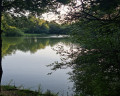
That way, our club can go out together and meet up for a picnic at lunchtime. There's a great spot near the ponds. 🥰🐸
So I'm absolutely delighted!! Thank you so much!!! ✨️🤗🥰.
Sylvette FRANCOIS.

Machine-translated

Other walks in the area

For more walks, use our search engine .

The GPS track and description are the property of this route's author. Please do not copy them without permission.