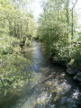
Mont d’Hiver and the Neufossé Canal in Blaringhem

A pleasant walk around the Brasserie du Pays Flamand in Blaringhem. With views over the Lys valley. Discover local agriculture and the hedgerow landscape.

Details

3600500
Creation:
Last update:
Last review:
  • Walking
    Activity: Walking
  • ↔
    Distance: 6.96 mi
  • ◔
    Average duration: 3h 20 
  • ▲
    Difficulty: Moderate

  • ⚐
    Back to start: Yes
  • ↗
    Ascent: + 180 ft
  • ↘
    Descent: - 177 ft

  • ▲
    Highest point: 217 ft
  • ▼
    Lowest point: 62 ft
  • ⚐ Country: France
  • ⚐ City: Blaringhem (59173)
  • ⚑
    Start/End: N 50.690837° / E 2.397394°
  • ❏
    IGN map(s): Ref. 2304E
  • Hour-by-hour weather

Description of the walk

Parking at the Brasserie du Pays Flamand – Estaminet car park.

(S/E) Head south-west, cross the bridge over the Canal de Neuffossé and follow the road. Please take care.

(1) Turn right.

(2) Turn left onto the small road (Rue Gommere), which quickly turns into a stony track.

(3) At the junction with the farm tracks, turn right, then carry on straight ahead along the track, which will take you back to the road after a right-angle bend.

(4) Turn left at the wayside cross and walk alongside the factory to the road junction.

(5) At the factory entrance, carry on straight ahead to the next crossroads.

(6) After the pasture, take the path on the right.

(7) Cross the small bridge, then turn left.

(8) The path descends to the right towards the canal. Follow the canal along the towpath as far as the Pont d’Asquin.

(9) Cross the bridge and, just after the bridge, turn right to follow the small road.

(10) Take the path on the left and head uphill towards a road junction.
Cross Rue du Mont d’Hiver (D406) and continue straight on.
Further on, take the path on the right which leads down towards a copse.
Continue along the path through the copse.
As soon as you reach the small road, turn right onto the path leading back towards Rue du Mont d’Hiver.
Turn left onto it. After about 300 metres along the road, turn right onto the path leading down to the Nouvelle Melde canal, which you can see between the hedges.

(11) Continue to the left, following the canal, to reach the village of Blaringhem.

(12) Turn right over the small bridge on the Nouvelle Melde via Rue André Plockyn, to reach the (S/E).

Waypoints

  1. S/E : mi 0 - alt. 69 ft - L’Estaminet car park. Towards the bridge at the - Canal de Neufossé
  2. 1 : mi 0.15 - alt. 72 ft - Blaringhem Bridge
  3. 2 : mi 0.28 - alt. 72 ft - Junction of the Grand Route and the path
  4. 3 : mi 0.79 - alt. 118 ft - At the crossroads, turn right
  5. 4 : mi 1.45 - alt. 79 ft - Junction – Factory
  6. 5 : mi 1.66 - alt. 75 ft - Factory guard post
  7. 6 : mi 1.82 - alt. 75 ft - Road junction – footpath
  8. 7 : mi 2.2 - alt. 75 ft - Small bridge
  9. 8 : mi 2.83 - alt. 72 ft - Towpath – Canal
  10. 9 : mi 3.29 - alt. 62 ft - Asquin Bridge
  11. 10 : mi 4.12 - alt. 69 ft - Crossroads
  12. 11 : mi 6.2 - alt. 69 ft - Crossroads
  13. 12 : mi 6.9 - alt. 69 ft - Return to the village
  14. S/E : mi 6.96 - alt. 69 ft - Estaminet car park

Worth a visit

Eating and drinking – bar – visit to the Brasserie du Pays Flamand.
St Martin’s Church (Altarpiece Trail).

Reviews and comments

4.8 / 5
Based on 2 reviews

Reliability of the description
5 / 5
Ease of following the route
5 / 5
Route interest
4.5 / 5
Alfredophilgar
Alfredophilgar

Overall rating : 5 / 5

Date of your route : Sep 19, 2024
Reliability of the description : ★★★★★ Very good
Ease of following the route : ★★★★★ Very good
Route interest : ★★★★★ Very good
Very busy route : No

A very pleasant route, set in the heart of the countryside, with plenty of variety. It’s worth noting, however, that there is a dangerous stretch on a county road: visibility is poor at this point, so if you’re travelling in a group, you need to be very careful.

Machine-translated

adav59
adav59

Overall rating : 4.7 / 5

Date of your route : Jan 07, 2021
Reliability of the description : ★★★★★ Very good
Ease of following the route : ★★★★★ Very good
Route interest : ★★★★☆ Good
Very busy route : No

The circular loop is lovely and easy to complete.
A significant proportion of the walk is on unpaved tracks, so you need to choose your dates carefully. We walked in early January, in the rain and cold, and on several occasions found ourselves with mud up to our ankles, which isn’t very pleasant.
Best done in dry weather

Machine-translated

Other walks in the area

For more walks, use our search engine .

The GPS track and description are the property of this route's author. Please do not copy them without permission.