The marshes as seen from Aire-sur-la-Lys

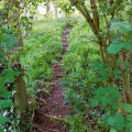
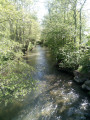
This is a route combining town and countryside. Walkers will discover part of Aire-sur-la-Lys’s historic heritage (remains of the fortifications, the bailiwick and the town hall) as well as a number of watercourses. It is a signposted trail managed by the Pays de Saint-Omer Urban Community.

Details

n°69112713
Creation:
Last update:
Last review:
  • Walking
    Activity: Walking
  • ↔
    Distance: 5.93 mi
  • ◔
    Average duration: 2h 45 
  • ▲
    Difficulty: Easy

  • ⚐
    Back to start: Yes
  • ↗
    Ascent: + 7 ft
  • ↘
    Descent: - 7 ft

  • ▲
    Highest point: 75 ft
  • ▼
    Lowest point: 62 ft

Photos

Description of the walk

The starting point is on Boulevard de la Manutention, in the car park.

(S/E) From the starting sign, turn left. After crossing the pedestrian crossing, turn left, then after a few metres, turn right to join the D943.

(1) Cross the main road carefully. Leave Rue Louis Braille on your left. At the end of Chemin de la Redoute, turn right. For safety reasons, after the cheese shop, cross at the pedestrian crossing and turn right (the signpost is further on at the junction) to reach the crossroads. 

(2) At this junction, turn left. At the crossroads, take Rue Pierre Framery straight ahead; after 350 m, you will see a ‘dead end’ sign on the left at 41 Rue Pierre Framery.

(3) Turn left onto the street where the sign is located. Cross the bridge and ignore the street on your left to reach the departmental road. At the stop sign, turn right. At the traffic lights, turn right; when you reach the Fork in the road, continue straight ahead and cross the bridge.

(4) Cross the road carefully to take the Chemin de la Laquette opposite and follow the stream until you reach a bridge on the left. Then turn left to reach the “give way” sign.

(5) Turn right and walk carefully along the D186. Take the path on the left. At the junction, turn left to reach a concrete path and the D943.

(6) Turn right to reach the sign marking the entrance to the built-up area of Lambres-lez-Aires.

(7) After the wooden footbridge, turn left: cross the D943 carefully at the pedestrian crossing. Then take the dirt track opposite. After the wooden gate, turn left. At the junction, turn left, then cross the bridge. Walk on the left-hand side and continue to the roundabout. Cross the roundabout carefully at the pedestrian crossing. Then, turn right straight away and then left to follow a path with an embankment on the left-hand side until you reach a junction.

(8) Turn right. Carry on straight ahead, crossing several streets, to reach the school on Rue Jules Ferry, where you’ll see the ‘dead end’ sign.

(9) After the school, turn left onto the street marked with the ‘dead end’ sign. Once on Rue de la Tour Blanche, turn right. At the traffic lights, go straight on to reach the town centre on Rue du Bourg.

(10) Cross the road. Then turn left until you reach the Fork in the road, turn right and walk past the town hall. At the end, turn left. Then, before the insurance agent’s office, turn right to reach Place Notre-Dame. Carry on straight ahead until you see the ‘no entry’ sign on your right.

(11) Turn left and, at the junction, turn right. After the garage, go straight on to reach the bridge. After the bridge, turn left. Then go straight on, passing two streets on the right and one on the left, to return to the starting point (S/E).

Waypoints

  1. S/E : mi 0 - alt. 69 ft - Car park, Boulevard de la Manutention
  2. 1 : mi 0.1 - alt. 72 ft - Traffic lights, D943
  3. 2 : mi 0.49 - alt. 72 ft - Carrefour
  4. 3 : mi 0.76 - alt. 69 ft - 41, rue Pierre Framery
  5. 4 : mi 1.3 - alt. 72 ft - Pont, 1 Chemin de la Laquette - Laquette (rivière)
  6. 5 : mi 2.08 - alt. 69 ft - ‘Give Way’ sign
  7. 6 : mi 3.05 - alt. 69 ft - Departmental Road 943
  8. 7 : mi 3.42 - alt. 72 ft - Lambres-lès-Aire
  9. 8 : mi 4.73 - alt. 62 ft - Junction with Chemin de Malannoy
  10. 9 : mi 5.21 - alt. 69 ft - ‘Give Way’ sign
  11. 10 : mi 5.46 - alt. 72 ft - 19, Rue du Bourg
  12. 11 : mi 5.66 - alt. 66 ft - 20, Place Notre-Dame
  13. S/E : mi 5.93 - alt. 69 ft - Car park: Boulevard de la Manutention

Worth a visit

After your walk, it’s well worth taking a stroll around Aire-sur-la-Lys. It was, in fact, a border town between Artois and Flanders. It was fortified. Traces of its military past remain, along with magnificent historic buildings: the bailiwick, the town hall and religious buildings.

There are many sites worth visiting in the Saint-Omer region. For further information, visit the website ofthe Saint-Omer Tourist and Convention Bureau

Reviews and comments

4.7 / 5
Based on 2 reviews

Reliability of the description
5 / 5
Ease of following the route
4.5 / 5
Route interest
4.5 / 5
User 31574924

Overall rating : 4.7 / 5

Date of your route : Oct 18, 2026
Reliability of the description : ★★★★★ Very good
Ease of following the route : ★★★★★ Very good
Route interest : ★★★★☆ Good
Very busy route : No

This walk was really lovely, with plenty of footpaths.
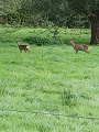
We spotted three roe deer.
Otherwise, there were no particular difficulties and the walk is well signposted, starting from the car park, passing through the town centre and returning to the car park.

Machine-translated

User 26768603

Overall rating : 4.7 / 5

Date of your route : Jul 28, 2025
Reliability of the description : ★★★★★ Very good
Ease of following the route : ★★★★☆ Good
Route interest : ★★★★★ Very good
Very busy route : No

A beautiful, easy and varied hike, but the starting point is poorly signposted

Machine-translated

Other walks in the area

For more walks, use our search engine .

The GPS track and description are the property of this route's author. Please do not copy them without permission.