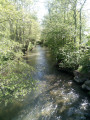
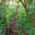
Les Héringaux in Roquetoire

This route will allow you to explore the hedgerow landscape of Roquetoire.
It is a signposted trail managed by the Pays de Saint-Omer Urban Community.

Details

n°62642538
Creation:
Last update:
Last review:
  • Walking
    Activity: Walking
  • ↔
    Distance: 8.53 mi
  • ◔
    Average duration: 4h 00 
  • ▲
    Difficulty: Moderate

  • ⚐
    Back to start: Yes
  • ↗
    Ascent: + 105 ft
  • ↘
    Descent: - 131 ft

  • ▲
    Highest point: 220 ft
  • ▼
    Lowest point: 75 ft
  • ⚐ Country: France
  • ⚐ City: Roquetoire (62120)
  • ⚑
    Start/End: N 50.671041° / E 2.343258°
  • ❏
    IGN map(s): Ref. 2304E, 2304O
  • Hour-by-hour weather

Description of the walk

The starting point is at 18, Place de la Mairie. There is a large car park near the sports hall (Rue Creuse Gabriel), which is on the route, close to the town hall.

(S/E) Opposite the chemist’s, turn right towards the municipal stadium. At the junction, carry on straight ahead. Then, after the second pedestrian crossing, turn right onto the grassy path leading downhill (it’s before the Vaesken premises). At the end of the grassy path, carry on straight ahead to reach Rue Saint-Michel.

(1) Turn left. Then take the first path on the right. Pass the path leading to the Saint-Michel spring on your left, then take the next path on the left. At the end, turn left, then turn right to reach the departmental road.

(2) From there, carry on straight ahead. At the junction, carry on straight ahead until you reach No. 10 Chemin Vieux Thérouanne.

(3) Turn right, then right again to reach a path.

(4) At the junction, carry on straight ahead. Cross the D196 with care and continue to number 18, Impasse des Champs.

(5) Turn right twice. At the end of the grassy track, turn sharply left. At the crossroads, turn right, leave the road on your left and then turn right onto Rue Basse.

(6) Turn left. At the end, turn right, then you’ll come to a Fork in the road.

(7) Keep well to the left. At the junction, turn right. At the crossroads, carry on straight ahead until you reach Rue Saint-Winocq.

(8) Walk up the street on the left. On the hill, take the grassy path on the right and follow it to the end, where it joins Rue de Ligne.

(9) Carry on to the left. At the junction, turn right and, at the crossroads, take the grassy path opposite. When you reach the road, turn right to reach the ‘Give Way’ sign on Rue Creuse Duhamel.

(10) Turn left. At the Fork in the road, turn left and you’ll come out onto the D195.

(11) Carry on to the right, then straight ahead along the path that climbs up to the town hall. There, turn left to return to the starting point (S/E).

Waypoints

  1. S/E : mi 0 - alt. 128 ft - 18, Place de la Mairie
  2. 1 : mi 0.44 - alt. 105 ft - 180, Rue Saint-Michel
  3. 2 : mi 1.2 - alt. 89 ft - D196
  4. 3 : mi 2.19 - alt. 79 ft - 10 Chemin Vieux Thérouanne (Aire/Lys)
  5. 4 : mi 2.95 - alt. 82 ft - Path
  6. 5 : mi 3.32 - alt. 89 ft - 18, Impasse des Champs
  7. 6 : mi 4.35 - alt. 95 ft - 659, Rue Basse
  8. 7 : mi 4.77 - alt. 105 ft - Y-junction
  9. 8 : mi 5.34 - alt. 151 ft - Rue Saint-Winocq
  10. 9 : mi 5.63 - alt. 180 ft - 968, Rue de Ligne
  11. 10 : mi 6.96 - alt. 190 ft - 715 Rue Creuse Duhamel
  12. 11 : mi 8.05 - alt. 95 ft - Departmental road
  13. S/E : mi 8.53 - alt. 128 ft - 18, Place de la Mairie

Notes

The market takes place on Wednesday and Saturday mornings at the Town Hall Square.

Worth a visit

Reviews and comments

5 / 5
Based on 1 review

Reliability of the description
5 / 5
Ease of following the route
5 / 5
Route interest
5 / 5
MAMIEJO
MAMIEJO

Overall rating : 5 / 5

Date of your route : Jul 24, 2025
Reliability of the description : ★★★★★ Very good
Ease of following the route : ★★★★★ Very good
Route interest : ★★★★★ Very good
Very busy route : No

A lovely walk. Varied scenery. A table was laid out for our picnic. We set off at around 10 am. We ended the day on the Yellow River trail, starting from Helfaut (3.5 km).

Machine-translated

Other walks in the area

For more walks, use our search engine .

The GPS track and description are the property of this route's author. Please do not copy them without permission.