


Refine your search for walks in Mégrit
Mégrit walks


 Route of the stones and moors of Mégrit
 Visorando Member
 7.64 mi
 +486 ft
 -495 ft
 3h 55
3h 55
 Moderate
 Departure from Mégrit (Côtes-d'Armor)
Mainly small roads and dirt tracks, very few footpaths. The route offers views of a few stone crosses. Yellow markings (on wooden signs or posts), but the markings are old and in some places non-existent.
The Picotous Route in Mégrit
3.84 mi
+318 ft
-302 ft
2h 05
 Easy
Departure from Mégrit (Côtes-d'Armor)
Easy
Departure from Mégrit (Côtes-d'Armor)
A short route that follows a number of paths through the woods, which are not always easy to follow as there are several paths. The route can also be started from the church, where there is a car park and toilets.
Route from Le Coudray to Languédias
6.59 mi
+98 ft
-69 ft
3h 05
Moderate
Departure from Languédias (Côtes-d'Armor)
There are quite a few crosses and granite buildings along this route , which takes you along small roads, sunken lanes and paths through the woods. No particular difficulty.
Tour of the lake at Jugon-les-Lacs
 11.21 mi
+745 ft
-735 ft
5h 50
Moderate
Departure from Jugon-les-Lacs (Côtes-d'Armor)
11.21 mi
+745 ft
-735 ft
5h 50
Moderate
Departure from Jugon-les-Lacs (Côtes-d'Armor)
The route follows the shaded shores of the lake, small gravel roads and a few short stretches of quiet roads.It will take you through villages with old houses, often beautifully restored.To round off your walk, you can explore the streets and alleyways of the village, following the stream alongside which the wash houses have been restored.
Tour of Lake Arguenon
19.96 mi
+1,250 ft
-1,234 ft
10h 15
 Very difficult
Departure from Jugon-les-Lacs (Côtes-d'Armor)
Very difficult
Departure from Jugon-les-Lacs (Côtes-d'Armor)
The walk around Lac de l’Arguenon allows you to discover the full beauty of the Breton countryside through a wooded route. Dotted with steep rocky outcrops, the path offers a succession of magnificent views.
Please note: this is a very long hike.
Route from Montafilan to Plélan-le-Petit
5.47 mi
+102 ft
-102 ft
2h 35
Easy
Departure from Plélan-le-Petit (Côtes-d'Armor)
The first part of the route is very interesting, passing through the Montafilan valley (although some sections are overgrown with ferns, so it is sometimes better to go round via the adjacent fields), an old wash house and a14th-century manor house. The second part, after the Montafilan Valley, follows rather long dirt tracks before returning to the centre of Plélan-le-Petit.
Circular route between Jugon and Tournemine along the Arguenon.
 Association / Club / Walk leader
 9.55 mi
+535 ft
-522 ft
4h 50
Moderate
Departure from Jugon-les-Lacs (Côtes-d'Armor)
9.55 mi
+535 ft
-522 ft
4h 50
Moderate
Departure from Jugon-les-Lacs (Côtes-d'Armor)
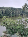
A pleasant walk along part of the Arguenon downstream from Jugon-les-Lacs, following the watercourse, with a few difficult sections. Suitable in all seasons, but take care in heavy rain.
Circular of the Arguenon via the Moulin de Lorgeril bridge
4.45 mi
+322 ft
-305 ft
2h 20
Moderate
Departure from Jugon-les-Lacs (Côtes-d'Armor)
A pleasant walk along the Arguenon downstream from Jugon-les-Lacs, following the water's edge, with a few difficult sections. Suitable in all seasons, but take care in heavy rain.
Around Sévignac
 5.19 mi
+417 ft
-433 ft
2h 45
Easy
Departure from Sévignac (Côtes-d'Armor)
5.19 mi
+417 ft
-433 ft
2h 45
Easy
Departure from Sévignac (Côtes-d'Armor)
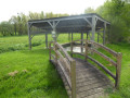
A walk around Sévignac, offering a glimpse of some of the local heritage.The route presents no particular difficulties, is largely tarmac-surfaced, and the walk described below was completed with two children aged 6 and 8 without any problems.Along the route, there is a pond that invites you to take a break, the old mill, a bread oven, the Rochereuil ‘cave’ with a lovely view just behind it, a wash house and a few other points of interest.
Walk around the Rochereuil site
 3.17 mi
+243 ft
-269 ft
1h 40
Easy
Departure from Sévignac (Côtes-d'Armor)
3.17 mi
+243 ft
-269 ft
1h 40
Easy
Departure from Sévignac (Côtes-d'Armor)
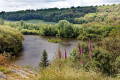
The Rochereuil site is a rocky promontory overlooking a pond. It has been a place of pilgrimage to the Virgin Mary since 1914, when a replica of the Grotto of Lourdes was built there. This short walk through the woodland offers views of the ponds at Château de la Moussaye and lovely panoramic views of the Sévignac countryside. It ends by following a botanical trail along the Ruisseau de la Rosaie.
Circular Tournemine along the Arguenon
 8.11 mi
+771 ft
-778 ft
4h 25
Moderate
Departure from Plorec-sur-Arguenon (Côtes-d'Armor)
8.11 mi
+771 ft
-778 ft
4h 25
Moderate
Departure from Plorec-sur-Arguenon (Côtes-d'Armor)
A very pleasant circular route around the Arguenon with many wooded sections. The route is sometimes steep and strewn with rocks. There is a series of viewpoints over the river, some of which are magnificent.
Route du Petit Tertre in Rouillac
4.68 mi
+269 ft
-259 ft
2h 25
Easy
Departure from Rouillac (Côtes-d'Armor) (Côtes-d'Armor)
A lovely little route with plenty of small roads in the heart of the Méné region, presenting no particular difficulty. There are some lovely views along the undulating roads starting from Étang du Hérisson, which you can walk all the way round.
The Étang du Val as seen from Trélivan
 7.46 mi
+200 ft
-207 ft
3h 35
Moderate
Departure from Trélivan (Côtes-d'Armor)
7.46 mi
+200 ft
-207 ft
3h 35
Moderate
Departure from Trélivan (Côtes-d'Armor)
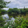
This route will take you through the countryside along lovely paths and tracks with very little tarmac. The stretch through the hamlet of Le Férulais is sure to make an impression. After skirting the Étang du Val and following some very pretty little paths through the woods, you’ll reach the village of Trélivan at the Val Drouet park, where old houses and a small pond lend it an undeniable charm.
Between lakes and forest in Pleven
 8.20 mi
+476 ft
-505 ft
4h 10
Moderate
Departure from Pléven (Côtes-d'Armor)
8.20 mi
+476 ft
-505 ft
4h 10
Moderate
Departure from Pléven (Côtes-d'Armor)
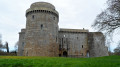
You will follow a very varied route, taking in a reservoir, a castle mound and the medieval Château de la Hunaudaye. Most of this hike takes place in woodland or fields.
From Le Diable to the Rance Valley via Guenroc
 5.62 mi
+505 ft
-502 ft
3h 00
Moderate
Departure from Guenroc (Côtes-d'Armor)
5.62 mi
+505 ft
-502 ft
3h 00
Moderate
Departure from Guenroc (Côtes-d'Armor)
A small village with unexpected treasures, perched high above the Rance Valley. Don’t miss a visit to the church with its devil, its Christ the King, and the view over the Rophemel Dam, which marks the end of the Rance Valley.
The Vallon de l’Osier, starting from Quédillac
3.70 mi
+66 ft
-66 ft
1h 45
Easy
Departure from Quédillac (Ille-et-Vilaine)
A pleasant walk around Quédillac, signposted with specific yellow and blue signs. It runs alongside Quédillac Pond and takes you along paths through unspoilt countryside. Please note that some sections may be difficult to navigate if it has rained heavily recently.
Route de la Forge in Saint-Launeuc
2.61 mi
+72 ft
-66 ft
1h 15
Easy
Departure from Saint-Launeuc (Côtes-d'Armor)
A short route offering views of the Étang de la Hardouinais with its leisure centre, as well as the estate of the same name. The village is also worth a visit, with its charming little church and beautifully decorated hotel-restaurant.
More walks in Mégrit
Select a point of interest below: