Country:
 City:
City:


Park at the sports ground near the school.
Blue markings (not always clearly visible)
(S/E) From the car park, walk slightly uphill towards the village and turn left onto a small path behind the houses in a housing estate. Take the path through the woods which descends towards the Vallée du Rochérel and joins a road.
(1) Follow it to the left towards the Carrière du Chêne Marqué and, at the D19, turn right for about 150 m.
(2) Leave the road and turn right, pass a cross, turn left to cross the Solais and then right to reach the hamlet of Le Tremblay.
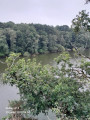
(3) In the hamlet, take the grassy track then the path through the woods at the very top of the valley. Follow the Ruisseau du Pont Renault and descend to the Étang de Rochérel.
(4) Climb up above the valley via the path through the woods, then descend in a zigzag towards the Rochérel Valley. Join the road taken on the way there.
(1) Take the valley road to the left, pass by the pond and then the mill, and before the bridge, head up to the right along the path through the woods to reach the Manoir de Pingy.
(5) Walk up alongside the manor house towards the church.
(6) Go round it on the left and turn right onto Rue Francis Guinard. Walk past the town hall and head for the sports ground car park near the school (S/E).

 Visorando Member
 Moderate

 Very difficult
  Association / Club / Walk leader