


Refine your search for walks in Fontiers-Cabardès
Fontiers-Cabardès walks


 The Camp de Las Brugos
 Visorando Member
 3.47 mi
 +443 ft
 -440 ft
 2h 00
2h 00
 Easy
Easy
 Departure from Fontiers-Cabardès (Aude)
This short walk follows the PR® “Entre Pierres et Forêt” route, which invites you to explore the Hauts de Fontiers, amidst woodland, ancient stone buildings, lush meadows and sweeping panoramic views along shaded paths linking one farmstead to another.
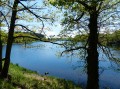
Saint-Denis and the walk around its lake
 3.78 mi
+305 ft
-305 ft
2h 00
Easy
Departure from Aude
3.78 mi
+305 ft
-305 ft
2h 00
Easy
Departure from Aude
A short, easy walk, sheltered for half the route.
Alzeau water intake
 5.19 mi
+482 ft
-482 ft
2h 50
Easy
Departure from Aude
5.19 mi
+482 ft
-482 ft
2h 50
Easy
Departure from Aude
A lovely little walk from the Bassin de Saint-Denis to the Prise Alzeau and back along the stream.
Les Escoussols, Fraisse-Cabardès and Brousses
 5.07 mi
+663 ft
-663 ft
2h 55
Easy
Departure from Fraisse-Cabardès (Aude)
5.07 mi
+663 ft
-663 ft
2h 55
Easy
Departure from Fraisse-Cabardès (Aude)
A walk through woods and fields. The first kilometre is a bit muddy after heavy rain.
Lake Saint-Denis, Les Cabanelles and Bès
 3.74 mi
+240 ft
-253 ft
1h 55
Easy
Departure from Saissac (Aude)
3.74 mi
+240 ft
-253 ft
1h 55
Easy
Departure from Saissac (Aude)
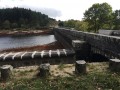
A pleasant walk through woodland and fields. The lake and the Bès reservoir prove, if proof were needed, that the Montagne Noire is like a sponge. Pierre-Paul Riquet was spot on when he created the Rigole, which feeds the Canal du Midi.
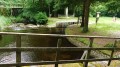
The channel through the Lac de Saint-Denis
 4.51 mi
+161 ft
-161 ft
2h 15
Easy
Departure from Saissac (Aude)
4.51 mi
+161 ft
-161 ft
2h 15
Easy
Departure from Saissac (Aude)
This is an easy hike, sheltered from the sun for 90% of the route. The hike can be done in either direction. You will be better sheltered from the sun if you follow the directions given here.
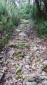
Brousses, following in the footsteps of ancient paths
 4.19 mi
+427 ft
-420 ft
2h 20
Easy
Departure from Brousses-et-Villaret (Aude)
4.19 mi
+427 ft
-420 ft
2h 20
Easy
Departure from Brousses-et-Villaret (Aude)
This route was created by the association "Environnement, Territoires et Paysages" and is very well marked with yellow lines in accordance with FFRP coding. Every slightly complicated crossroads has been clearly marked.
Very well protected, it can be done in both winter and summer.
Two or three fords have been damaged by the floods of 15 October 2018, but they can be crossed without any problems.
You can visit the town hall website to download another description of this hike.
Brousses - Between woods, meadows and heaths.
 4.89 mi
+328 ft
-331 ft
2h 30
Easy
Departure from Brousses-et-Villaret (Aude)
4.89 mi
+328 ft
-331 ft
2h 30
Easy
Departure from Brousses-et-Villaret (Aude)
This walk was created by the association "Environnement, territoires et paysages" (Environment, Territories and Landscapes). Another description can be found at the Brousses town hall or at the paper mill.
Half of the route is on tarmac roads, but with wide, well-mowed verges that allow you to walk on the grass. This walk is particularly enjoyable after heavy rainfall, as in 2018/2019.
In the Loubatière National Forest
2.96 mi
+446 ft
-443 ft
1h 45
Easy
Departure from Lacombe (Aude)
Nestled between Lake Galaube and Lake Laprade Basse, the Loubatière State Forest covers 450 hectares. It is located in the western part of the vast forest that covers the southern slope of the Montagne Noire in the Aude department. A single, completely wooded area, this forest, which ranges in altitude from 660 to 885 metres, forms the headwaters of the Linon stream. In autumn, it offers a dream setting for hikers in search of mushrooms and chestnuts, with the golden colours of oak, beech, birch and chestnut leaves carpeting the ground. This is the ideal playground for an easy walk starting from the hamlet of Cals Haut, part of the commune of Lacombe, between Saissac and Les Martys.
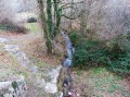
Cuxac, Goutarende, Bertrande and Plaine de Cazelle
 4.26 mi
+604 ft
-614 ft
2h 30
4.26 mi
+604 ft
-614 ft
2h 30
 Moderate
Departure from Cuxac-Cabardès (Aude)
Moderate
Departure from Cuxac-Cabardès (Aude)
Three-quarters of the route is sheltered from the wind and sun. A beautiful walk through a chestnut forest.
The different markings cross each other. This should not be taken into account as several of the paths taken are marked with a cross, but they are the right paths nonetheless. (in (2), in (6) and in (7))
In the Loubatière Forest
4.50 mi
+528 ft
-531 ft
2h 30
Easy
Departure from Lacombe (Aude)
In hot weather, here’s a short, shaded walk in the Loubatière State Forest along paths not necessarily marked on the IGN map but very pleasant to walk along with little elevation gain. The route shares a section with the Lacombe PR°°®°° trail
The Bois de la Serre Haute
 6.54 mi
+738 ft
-735 ft
3h 40
Moderate
Departure from Lacombe (Aude)
6.54 mi
+738 ft
-735 ft
3h 40
Moderate
Departure from Lacombe (Aude)
Walk along forest paths towards the Bois de la Serre Haute and the Forêt Domaniale de la Loubatière from Lacombe, stopping at the source of the Canal du Midi, the Prise d'Alzeau, before following the left bank of the Lac de la Galaube.
The route is marked locally (yellow line). It is taken in the opposite direction to the description with a few modifications for greater comfort (descent at the end of the route).
La Galaube, Cals and Prat d’al Rei
 3.89 mi
+430 ft
-410 ft
2h 10
Easy
Departure from Lacombe (Aude)
3.89 mi
+430 ft
-410 ft
2h 10
Easy
Departure from Lacombe (Aude)
A short, leisurely walk, always on fairly wide paths and well sheltered from the wind that is common in our region. In spring, the undergrowth is strewn with daffodils, dog’s-tooth violets and small comfrey plants.
In 2016, the foresters felled a great deal of timber and left the undergrowth in a sorry state. Let’s hope that, over time, the forest will regain its usual appearance. But that doesn’t spoil the walk.
In the footsteps of Pierre Paul Riquet's "Rigole d'Essai"
 1.73 mi
+292 ft
-289 ft
1h 05
Easy
Departure from Lacombe (Aude)
1.73 mi
+292 ft
-289 ft
1h 05
Easy
Departure from Lacombe (Aude)
360 years ago, Pierre Paul Riquet had the trial trench for the Canal du Midi dug. The official purpose of this small diversion canal was to prove that large quantities of water could be brought from the Montagne Noire to the Naurouze threshold, where the planned navigation canal would have its "dividing point", its highest watercourse. However, for Riquet, the stakes were much higher: he also wanted to prove that he was fully capable of managing a project as large as the gigantic structure he had planned. To convince Colbert and the commission responsible for examining the feasibility of the project, he offered to finance the test canal himself and only be reimbursed if the objectives were achieved... Theoutcome proved this stubborn man right!
This walk takes you on a journey of discovery to find traces of this "Rigole d'Essai" in the Alzeau valley, starting from the village of Lacombe. Parking is available opposite the town hall.
Between the forest and the Montagne Noire drainage ditch
 7.58 mi
+774 ft
-784 ft
4h 10
Moderate
Departure from Lacombe (Aude)
7.58 mi
+774 ft
-784 ft
4h 10
Moderate
Departure from Lacombe (Aude)
A refreshing walk in the Montagne Noire from the small village of Lacombe (11310) to the Ramondens national forest (Tarn) with a picnic stop near the retaining dyke of the St-Denis basin.
Return via the right bank of the Alzeau and passage at the Prise d'Alzeau, source of the Canal du Midi, before climbing back up to Lacombe.
Walk checked on 18/06/23. A few details have been added by the author
La Rigole via the Prise d'Alzeau
 3.76 mi
+144 ft
-144 ft
1h 50
Easy
Departure from Lacombe (Aude)
3.76 mi
+144 ft
-144 ft
1h 50
Easy
Departure from Lacombe (Aude)
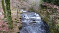
The walk is always in the shade and sheltered by very large beech and oak trees. There is practically no elevation gain as you follow the water.
Cuxac and La Combe Haute Wind Farm
 5.32 mi
+371 ft
-381 ft
2h 45
Easy
Departure from Cuxac-Cabardès (Aude)
5.32 mi
+371 ft
-381 ft
2h 45
Easy
Departure from Cuxac-Cabardès (Aude)
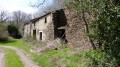
A lovely walk, almost entirely through woodland, sheltered from the wind and direct sunlight. La Combe Haute is an old, abandoned property now in ruins.
Cuxac and Les Grands Champs Wind Farm
 5.28 mi
+476 ft
-472 ft
2h 50
Easy
Departure from Cuxac-Cabardès (Aude)
5.28 mi
+476 ft
-472 ft
2h 50
Easy
Departure from Cuxac-Cabardès (Aude)
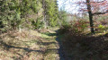
A lovely walk, sheltered from the sun and wind for two-thirds of the route. You’ll pass right by several wind turbines.
La Galaube and Ramondens
 3.98 mi
+312 ft
-302 ft
2h 05
Easy
Departure from Arfons (Tarn)
3.98 mi
+312 ft
-302 ft
2h 05
Easy
Departure from Arfons (Tarn)
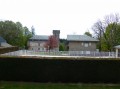
This is a forest walk where you’ll often find yourself between state-owned and privately-owned woodland, resulting in a variety of trees on either side of the path. Beech and coniferous trees share the space. You’ll always be on fairly wide paths.
Forestry work often alters the course of the paths. Don’t worry if the route doesn’t follow the map’s markings exactly. As long as you keep heading in the right direction, you won’t get lost!
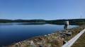
Lac de Laprade Basse around Grand Bois
 3.85 mi
+351 ft
-374 ft
2h 05
Easy
Departure from Lacombe (Aude)
3.85 mi
+351 ft
-374 ft
2h 05
Easy
Departure from Lacombe (Aude)
Hike in the forest, almost always marked in yellow. Short off-trail excursion on paths not marked on the map. In autumn, you may be lucky enough to find some porcini mushrooms.
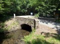
La Rigole via La Galaube
 4.56 mi
+299 ft
-315 ft
2h 20
Easy
Departure from Lacombe (Aude)
4.56 mi
+299 ft
-315 ft
2h 20
Easy
Departure from Lacombe (Aude)
The Rigole de la Montagne again. But this time you won’t be walking alongside it. You’ll go round it on a route that’s shaded all the way. The return along the road is a bit long, but you can walk on the verges if you don’t like tarmac.
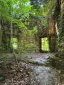
La Rigole from Les Cabanelles to the locks
 3.37 mi
+98 ft
-92 ft
1h 40
Easy
Departure from Saissac (Aude)
3.37 mi
+98 ft
-92 ft
1h 40
Easy
Departure from Saissac (Aude)
A short, gentle walk with no uphill sections, sheltered by the forest throughout. Suitable in summer and winter, even in strong winds.
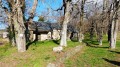
Cuxac Cabardès - The heights of Saint-Pierre
 5.05 mi
+715 ft
-715 ft
2h 55
Easy
Departure from Caudebronde (Aude)
5.05 mi
+715 ft
-715 ft
2h 55
Easy
Departure from Caudebronde (Aude)
A mid-season hike as it’s always exposed to the sun and wind. It climbs for 3.5 km before heading back down… obviously!
Laprade Lake - Les Tables
 3.68 mi
+371 ft
-354 ft
2h 00
Easy
Departure from Cuxac-Cabardès (Aude)
3.68 mi
+371 ft
-354 ft
2h 00
Easy
Departure from Cuxac-Cabardès (Aude)
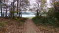
The walk remains entirely in the forest and is completely off-road. Wear suitable footwear as the route is very stony.
En forêt de Ramondens
6.55 mi
+610 ft
-636 ft
3h 35
Moderate
Departure from Arfons (Tarn)
Balade vers le Parc éolien d'Arfons-Sor, situé sur la commune d'Arfons, depuis le château de Ramondens, qui a été un temps la propriété de P.P Riquet, et siège maintenant du CCAS d'EDF qui y organise des colonies de vacances pour les enfants. Le parcours, sans balisage (ou presque), se situe entièrement dans la Forêt Domaniale de la Montagne Noire, au Nord du torrent de l'Alzeau, "frontière" naturelle entre Aude et Tarn, à deux pas de la célèbre Prise d'Alzeau. Après l'arrêt à une ancienne cabane de pisciculture, réaménagée par l'ONF, le retour s'effectue par le vallon de Bergnassonne pour retrouver le château de Ramondens.
The Lampy Neuf Reservoir as seen from Ramondens
9.00 mi
+692 ft
-719 ft
4h 45
Moderate
Departure from Arfons (Tarn)
From Ramondens Castle, follow in the footsteps of P.P. Riquet as you discover the ingenious water supply system for his “Canal des Deux Mers”, established over four centuries ago in the Montagne Noire, before reaching the Lampy Neuf Reservoir, subsequently created to provide the extra water needed for the Canal de Jonction, the link between the Canal du Midi and the Canal de la Robine in Narbonne.
Please take care on a section of the route that goes off the beaten track (further details in the description)
Col de Fangas Haut and the boundary markers
 4.14 mi
+571 ft
-551 ft
2h 25
Moderate
Departure from Lacombe (Aude)
4.14 mi
+571 ft
-551 ft
2h 25
Moderate
Departure from Lacombe (Aude)
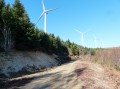
A walk entirely through the woodland of the Forêt de La Loubatière. Following paths and tracks, without ever walking on tarmac, you will follow the Ruisseau de Fraïssègne, one of the streams feeding into Lac de la Galaube, along whose eastern arm you will walk.
Fraïsse-Cabardès and Les Bouriettes
 3.36 mi
+344 ft
-315 ft
1h 50
Easy
Departure from Fraisse-Cabardès (Aude)
3.36 mi
+344 ft
-315 ft
1h 50
Easy
Departure from Fraisse-Cabardès (Aude)
An easy walk through woods and fields. A lovely climb through the forest alongside the Moureau stream.
Fraïsse-Cabardès, the Aiguebelle stream and the Cascailloux
 3.46 mi
+269 ft
-236 ft
1h 50
Easy
Departure from Fraisse-Cabardès (Aude)
3.46 mi
+269 ft
-236 ft
1h 50
Easy
Departure from Fraisse-Cabardès (Aude)
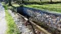
An easy walk through fields and woodland. Well signposted in yellow. Three signs reading ‘Entre puits et heaths’ indicate that you are on the right track.
Fraïsse-Cabardès and its cliff
 4.06 mi
+489 ft
-489 ft
2h 20
Easy
Departure from Fraisse-Cabardès (Aude)
4.06 mi
+489 ft
-489 ft
2h 20
Easy
Departure from Fraisse-Cabardès (Aude)
A short walk, sheltered from the sun and wind for almost the entire length as it is in the forest. It had been marked in blue for an event and these markings remain visible in 2016 – but for how long? In two places, we follow paths that are not shown on the IGN map. Hence the importance of following the Visorando route.
La Montagnole, land of renewable energy
 9.56 mi
+614 ft
-633 ft
4h 55
Moderate
Departure from Les Martys (Aude)
9.56 mi
+614 ft
-633 ft
4h 55
Moderate
Departure from Les Martys (Aude)
Forest hike to the Cuxac-Cabardès wind farm, above the Dure valley, and almost complete tour of Lake Laprade Basse via the recently constructed path that avoids the D101 between the hamlet and the dam dyke (see info).
Lac de Laprade via the peat bogs
 4.05 mi
+138 ft
-167 ft
2h 00
Easy
Departure from Cuxac-Cabardès (Aude)
4.05 mi
+138 ft
-167 ft
2h 00
Easy
Departure from Cuxac-Cabardès (Aude)
Here is a variation on the "Lac de Laprade, around the lake" hike. This variation avoids the climb up the paved road to the village of Laprade Basse. It allows you to visit the Laprade peat bogs and enjoy a pleasant walk on pontoons.
Circular forest starting from Lac de Laprade Basse
10.05 mi
+1,047 ft
-1,060 ft
5h 30
Moderate
Departure from Cuxac-Cabardès (Aude)
From Lac de Laprade Basse in the commune of Cuxac-Cabardès, "Let's go for a walk in the woods to see if the wolf is there!"
In fact, let's set off to explore the Loubatière National Forest, from the Dure River, which feeds the lake, to the Linon Stream, which joins it upstream from Montolieu. Beneath centuries-old trees stand the ruins of an old Carthusian monastery abandoned long before the Revolution, due, among other things, to wolves... which have since been replaced by deer.