


Refine your search for walks in Clans
Clans walks


 The Rocher de Chastellare, starting from Clans
 Visorando Member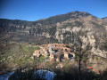
 7.10 mi
 +2,986 ft
 -2,986 ft
 5h 50
5h 50
 Difficult
 Departure from Clans (Alpes-Maritimes)
An excellent area to prepare for the alpine summer season. Areal pleasure to explore this wooded massif, home to a rich variety of species and one of the most beautiful forests in the Alpes-Maritimes department. This paved slanting street, these terraced walls and these ruins bear witness to an ancient agricultural tradition.
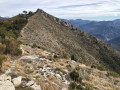
Mont Falourde from Bairols
 9.16 mi
+2,559 ft
-2,566 ft
6h 25
Difficult
Departure from Bairols (Alpes-Maritimes)
9.16 mi
+2,559 ft
-2,566 ft
6h 25
Difficult
Departure from Bairols (Alpes-Maritimes)
Mont Falourde is situated at the junction of the Var and Tinée valleys, and is well worth the detour in its own right. This hike follows some beautiful high-altitude trails, with numerous steep sections offering magnificent panoramic views. The final stretch of the trail runs at the foot of cliffs.
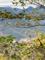
Lake plateau from Bairols with return via the chestnut tree trail.
 Association / Club / Walk leader
 5.94 mi
+1,699 ft
-1,696 ft
4h 15
5.94 mi
+1,699 ft
-1,696 ft
4h 15
 Moderate
Departure from Bairols (Alpes-Maritimes)
Moderate
Departure from Bairols (Alpes-Maritimes)
A lovely autumn hike starting from the medieval hilltop village of Bairols in the middle of the Tinée valley. The climb up to the Col de l'Espalla offers splendid views of the Tinée valley before reaching the lake plateau. The return trip along the chestnut tree trail is also very pleasant and, at this time of year, you can pick up a few chestnuts to roast in a pan in the evening.
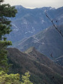
Pointe de Clamia and La Séréna from the village of Marie
 6.38 mi
+2,625 ft
-2,628 ft
5h 15
Moderate
Departure from Marie (Alpes-Maritimes)
6.38 mi
+2,625 ft
-2,628 ft
5h 15
Moderate
Departure from Marie (Alpes-Maritimes)
This hike is mainly through forest and offers beautiful views of the Alps. The Clamia ridge is a rocky outcrop facing the village of Rimplas, which overlooks the Tinée valley.
The Mont d'Ilonse circuit
 11.26 mi
+3,747 ft
-3,727 ft
8h 25
11.26 mi
+3,747 ft
-3,727 ft
8h 25
 Very difficult
Departure from Ilonse (Alpes-Maritimes)
Very difficult
Departure from Ilonse (Alpes-Maritimes)
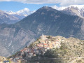
A very pleasant mule track, built by the people of Ilonzo, used for centuries to link the hamlets of Irougne and Le Pous, providing access to farmland and pastures. The path leading to the Col de Fourches is wide but very steep.
The Fort du Pic Charvet from Tournefort
 4.68 mi
+1,188 ft
-1,181 ft
3h 10
Moderate
Departure from Tournefort (Alpes-Maritimes)
4.68 mi
+1,188 ft
-1,181 ft
3h 10
Moderate
Departure from Tournefort (Alpes-Maritimes)
A pleasant hike with no major difficulties, featuring a superb ridge walk and, as a reward, a visit to Fort Charvet. Built between 1883 and 1890, this fort occupies a rocky promontory overlooking the confluence of the Tinée and Var rivers.
Tour of Mont Falourde from Massoins
 9.80 mi
+3,307 ft
-3,307 ft
7h 25
Difficult
Departure from Massoins (Alpes-Maritimes)
9.80 mi
+3,307 ft
-3,307 ft
7h 25
Difficult
Departure from Massoins (Alpes-Maritimes)
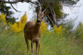
A beautiful, challenging hike between the Var and Tinée rivers.
Le Brec d'Utelle from La Tour via Pas Massena
 11.10 mi
+4,895 ft
-4,869 ft
6 hrs
Very difficult
Departure from La Tour (Alpes-Maritimes)
11.10 mi
+4,895 ft
-4,869 ft
6 hrs
Very difficult
Departure from La Tour (Alpes-Maritimes)
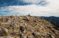
This is a long, somewhat technical hike, starting from the beautiful village of La Tour on the edge of the Tinée valley, which will take you to the summit of Brec d'Utelle with an incredible view of the Tinée and Vésubie valleys.
Western circular of La Tour-sur-Tinée
 4.63 mi
+1,526 ft
-1,532 ft
3h 25
Very difficult
Departure from La Tour (Alpes-Maritimes)
4.63 mi
+1,526 ft
-1,532 ft
3h 25
Very difficult
Departure from La Tour (Alpes-Maritimes)
A very beautiful hike with a variety of trails and vegetation, enhanced by a village classified as a historical monument to discover. Take into account the practical information mentioned in the description regarding the period and the off-trail section.
⚠️ GPS or app essential for this hike! Avoid the winter period, as the rocks near the rivers are slippery.
Lauvet d'Ilonse
7.07 mi
+2,799 ft
-2,776 ft
5h 40
Moderate
Departure from Ilonse (Alpes-Maritimes)
The Lauvet d’Ilonse walk is very accessible. Mostly following the ridge line, it offers views of many surrounding peaks: the Mounier to the north-west and numerous Mercantour peaks on the border with Italy.
Lauvet d'Ilonse from Col de la Sinne
 8.41 mi
+2,142 ft
-2,113 ft
5h 45
Difficult
Departure from Ilonse (Alpes-Maritimes)
8.41 mi
+2,142 ft
-2,113 ft
5h 45
Difficult
Departure from Ilonse (Alpes-Maritimes)
A very fine walk in the middle country of the Alpes Maritimes, alternating between open views and coniferous forests. The 360° panorama from the Lauvet d'Ilonse is well worth the diversions: you can see the whole of the Mercantour and the main peaks of the mid-country.
Route de la Couletta from Rimplas
 5.20 mi
+1,640 ft
-1,667 ft
3h 50
Moderate
Departure from Rimplas (Alpes-Maritimes)
5.20 mi
+1,640 ft
-1,667 ft
3h 50
Moderate
Departure from Rimplas (Alpes-Maritimes)
A magnificent hike with breathtaking views, particularly over the Tinée valley; not very long and easy. Allow between 3 and 3½ hours to complete this sublime route, which is perfectly suited to average but fit walkers. Furthermore, there are no navigation difficulties on this well-marked route. In summer, it is best to walk this route in a clockwise direction.
Mont Giraud
 9.34 mi
+5,217 ft
-5,180 ft
10 hrs
Very difficult
Departure from Rimplas (Alpes-Maritimes)
9.34 mi
+5,217 ft
-5,180 ft
10 hrs
Very difficult
Departure from Rimplas (Alpes-Maritimes)
A superb hike, though very demanding. The route, which crosses a mountain zone as far as the Rimplas dairy, quickly becomes alpine from the ascent to the Pas de Rimplas. At the summit of Mont Giraud, your efforts will soon be forgotten and you will be rewarded with the magnificent panorama stretching from the Queyras and Mont Viso in the north to the Argentera and the Mercantour in the east.
La Bolline via the Chemin de Rouagne
 6.31 mi
+2,703 ft
-2,720 ft
5h 15
Moderate
Departure from Rimplas (Alpes-Maritimes)
6.31 mi
+2,703 ft
-2,720 ft
5h 15
Moderate
Departure from Rimplas (Alpes-Maritimes)
A beautiful hike to discover Valdeblore and the pretty village of La Bolline. This route offers extensive views of La Bolline and La Roche, as well as the Fort de Rimplas.
A round trip from Var to Massoins
 3.02 mi
+781 ft
-810 ft
2h 05
3.02 mi
+781 ft
-810 ft
2h 05
 Easy
Departure from Malaussène (Alpes-Maritimes)
Easy
Departure from Malaussène (Alpes-Maritimes)
This is a very pleasant short walk with a south-facing route, which is very pleasant in winter. This century-old mule track linked the village of Massoins to Malaussène railway station, facilitating logistics and trade.
Circular South of Massoins, return via the Var
 3.05 mi
+935 ft
-955 ft
2h 15
Moderate
Departure from Malaussène (Alpes-Maritimes)
3.05 mi
+935 ft
-955 ft
2h 15
Moderate
Departure from Malaussène (Alpes-Maritimes)
A very pleasant hike, the start of which is south-facing, which is very pleasant in winter. Once you have visited the village, the rarely used return trail ends in a rocky area, where it disappears. Take care when walking through the wooded area of thorn bushes and oak trees on the Dos de l'Éléphant ridge along the banks of the Var .
Mont Vial from Malaussène
 12.02 mi
+4,524 ft
-4,518 ft
9h 30
Difficult
Departure from Malaussène (Alpes-Maritimes)
12.02 mi
+4,524 ft
-4,518 ft
9h 30
Difficult
Departure from Malaussène (Alpes-Maritimes)
A beautiful route through the ‘moyen pays’ region, offering the chance to explore the village of Malaussène, the forest and the ridge of Mont Vial. The 360° panorama from Mont Vial is sublime, with views of both sea and mountains.
Tour of Mont Ragias from Villars-sur-Var
 9.10 mi
+2,612 ft
-2,615 ft
6h 30
Moderate
Departure from Villars-sur-Var (Alpes-Maritimes)
9.10 mi
+2,612 ft
-2,615 ft
6h 30
Moderate
Departure from Villars-sur-Var (Alpes-Maritimes)
This beautiful hike will allow you to explore both sides of Mont Ragias, the highest peak in the Middle Var at 1,174 metres. The eastern slope, which alternates between terraced paths and forest, climbs up the Espignole valley. The other slope, more rocky, overlooks the Var valley, offering beautiful panoramic views. It is only at the Chapelle Saint-Jean du Désert, almost at the end of the route, that you can see Mont Ragias.
The Adous Canal at Malaussène
 5.21 mi
+535 ft
-535 ft
2h 50
Easy
Departure from Malaussène (Alpes-Maritimes)
5.21 mi
+535 ft
-535 ft
2h 50
Easy
Departure from Malaussène (Alpes-Maritimes)
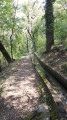
Starting from the village of Malaussène, part of the Serse route has become impassable due to rockfalls. A local advised us to follow the Adous Canal. It’s an easy, almost flat, round-trip walk.
To make the return journey a bit more challenging over the final few kilometres, we turned off to rejoin a section of the Serse route.
Tour of Mont Fracha
7.82 mi
+2,753 ft
-2,749 ft
6h 00
Difficult
Departure from Thiéry (Alpes-Maritimes)
A wild and varied route around Mont Fracha, revealing forests, valleys and panoramic ridges. A changing landscape on this route marked by traces of ancient human activity, between wooded areas, steep terrain and open views over the landscapes of the Cians and the Tinée.
Fort Charvet from the Courbaisse
 6.09 mi
+1,791 ft
-1,791 ft
4h 20
Moderate
Departure from Tournefort (Alpes-Maritimes)
6.09 mi
+1,791 ft
-1,791 ft
4h 20
Moderate
Departure from Tournefort (Alpes-Maritimes)
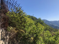
Forgotten on its rocky ridge, the main attraction of this hike is a visit to Fort Charvet. But it is also an opportunity to imagine, for a few minutes, what it was like for the soldiers who were tasked with observing the Var and Tinée valleys at the end of the 18th century in order to protect against a possible Piedmontese invasion. Let us not forget that this area has been French since 1860.
The Villars-sur-Var Mill Canal
 3.87 mi
+1,033 ft
-1,033 ft
2h 40
Moderate
Departure from Villars-sur-Var (Alpes-Maritimes)
3.87 mi
+1,033 ft
-1,033 ft
2h 40
Moderate
Departure from Villars-sur-Var (Alpes-Maritimes)
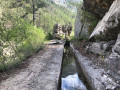
This walk takes us to explore the gorges of the River Espignole. This round trip offers a delightful mix of views of the Var, a visit to the beautiful village of Villars-sur-Var, its church and streets, and the chance to discover an unmarked path that follows the route of the Canal du Moulin, which brings water to the village, without any significant change in elevation.
The Ilonse circular route via Abéliéra
 10.53 mi
+3,379 ft
-3,379 ft
7h 45
Difficult
Departure from Saint-Sauveur-sur-Tinée (Alpes-Maritimes)
10.53 mi
+3,379 ft
-3,379 ft
7h 45
Difficult
Departure from Saint-Sauveur-sur-Tinée (Alpes-Maritimes)
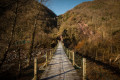
A very pretty circular route in the Tinée Valley featuring an abandoned hamlet, magnificent climbs through the woods and breathtaking views of several villages in the area.
Around the village of La Bolline in Valdeblore
4.23 mi
+663 ft
-640 ft
2h 30
Easy
Departure from Valdeblore (Alpes-Maritimes)
This walk around La Bolline, a village in Valdeblore, takes you along pretty paths through wooded valleys. It takes you to the village of La Bolline, the Chapel of Sainte-Croix des Pénitents Blancs, the fountain in Place de Casetto (1857) and the Church of Saint-Jacques-le-Majeur (17th century), as well as the village of La Roche and the Chapel of the Pénitents Noirs de l'Annonciation.
Saint-Dalmas de Valdeblore - Utelle
15.74 mi
+4,354 ft
-5,919 ft
11h 00
Difficult
Departure from Valdeblore (Alpes-Maritimes)
Étape de la traversée des Alpes de Saint-Dalmas de Valdeblore jusqu'à Utelle. Randonnée sur une ligne de crête offrant des panoramas extraordinaires sur l'arrière pays niçois.
Saint-Dalmas de Valdeblore – Le Boréon
 12.91 mi
+4,491 ft
-3,720 ft
10 hrs
Very difficult
Departure from Valdeblore (Alpes-Maritimes)
12.91 mi
+4,491 ft
-3,720 ft
10 hrs
Very difficult
Departure from Valdeblore (Alpes-Maritimes)
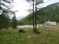
Second stage of the route and first stage on theGR®52. A long 21km stage taking in the Col de Veillos, numerous lakes, the Col du Barn, the Vacherie du Collet and the Col de Salèse, ending at a place called Le Boréon.
A spectacular stage thanks to its landscapes and views, but very difficult.
From Saint-Dalmas to Utelle
 15.80 mi
+4,124 ft
-5,745 ft
10h 50
Difficult
Departure from Valdeblore (Alpes-Maritimes)
15.80 mi
+4,124 ft
-5,745 ft
10h 50
Difficult
Departure from Valdeblore (Alpes-Maritimes)
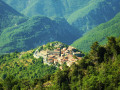
This twentieth stage marks the end of the crossing of the Mercantour Massif. From Saint-Dalmas, the GR®5 heads south to climb the steep slope towards the Cime de Colmiane, which it bypasses by heading for the Col du Varaire. It crosses the Bois Noir and reaches the Col des Deux Caïres, then the Caïre Gros. The route follows its ridge and, hugging the hillside, passes beneath Mont Chalancha, La Partissuola and the Cime de la Combe before descending to the small pass of Trous. Before the Col du Fort, the path descends to the Granges de la Brasque, crosses the upper part of the Riou du Figaret valley and arrives at the Col d’Andrion. Cutting across the hairpin bends of the M33, the GR®5 reaches the Col des Fournès and the Col de Gratteloup. Through rocky gaps, it runs alongside the Petit Brec d’Utelle and then the Brec d’Utelle. From there, the path descends towards the Crête de l’Albaréa and reaches the Col du Castel Ginesté. It crosses the slope below the ridges of the Têtes du Sac de Bécasse, Parabosquet and Les Pennes to reach the Utelle community lodge.
The Belvédère de Séréna via Mont Viroulet
 7.59 mi
+2,385 ft
-2,375 ft
5h 35
Difficult
Departure from Valdeblore (Alpes-Maritimes)
7.59 mi
+2,385 ft
-2,375 ft
5h 35
Difficult
Departure from Valdeblore (Alpes-Maritimes)
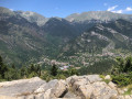
A beautiful hike in a very shady forest environment, best done in spring or during the warmer months, where you can enjoy this area rich in fir and spruce trees. Finally, enter the fortified village through the old ogival gate to discover what is certainly the oldest of the three villages of Valdeblore.
Tour du Chaussemine and return via the banks of the Var
 6.85 mi
+2,320 ft
-2,320 ft
5h 10
Difficult
Departure from Villars-sur-Var (Alpes-Maritimes)
6.85 mi
+2,320 ft
-2,320 ft
5h 10
Difficult
Departure from Villars-sur-Var (Alpes-Maritimes)
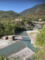
A lovely walk for those who enjoy wooded areas in a very quiet spot. Beautiful views of the Pointe de Chavanette and the Cime des Quatre Cantons. A very pleasant return journey along the banks of the Var.
The Roman bridge at Thiéry
 2.48 mi
+886 ft
-883 ft
1h 55
Easy
Departure from Thiéry (Alpes-Maritimes)
2.48 mi
+886 ft
-883 ft
1h 55
Easy
Departure from Thiéry (Alpes-Maritimes)
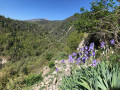
A very beautiful and short walk, following a centuries-old path, as evidenced by these two ancient bridges. The bridge and the unmarked wooded path are a lovely discovery. Beautiful views of the village of Thiéry before crossing it.
Alpine pastures and woodland above the Vésubie Valley and Valdeblore
6.28 mi
+2,398 ft
-2,398 ft
5h 00
Moderate
Departure from Venanson (Alpes-Maritimes)
A hike starting from the village of Venanson in the Vésubie Valley; relatively short but with a significant elevation gain. It offers a variety of views over different parts of the region: the Tinée and Vésubie valleys, and the villages in the Valdeblore area. A good mix of wooded and open sections. There are no difficulties with navigation. The paths are clearly visible and the signposts are very helpful.
Mont Fracha via the Gardettes and Briu ridges
 9.42 mi
+2,995 ft
-2,979 ft
6h 55
Difficult
Departure from Thiéry (Alpes-Maritimes)
9.42 mi
+2,995 ft
-2,979 ft
6h 55
Difficult
Departure from Thiéry (Alpes-Maritimes)
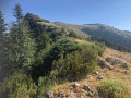
The view from Mont Fracha (1,776 m) is exceptional, but it’s hard-earned as the off-trail route along the Gardettes ridge is steep. The Brec d’Illonse rounds off the exceptional panoramic views on this hike.
La Villa Souberre de Thiéry
 5.19 mi
+1,427 ft
-1,427 ft
3h 40
Easy
Departure from Thiéry (Alpes-Maritimes)
5.19 mi
+1,427 ft
-1,427 ft
3h 40
Easy
Departure from Thiéry (Alpes-Maritimes)
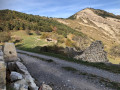
Un joli circuit dans un domaine forestier très agréable aux essences de pins diverses. La montée jusqu'à la Villa Souberre, en pente douce, permet d'admirer les alpages.
The underside of the Crête des Charbonnières starting from Thiéry
 7.11 mi
+2,510 ft
-2,520 ft
5h 25
Moderate
Departure from Thiéry (Alpes-Maritimes)
7.11 mi
+2,510 ft
-2,520 ft
5h 25
Moderate
Departure from Thiéry (Alpes-Maritimes)
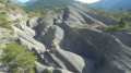
A beautiful circular wooded path starting from the village of Thiéry, allowing you to admire the Crête des Charbonnières, then walk along it on the way back. The route is a little long (6 hours including breaks) but does not present any technical difficulties. At the end of the hike, we recommend visiting the village.
Caïre Gros
 6.51 mi
+2,270 ft
-2,254 ft
5h 00
Moderate
Departure from Valdeblore (Alpes-Maritimes)
6.51 mi
+2,270 ft
-2,254 ft
5h 00
Moderate
Departure from Valdeblore (Alpes-Maritimes)
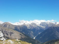
A magnificent viewpoint, the summit of Caïre Gros, between the Tinée and Vésubie valleys, offers superb views of the Franco-Italian mountain range and the main peaks of the Mercantour.
From Saint-Sauveur-sur-Tinée to Roure via the canal
 5.13 mi
+2,028 ft
-2,041 ft
4h 10
Moderate
Departure from Saint-Sauveur-sur-Tinée (Alpes-Maritimes)
5.13 mi
+2,028 ft
-2,041 ft
4h 10
Moderate
Departure from Saint-Sauveur-sur-Tinée (Alpes-Maritimes)
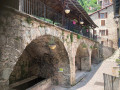
This route begins in woodland where wild strawberries grow, followed by an unusual, little-used canal, before joining the GR®5. The beautiful village of Roure is well worth a visit: original wash house, fountains, a wealth of renowned local heritage.
Mont Pepoiri, Petoumier and Lacs de Millefonts
 12.11 mi
+5,696 ft
-5,669 ft
10 hrs
Very difficult
Departure from Valdeblore (Alpes-Maritimes)
12.11 mi
+5,696 ft
-5,669 ft
10 hrs
Very difficult
Departure from Valdeblore (Alpes-Maritimes)
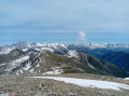
This is a beautiful circuit that allows you to discover the Baus de la Frema and Mont Pétoumier with incredible views of the Argentera and Gélas massifs, then the Lacs de Millefonts with the final climb to Mont Pépoiri, which offers an extraordinary panorama of the entire Mercantour and the middle country.
The Crête de la Madone via Le Reveston
 7.34 mi
+3,671 ft
-3,665 ft
6h 35
Very difficult
Departure from Utelle (Alpes-Maritimes)
7.34 mi
+3,671 ft
-3,665 ft
6h 35
Very difficult
Departure from Utelle (Alpes-Maritimes)
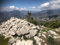
A difficult, unspoilt and wild route which, after an hour’s walk, leaves the Reveston path (alt. 560 m) to reach the Crête de la Madone (alt. 1154 m). Please note : this hike is intended for those who enjoy challenging terrain and sustained physical exertion.
The Madone d’Utelle as seen from the Gorges de la Mescla
 9.56 mi
+3,957 ft
-3,947 ft
7h 50
Difficult
Departure from Utelle (Alpes-Maritimes)
9.56 mi
+3,957 ft
-3,947 ft
7h 50
Difficult
Departure from Utelle (Alpes-Maritimes)
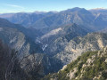
A beautiful walk with varied scenery, offering a 360° view from the sanctuary. Walking through the ruins, hidden reminders of times gone by, allows us to forget the hustle and bustle of everyday life for a few moments.
Cime des Collettes
 4.45 mi
+1,739 ft
-1,732 ft
3h 35
Moderate
Departure from Toudon (Alpes-Maritimes)
4.45 mi
+1,739 ft
-1,732 ft
3h 35
Moderate
Departure from Toudon (Alpes-Maritimes)
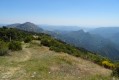
This circular hike starting from the village of Toudon provides access to one of the main peaks of the Mont Vial massif between Var and Estéron.
On the menu for this hike: pine forests and broom scrub, grassy terraces of abandoned countryside, a slightly steep passage at the foot of a limestone cliff, panoramic views of Cheiron, the Var valley, Mercantour... and even Nice and the sea on a clear day.
Ascent of Baus de la Frema
 4.46 mi
+1,982 ft
-1,988 ft
3h 45
Moderate
Departure from Valdeblore (Alpes-Maritimes)
4.46 mi
+1,982 ft
-1,988 ft
3h 45
Moderate
Departure from Valdeblore (Alpes-Maritimes)
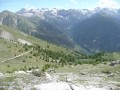
An easy hike offering beautiful views of the Mercantour Massif and, opposite, the Madone de Fenestre valley. You can extend the hike on the mountain pasture towards the Tête du Brec (2566m).
Circular route around the Madone d’Utelle via the Col d’Ambellarte and the Reveston
7.61 mi
+2,799 ft
-2,815 ft
5h 55
Difficult
Departure from Utelle (Alpes-Maritimes)
A lovely circular walk around the Madone d’Utelle.
It offers a wide variety of landscapes: from woodland to meadows, Mediterranean scenery and terraced fields, passing through drier terrain.
The view is at times quite narrow, at other times very expansive, offering vistas of the surrounding peaks of the Mercantour, the Cians and the Tinée, as well as the Gorges de la Mescla.
Roure - Saint Dalmas Valdeblore
9.54 mi
+3,261 ft
-2,657 ft
7h 15
Difficult
Departure from Alpes-Maritimes
Étape de la traversée des Alpes avec un départ de Roure jusqu'à Saint Dalmas de Valdeblore.
Randonnée allant de la vallée de la Tinée à l'arrière pays niçois.
Ridge and Sanctuary of the Madonna of Utelle
 5.73 mi
+1,713 ft
-1,716 ft
4h 10
Moderate
Departure from Utelle (Alpes-Maritimes)
5.73 mi
+1,713 ft
-1,716 ft
4h 10
Moderate
Departure from Utelle (Alpes-Maritimes)
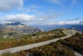
A loop starting from Utelle, a charming village perched in the Vésubie Valley. The first part is wild and rocky on a ledge above the Vésubie, followed by a gentle climb through an amazing forest of terraced fields. The final climb, steeper up to the Crête de la Madone d'Utelle, offers a 360° view of the coastline, the Var Valley, the peaks of the Mercantour and the Nice hinterland. Finally, the descent offers numerous views of the village of Utelle.
Mercantour route via the GR®52
 65.54 mi
+21,585 ft
-24,639 ft
7 days
Very difficult
Departure from Saint-Martin-Vésubie (Alpes-Maritimes)
65.54 mi
+21,585 ft
-24,639 ft
7 days
Very difficult
Departure from Saint-Martin-Vésubie (Alpes-Maritimes)
TheGR® 52 is a route that crosses the Mercantour National Park, through the Alpes-Maritimes from Saint-Dalmas-de-Valdeblore to Menton.
ThisGR® route is very challenging due to the varied terrain and significant elevation changes.
You’ll reach altitudes of up to 2,700m, where you can admire the high-mountain landscapes, flora and fauna. Then, in the second half of the route, you’ll encounter panoramas that are more southern in character but just as extraordinary.
Saint-Martin-de-Vésubie - Saint-Dalmas de Valdeblore
 4.01 mi
+1,821 ft
-732 ft
3h 25
Moderate
Departure from Saint-Martin-Vésubie (Alpes-Maritimes)
4.01 mi
+1,821 ft
-732 ft
3h 25
Moderate
Departure from Saint-Martin-Vésubie (Alpes-Maritimes)
The GR®52 starts in Saint-Dalmas de Valdeblore. This first stage is a transition to reach the starting point of the GR®.This is a lovely hike that passes through the small resort of La Colmiane and offers a relatively easy climb, following the GR®52 A through the woods for just over 6km.
Cime de Piagu
 11.88 mi
+5,249 ft
-5,233 ft
10h 00
Difficult
Departure from Saint-Martin-Vésubie (Alpes-Maritimes)
11.88 mi
+5,249 ft
-5,233 ft
10h 00
Difficult
Departure from Saint-Martin-Vésubie (Alpes-Maritimes)
A magnificent mid-mountain hike offering a variety of landscapes: the village of Saint-Martin-Vésubie, the Boréon forest and, finally, a rocky landscape with a 360° view of the surrounding peaks.
Utelle - Levens
7.41 mi
+1,870 ft
-2,680 ft
5h 00
Moderate
Departure from Utelle (Alpes-Maritimes)
Etape de la traversée des Alpes d'Utelle jusqu'à Levens. Randonnée entre la vallée de la Vésubie et les derniers reliefs alpins.
From Utelle to Nice Ville railway station
 21.50 mi
+3,806 ft
-6,385 ft
13h 10
Difficult
Departure from Utelle (Alpes-Maritimes)
21.50 mi
+3,806 ft
-6,385 ft
13h 10
Difficult
Departure from Utelle (Alpes-Maritimes)
This twenty-first stage, once you have crossed the Vésubie, takes place in the Nice Pre-Alps and brings the GTA (Grande Traversée des Alpes) to a close by the sea. From the Place de la Fontaine in Utelle, the GR®5 heads west, then south, crossing a few small valleys to reach the hamlet of Cros d’Utelle. It crosses the Vésubie valley, climbs the opposite slope after the town of Levens, ascends through woodland to Colla Partida, passes beneath Mont Cima and descends to the beautiful circular fortified village of Aspremont. The path climbs the western flank of Mont Chauve d’Aspremont without reaching the summit. It descends the Crête de Graus until it reaches Château Renard and then La Bauma. The path enters a valley, which it follows eastwards, then due south towards La Fontaine Sainte, and crosses the bridge over the Autoroute de la Provençale. It enters the city of Nice, which it crosses from north to south to reach Nice Ville railway station.
Le Brec d'Utelle
 6.86 mi
+2,995 ft
-2,995 ft
5h 45
Moderate
Departure from Utelle (Alpes-Maritimes)
6.86 mi
+2,995 ft
-2,995 ft
5h 45
Moderate
Departure from Utelle (Alpes-Maritimes)
From the village of Utelle, this hike leads to a fairly steep rocky outcrop. On a clear day, the Brec d'Utelle offers a 360° panorama from the Mercantour to the gulfs of the Côte d'Azur. This hike is almost entirely along theGR®5.
Caution: footbridges and very tricky sections in the final ascent.
Around the Suc de Cabagne
 7.82 mi
+3,438 ft
-3,402 ft
6h 35
Difficult
Departure from Utelle (Alpes-Maritimes)
7.82 mi
+3,438 ft
-3,402 ft
6h 35
Difficult
Departure from Utelle (Alpes-Maritimes)
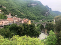
A beautiful paved slanting street mule track taking you through fields and ruins to the small rural chapel of Saint-Pierre. This lovely walk, a testament to many ancestral exchanges, offers a journey back in time.
The Col de la Couillole and Pin Pourri in a circular route from Roubion
 9.09 mi
+2,359 ft
-2,356 ft
6h 15
Moderate
Departure from Roubion (Alpes-Maritimes)
9.09 mi
+2,359 ft
-2,356 ft
6h 15
Moderate
Departure from Roubion (Alpes-Maritimes)
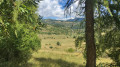
This is a magnificent hike that starts in the picturesque medieval village of Roubion, with part of the trail already described on Visorando. Partly shaded by the forest, it will guide you through the Bois du Falcon and the meadows to the foot of Mont Buissière, at the Col de la Couillole, then to the Pin Pourri, where you can admire the Tête de Giarons and its vast meadows. The return journey will take you through the charming hamlet of Villars.
The Falcon Wood starting from Roubion
 5.27 mi
+1,601 ft
-1,627 ft
3h 50
Moderate
Departure from Roubion (Alpes-Maritimes)
5.27 mi
+1,601 ft
-1,627 ft
3h 50
Moderate
Departure from Roubion (Alpes-Maritimes)
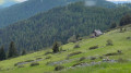
A short hike at the foot of the Falcon rock faces, in a varied landscape: climb through a sparse forest of spruce and Scots pine, enjoy beautiful views of the valley from the Falcon ridge, then descend among the sheepfolds and hamlets of Falcon and Les Vallons.
This hike is featured in the short guidebook "Rando Passion" published by the Roubion tourist office.
The elevation gain is lower than that indicated by Visorando, at around 400 metres.
Discovering Roubion
 3.29 mi
+1,437 ft
-1,414 ft
2h 45
Moderate
Departure from Roubion (Alpes-Maritimes)
3.29 mi
+1,437 ft
-1,414 ft
2h 45
Moderate
Departure from Roubion (Alpes-Maritimes)
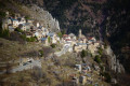
Starting from the charming village of Roubion – well worth a visit for its painted doors – you’ll head up towards Les Buisses via the Chapel of Saint-Sébastien (with its remarkable frescoes).
After climbing Le Puy, you’ll descend through the forest to the Vallon de Saint-Sébastion, passing through some impressive and surprising natural arches.
Finally, a final climb will offer you another view of the village.
Cime de l'Autaret
 7.31 mi
+2,654 ft
-2,641 ft
5h 40
Moderate
Departure from Duranus (Alpes-Maritimes)
7.31 mi
+2,654 ft
-2,641 ft
5h 40
Moderate
Departure from Duranus (Alpes-Maritimes)
A hike in complete tranquillity. Along the trail, you can admire small pebbles in the rock cavities and small drawings. From several places, you can see the Madonna of Utelle and magnificent views of the Vésubie valley.
Cime de Rocassièra, starting from Calençon
 7.33 mi
+3,720 ft
-3,701 ft
6h 35
Difficult
Departure from Duranus (Alpes-Maritimes)
7.33 mi
+3,720 ft
-3,701 ft
6h 35
Difficult
Departure from Duranus (Alpes-Maritimes)
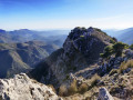
A magnificent hike that starts from the hamlet of Calençon and offers a 360° view of the Mercantour Massif, the Haute Vésubie and all the way to the sea! The Madone d’Utelles is visible on its ridge. Abundant and varied vegetation throughout the route.