Circular route around the Madone d’Utelle via the Col d’Ambellarte and the Reveston

A lovely circular walk around the Madone d’Utelle.
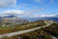
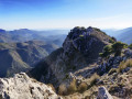
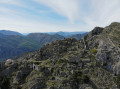
It offers a wide variety of landscapes: from woodland to meadows, Mediterranean scenery and terraced fields, passing through drier terrain.
The view is at times quite narrow, at other times very expansive, offering vistas of the surrounding peaks of the Mercantour, the Cians and the Tinée, as well as the Gorges de la Mescla.

Details

40893885
Creation:
Last update:
Last review:
  • Walking
    Activity: Walking
  • ↔
    Distance: 7.61 mi
  • ◔
    Average duration: 5h 55 
  • ▲
    Difficulty: Difficult

  • ⚐
    Back to start: Yes
  • ↗
    Ascent: + 2,799 ft
  • ↘
    Descent: - 2,815 ft

  • ▲
    Highest point: 3,865 ft
  • ▼
    Lowest point: 1,473 ft
  • ⚐ Country: France
  • ⚐
    Area: Alps
  • ⚐ City: Utelle (06450)
  • ⚑
    Start/End: N 43.916025° / E 7.231078°
  • ❏
    IGN map(s): Ref. 3641ET, 3642ET, 3741ET, 3741OT
  • Hour-by-hour weather

Description of the walk

For access to the starting point, see the ‘Practical information’ section.

(S) Follow the road uphill for about 100 m until you reach marker 115.

(1) Take the path branching off to the right, which winds its way through the trees, crossing the road in two places (take care when crossing), to reach the Sanctuary of Our Lady of Utelle.
Continue along the road, towards the mast, until you reach marker 117.

(2) From marker 117, take the path that descends to the left of the road towards the Col d’Ambellarte. The path is quite stony, consisting at times of large flat stones and at other times of pebbles, and descends quite steeply. It is poorly marked, but the very regular yellow markings allow you to follow it to the plateau.

(3) Continue straight on, following the descent, until you reach a grassy plateau. Cross it to reach the Col d’Ambellarte, at marker 118.

(4) Carry on a little further along the same path, then turn right up another path through the forest towards the Col de la Moutète. You’ll reach marker 105.

(5) Turn right, still heading towards the Col de la Moutète, and cross the grassy plateau to its far end.
Follow the path on the left, which descends towards the forest, until you reach a junction (elevation 884 m).

(6) Turn right onto the path, which takes you round to the other side of the mountain. This will take you to the Col de la Moutète at marker 100.

(7) Turn sharply right, heading north, onto the path towards Le Reveston (yellow markings). Pass under the power line and arrive at a Fork in the road.

(8) Take the path that descends slightly to the left, then pass under the power line again a little further on.

(9) Turn left and cross the stream bed (dry in September 2023), passing a wash house on your right.
Continue past a high-voltage pylon. Cross several scree slopes where the path is quite narrow. Reach a junction at marker 107.

(10) Turn right onto the path, heading towards Le Reveston, which you’ll reach at marker 108.

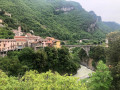
(11) Head straight on along the path towards the Madone d’Utelle, pass through the hamlet of Le Reveston, and follow a path flanked on either side by two low walls, as if on a bridge, until you reach marker 109.

(12) Head up to the right along the path towards the Madone d’Utelle, through the grassy meadow. Pass several scree slopes and continue uphill until you cross an old concrete bridge, which takes you to the other side of the mountain. The path then becomes much rockier, with sparser vegetation. Wind your way along a balcony-like path with a fairly steady gradient.
In the distance, you can see a pylon; take the path on your left towards the pylon, then reach a plateau and head for marker 119.

Take the path on the right towards La Madone, then continue along a wide forest track.
After passing through a section of woodland and then out into the open, you’ll reach marker 114.

Head back up to the right onto the road and follow it to the right to return to your car park (S/E).

For those who have parked at the Madone d’Utelle: turn right onto the road as far as marker 115, then take the path that winds its way up to the Sanctuary of the Madone d’Utelle.

Waypoints

  1. S/E : mi 0 - alt. 3,445 ft - RM 132 – marker 114
  2. 1 : mi 0.09 - alt. 3,481 ft - Marker 115
  3. 2 : mi 0.6 - alt. 3,845 ft - Marker 117 - Sanctuaire de la Madone d'utelle
  4. 3 : mi 1.05 - alt. 3,255 ft - Plateau
  5. 4 : mi 1.25 - alt. 3,176 ft - Marker 118 - Col d'Ambellarte
  6. 5 : mi 1.57 - alt. 3,412 ft - Marker 105
  7. 6 : mi 2.94 - alt. 2,851 ft - Junction – altitude 884 m
  8. 7 : mi 3.12 - alt. 2,762 ft - Marker 100 - Col de la Moutète
  9. 8 : mi 3.63 - alt. 2,428 ft - Fork in the road; turn left
  10. 9 : mi 4.08 - alt. 1,824 ft - Stream
  11. 10 : mi 4.8 - alt. 1,473 ft - Marker 107
  12. 11 : mi 5.16 - alt. 1,775 ft - Marker 108 - Le Reveston
  13. 12 : mi 5.27 - alt. 1,867 ft - Marker 109 - Le Reveston
  14. 13 : mi 6.67 - alt. 3,058 ft - Marker 119
  15. S/E : mi 7.61 - alt. 3,445 ft - RM 132 – Marker 114

Notes

There are two options for starting the walk:

  • either from the car park at the Madone d’Utelle sanctuary to start directly with the descent: in that case, begin the route description at (2).
  • or at the bend before marker 115 (two hairpin bends before the sanctuary): the road widens, providing space for two or three cars to park. This option will save you 200 metres of elevation gain at the end of the walk. In this case, follow the route description above.

Alternative route:
(2) You can continue past marker 117 towards the summit orientation table. Just after this, turn left onto a wider forest track and descend via a series of hairpin bends to the start of the plateau (3).

There are no water supply points along the route.
Yellow markings throughout the route.
This walk has been classified as difficult due to numerous fairly narrow sections or ledges, with frequent scree or very stony paths. Note that this path must have been little used recently, as vegetation has grown rampant in places. A few trees, easily crossed, lie across the path on the ascent (September 2023).
The path is sheltered from the sun (by the forest) for about one-third of the route; the remaining two-thirds are in open terrain.

Worth a visit

A visit to the Madone d’Utelle, with its church… and its refreshment bar!

Reviews and comments

4.6 / 5
Based on 3 reviews

Reliability of the description
4.7 / 5
Ease of following the route
4.7 / 5
Route interest
4.3 / 5
Perseepj
Perseepj
• Edited:

Overall rating : 4.7 / 5

Date of your route : Jul 24, 2024
Reliability of the description : ★★★★★ Very good
Ease of following the route : ★★★★★ Very good
Route interest : ★★★★☆ Good
Very busy route : No

A really lovely walk with a challenging side that shouldn’t be overlooked (quite a significant elevation gain).
It’s a shame that La Madone d’Utelle has been closed since the bad weather of winter 23/24. But the refreshment bar next to La Madone is still open – it’s a welcome stop after the final climb (I parked in the top car park)!
I think doing the circular route in the opposite direction is also a good option to make the most of the sweeping views over the valley between points 2 and 12.

Machine-translated

randonneurintrépide
randonneurintrépide

Overall rating : 5 / 5

Date of your route : Oct 30, 2023
Reliability of the description : ★★★★★ Very good
Ease of following the route : ★★★★★ Very good
Route interest : ★★★★★ Very good
Very busy route : No

It was really hot. But the route is lovely.

Machine-translated

Gilbert Fournier
Gilbert Fournier

Overall rating : 4 / 5

Date of your route : Oct 09, 2023
Reliability of the description : ★★★★☆ Good
Ease of following the route : ★★★★☆ Good
Route interest : ★★★★☆ Good
Very busy route : No

This route is best tackled outside the hot season, as the steep climb is at the end of the route and is very exposed to the sun.

Machine-translated

Other walks in the area

For more walks, use our search engine .

The GPS track and description are the property of this route's author. Please do not copy them without permission.