The Adous Canal at Malaussène

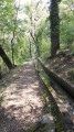
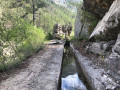
Starting from the village of Malaussène, part of the Serse route has become impassable due to rockfalls. A local advised us to follow the Adous Canal. It’s an easy, almost flat, round-trip walk.
To make the return journey a bit more challenging over the final few kilometres, we turned off to rejoin a section of the Serse route.

Details

13800490
Creation:
Last update:
Last review:
  • Walking
    Activity: Walking
  • ↔
    Distance: 5.21 mi
  • ◔
    Average duration: 2h 50 
  • ▲
    Difficulty: Easy

  • ⚐
    Back to start: Yes
  • ↗
    Ascent: + 535 ft
  • ↘
    Descent: - 535 ft

  • ▲
    Highest point: 1,391 ft
  • ▼
    Lowest point: 1,125 ft
  • ⚐ Country: France
  • ⚐
    Area: Alps
  • ⚐ City: Malaussène (06710)
  • ⚑
    Start/End: N 43.927307° / E 7.131102°
  • ❏
    IGN map(s): Ref. 3641ET, 3641OT, 3642ET
  • Hour-by-hour weather

Photos

Description of the walk

Park in the car park at the entrance to the village.

(S/E) Make your way to the square where the starting marker for the Serse route is located. Do not take that route; instead, head down the street to the right until you reach the wash house.

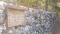
(1) At the wash house, take the small alleyway on the left: there’s a yellow sign on the corner, see photo. Along the route, you’ll find various information boards in front of wash houses and an oil mill.

(2) Carry on straight ahead, leaving the path on your left which you will use for the return journey. Cross the aqueduct and continue along the path that runs alongside the canal, which you can recognise by the inspection hatches in the ground.

(3) Stay on the path on the right – the flattest one – continuing to follow the canal. You’ll come to a footbridge.

(4) Carry on straight ahead, continuing to follow the canal. At junctions with other paths, always take the flattest path. You may sometimes have to walk on the canal itself when the path is too narrow.

(5) Turn back. But there’s nothing to stop you from carrying on to the end of the canal path.

(4) Just before crossing the footbridge again, turn right onto a stony track which joins a flat path on the right. Then cross a tree-thinning area (where no work was taking place when we passed through in August 2021), and reach a sharp bend to the right of the track.

(6) At this bend in the track, it is a little difficult to spot the path on the left leading to the Serse route, as there are no markings. This barely visible path climbs towards some ruins, which you should leave on your left. Follow the GPS track.

At the next fork, continue straight on and rejoin the Serse route, marked in yellow.

(7) Caution: there has been a small rockslide on the path; cross it with due care. You will then rejoin the path you took on the way there.

(3) Turn right, following the route you took on the way there.

(2) Leave the canal and continue to the right along the path marked in yellow until you reach the centre of the village. Return to the car park where you started (S/E).

Waypoints

  1. S/E : mi 0 - alt. 1,276 ft - Car park
  2. 1 : mi 0.15 - alt. 1,230 ft - Washing place
  3. 2 : mi 0.43 - alt. 1,207 ft - Junction: A/ straight on – R/ right
  4. 3 : mi 0.56 - alt. 1,250 ft - Common junction for out-and-back route
  5. 4 : mi 1.79 - alt. 1,243 ft - Footbridge. Common junction for out-and-back route
  6. 5 : mi 2.87 - alt. 1,247 ft - Return point
  7. 6 : mi 4.65 - alt. 1,365 ft - Crossroads: track / path
  8. 7 : mi 4.81 - alt. 1,332 ft - Serse Route
  9. S/E : mi 5.21 - alt. 1,276 ft - Car park

Notes

For a family-friendly and/or leisurely walk, I recommend doing the round trip without taking the fork (4) on the return leg. That way, you won’t have to find your way at (6), nor will you have to climb over the small scree slope on the Serse track after (7).

The route is almost flat and largely shaded, making it suitable for summer walks… but do bring water with you, as the water from the canal is not drinkable.

Worth a visit

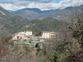
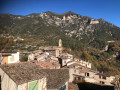
The village of Malaussène is picturesque and full of flowers.

Highly informative signs explaining the importance of water in the villages of the Haut-Var line the start of the canal route.

Reviews and comments

4.6 / 5
Based on 4 reviews

Reliability of the description
4.8 / 5
Ease of following the route
4.8 / 5
Route interest
4.3 / 5
NELLY J
NELLY J

Overall rating : 5 / 5

Date of your route : Jun 10, 2026
Reliability of the description : ★★★★★ Very good
Ease of following the route : ★★★★★ Very good
Route interest : ★★★★★ Very good
Very busy route : No

A pleasant walk along the canal, sheltered from the rather warm sun. The stretch through the forest offers glimpses of beautiful scenery and the charming village of Malaussène. We came across four Patou dogs on our path – their leader looking rather menacing – whilst the herd was passing further up the slope. For those who are afraid of dogs, this might spoil the walk.

Machine-translated

User 26459558

Overall rating : 5 / 5

Date of your route : Apr 28, 2026
Reliability of the description : ★★★★★ Very good
Ease of following the route : ★★★★★ Very good
Route interest : ★★★★★ Very good
Very busy route : Yes

A lovely walk at this time of year – neither too hot nor too cold – surrounded by nature, very pleasant along the canal, easy going and accessible.

Machine-translated

Crapahuteur54
Crapahuteur54

Overall rating : 5 / 5

Date of your route : Sep 07, 2025
Reliability of the description : ★★★★★ Very good
Ease of following the route : ★★★★★ Very good
Route interest : ★★★★★ Very good
Very busy route : No

Charming village and very pleasant route dotted with interesting information boards. Hike very suitable for people who are not very athletic or elderly, and for children. Thank you for this suggestion.

Machine-translated

yvesmunier
yvesmunier

A lovely walk along the canal. The path is under repair until the end of August, except at weekends; in the village, a visit to La Chapelle is a must – a 200-metre round trip. There’s a nice restaurant in Mallauseme.

Machine-translated

Eric VANAERDE
Eric VANAERDE

Overall rating : 3.3 / 5

Date of your route : Oct 08, 2022
Reliability of the description : ★★★★☆ Good
Ease of following the route : ★★★★☆ Good
Route interest : ★★☆☆☆ Disappointing
Very busy route : No

Not particularly interesting.

Machine-translated

Other walks in the area

For more walks, use our search engine .

The GPS track and description are the property of this route's author. Please do not copy them without permission.