


Refine your search for walks in Brenas
Brenas walks


 From Brenas to the Saint-Amans Chapel
 Visorando Member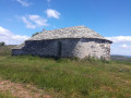
 8.30 mi
 +1,240 ft
 -1,270 ft
 4h 55
4h 55
 Moderate
 Departure from Brenas (Hérault)
This hike takes you from Brenas to the Saint-Amans Chapel via a fairly easy and varied route.
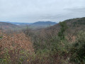
The local road from Lieude to Causse de Carlencas
 5.12 mi
+719 ft
-715 ft
3h 00
Moderate
Departure from Mérifons (Hérault)
5.12 mi
+719 ft
-715 ft
3h 00
Moderate
Departure from Mérifons (Hérault)
Having found traces of this local road No. 13 on the 1827 land registry, I went in search of it. It starts at La Lieude and climbs up through the Las Moles valley.
This hike is reserved for experienced hikers who are familiar with the terrain and enjoy getting off the beaten track.
The path is not always easy to follow in the ruffes (red earth).
Return via Mas Bousquet and Mas Valos le Vieux and Valos le Bas.
No markings - GPS very useful.
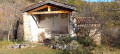
Montagne de la Boutine and the Saint-Fulcran Chapel
 4.36 mi
+643 ft
-643 ft
2h 35
4.36 mi
+643 ft
-643 ft
2h 35
 Easy
Departure from Mérifons (Hérault)
Easy
Departure from Mérifons (Hérault)
This easy walk takes you to the Chapel of Saint-Fulcran, where tradition holds that Saint-Fulcran – Bishop of Lodève from 949 to 1006 – was born in the vicinity. You then climb along an old path to Mas de Pradels. The return journey takes you to the Montagne de la Boutine, from where you descend via a winding track.
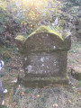
Chapelle Notre-Dame de Roubignac on the way to Château de Lauzières
 4.76 mi
+787 ft
-774 ft
2h 50
Easy
Departure from Octon (Hérault)
4.76 mi
+787 ft
-774 ft
2h 50
Easy
Departure from Octon (Hérault)
Starting from Octon, this beautiful walk takes you to the ruins of Château de Lauzières and the 12th-century Romanesque chapel of Roubignac.
Chapelle Notre-Dame de Roubignac via the dolmens at Octon
 6.52 mi
+932 ft
-932 ft
3h 50
Moderate
Departure from Octon (Hérault)
6.52 mi
+932 ft
-932 ft
3h 50
Moderate
Departure from Octon (Hérault)
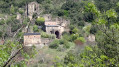
A short but very pretty hike in the Octon hills, offering views of Lake Salagou at the start. The destination is the small Romanesque chapel of Notre-Dame de Roubignac (7), but there are other places of interest along the way, such as the dolmen and the ruins of Octon Castle, visible from the other side of the valley.
Laval de Nize Circular
3.77 mi
+827 ft
-827 ft
2h 25
Easy
Departure from Lunas (Hérault) (Hérault)
A lovely walk through the upper cantons: along the Ruisseau de Nize, then up through the boxwood trees towards the hamlet of Briandes and back via the postman’s path.
The Béals trail
 2.85 mi
+653 ft
-669 ft
1h 55
Moderate
Departure from Salasc (Hérault)
2.85 mi
+653 ft
-669 ft
1h 55
Moderate
Departure from Salasc (Hérault)
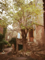
Set off to explore the village of Salasc, for a refreshing break, and its partly shaded hills, which offer views of the surrounding area and the Salagou valley. The Béals are irrigation channels that have long watered the gardens and are still used today in Salasc.
This hike may be closed depending on the fire risk level. Remember to check the map.
Le Cayroux and its ruffes
 6.99 mi
+1,214 ft
-1,211 ft
4h 15
Moderate
Departure from Le Puech (Hérault)
6.99 mi
+1,214 ft
-1,211 ft
4h 15
Moderate
Departure from Le Puech (Hérault)
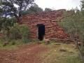
At the gateway to Lodève and Lake Salagou, on the Cayroux plateau, discover dolmens, drystone shelters and stone enclosures as you cross a landscape of "ruffes", an astonishing red earth.
Villecun route via the Col de la Défriché and Lavalette
9.80 mi
+1,312 ft
-1,306 ft
5h 40
Moderate
Departure from Olmet-et-Villecun (Hérault)
A pleasant walk, starting with unobstructed views of the highest peaks, then shaded after Lavalette. A short stretch of tarmac at the start and halfway along the route.
Saint-Amans Chapel from Villecun
10.72 mi
+1,575 ft
-1,594 ft
6h 20
Moderate
Departure from Olmet-et-Villecun (Hérault)
A beautiful hike with 360° views on very good paths. The ridge section is exposed to the wind.
Circular walk between Pézènes-les-Mines and La Braunhe
 5.87 mi
+1,194 ft
-1,214 ft
3h 45
Moderate
Departure from Pézènes-les-Mines (Hérault)
5.87 mi
+1,194 ft
-1,214 ft
3h 45
Moderate
Departure from Pézènes-les-Mines (Hérault)
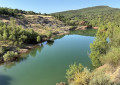
For walkers who like to venture a little off the beaten track and who have a good sense of direction. A lovely walk through the maquis, the tops of the old bauxite quarries and the Bois de Levers, mostly in the shade apart from a few sections of quiet road.
Circular route above Lake Salagou
12.96 mi
+2,001 ft
-2,005 ft
7h 40
 Difficult
Departure from Celles (Hérault) (Hérault)
Difficult
Departure from Celles (Hérault) (Hérault)
This walk takes you around the northern part of Lake Salagou, passing through the village of Le Puech. It takes you across the Cayroux plateau and to the village of Celles.
Auverne plateau from Vailhés
 5.80 mi
+486 ft
-489 ft
3h 05
Easy
Departure from Celles (Hérault) (Hérault)
5.80 mi
+486 ft
-489 ft
3h 05
Easy
Departure from Celles (Hérault) (Hérault)
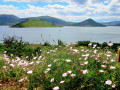
At the edge of Lake Salagou, there are beautiful views of the lake, first between the red cliffs and the blue waters of the lake, then from the balcony at the edge of the Auverne plateau.
Route of the Saint-Amans and Notre-Dame-de-Nize chapels
 11.85 mi
+1,680 ft
-1,686 ft
6h 55
Difficult
Departure from Lodève (Hérault)
11.85 mi
+1,680 ft
-1,686 ft
6h 55
Difficult
Departure from Lodève (Hérault)
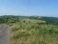
From Col de la Baraque to Chapelle de Saint-Amans via the ridges, then to Chapelle de Notre-Dame-de-Nize via a chestnut grove.
La Tour-sur-Orb and Boubals via the Brousson Chapel
 3.63 mi
+344 ft
-344 ft
2h 00
Easy
Departure from La Tour-sur-Orb (Hérault)
3.63 mi
+344 ft
-344 ft
2h 00
Easy
Departure from La Tour-sur-Orb (Hérault)
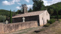
A lovely walk through vineyards and holm oak woods.
Cirque de Mourèze from Liausson
 8.16 mi
+2,142 ft
-2,146 ft
5h 35
Difficult
Departure from Liausson (Hérault)
8.16 mi
+2,142 ft
-2,146 ft
5h 35
Difficult
Departure from Liausson (Hérault)
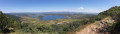
This hike will offer you a panoramic view of Lac du Salagou and take you into the heart of the Cirque de Mourèze
This hike may be closed depending on the fire risk level. Remember to check the map.
Cirque de Mourèze, Montagne de Liausson
 4.56 mi
+1,421 ft
-1,450 ft
3h 20
Difficult
Departure from Liausson (Hérault)
4.56 mi
+1,421 ft
-1,450 ft
3h 20
Difficult
Departure from Liausson (Hérault)
This is a pleasant hike that takes you through the Cirque de Mourèze and offers superb views of Lake Salagou.
This hike may be closed depending on the fire risk level. Be sure to check the map.
The Mourèze Circus
 4.24 mi
+1,145 ft
-1,145 ft
2h 55
Moderate
Departure from Mourèze (Hérault)
4.24 mi
+1,145 ft
-1,145 ft
2h 55
Moderate
Departure from Mourèze (Hérault)
Discover the dolomitic cirque of Mourèze, shaped by erosion, with exceptional views of the Lac du Salagou and the Mediterranean coast.
This hike may be prohibited depending on the level of fire risk. Please consult the map.
Salagou Lake - Liausson - Mourèze
 7.92 mi
+2,133 ft
-2,113 ft
5h 30
Moderate
Departure from Liausson (Hérault)
7.92 mi
+2,133 ft
-2,113 ft
5h 30
Moderate
Departure from Liausson (Hérault)
Mont Liausson overlooks Lake Salagou, and the climb offers beautiful views.
Hike modified on 11/05/2023 with Hérault Tourisme. See practical information.
This hike may be prohibited depending on the fire risk level. Remember to check the map.
Cirque de Moureze via Mont Liausson
 7.15 mi
+2,011 ft
-1,985 ft
5h 00
Moderate
Departure from Liausson (Hérault)
7.15 mi
+2,011 ft
-1,985 ft
5h 00
Moderate
Departure from Liausson (Hérault)
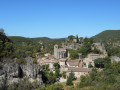
A very beautiful hike with stunning views of Lake Salagou on one side and the Cirque de Mouréze on the other, as well as magnificent views of the Cévennes and the Mediterranean.
Hike modified on 11/05/2023 with Hérault Tourisme. See practical information.
This hike may be prohibited depending on the fire risk level. Remember to check the map.
Mont Sénégra
 3.79 mi
+709 ft
-728 ft
2h 20
Easy
Departure from La Tour-sur-Orb (Hérault)
3.79 mi
+709 ft
-728 ft
2h 20
Easy
Departure from La Tour-sur-Orb (Hérault)
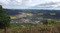
A beautiful walk through a former mining site, among chestnut trees and terraced vineyards, overlooking a magnificent landscape.
Mont Liausson - Mourèze
 6.60 mi
+1,765 ft
-1,762 ft
4h 35
Moderate
Departure from Liausson (Hérault)
6.60 mi
+1,765 ft
-1,762 ft
4h 35
Moderate
Departure from Liausson (Hérault)
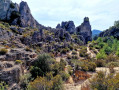
A circular hike allowing you to discover the Cirque de Mourèze, the picturesque village of the same name and enjoy an exceptional view of Lake Salagou.
Hike modified on 11/05/2023 with Hérault Tourisme. See practical information.
This hike may be prohibited depending on the fire risk level. Remember to check the map.
Extreme route of the Cirque de Mourèze – caves – monuments – Lake Salagou
13.04 mi
+3,825 ft
-3,802 ft
10 hrs
 Very difficult
Departure from Mourèze (Hérault)
Very difficult
Departure from Mourèze (Hérault)
An extreme challenge: this route takes you from the Cirque de Mourèze to the shores of Lake Salagou, followed by a climb up some of the most beautiful peaks and past several landmarks along the way. As many kilometres as there are places to visit!
Prehistoric site and UNESCO Global Geopark, Natura 2000
 The tour of Lake Salagou from Lodève
 31.43 mi
+1,575 ft
-1,575 ft
4 hrs
Moderate
Departure from Lodève (Hérault)
31.43 mi
+1,575 ft
-1,575 ft
4 hrs
Moderate
Departure from Lodève (Hérault)
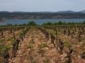
This varied route mainly follows small roads with little traffic.
Les Crozes - Vailhan loop via the ruins of Tibéret
 7.83 mi
+1,280 ft
-1,263 ft
4h 45
Moderate
Departure from Cabrières (Hérault) (Hérault)
7.83 mi
+1,280 ft
-1,263 ft
4h 45
Moderate
Departure from Cabrières (Hérault) (Hérault)
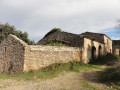
A pleasant hike with remarkable views and beautiful 360° panoramas of Mont Saint-Clair and the Mediterranean, Caroux, Pic de Vissous and Mont Baudille Séranne. We were lucky enough to catch a glimpse of the Canigou massif.
The Soumartre Cave, the Faugères Mills and the Carabelles
3.92 mi
+663 ft
-663 ft
2h 25
Easy
Departure from Faugères (Hérault) (Hérault)
Set in the heart of the Hérault heath, this route offers an immersion in a landscape typical of the southern Mediterranean, blending unspoilt nature with rural heritage. The walk begins at the Grotte de Soumartre, a natural formation comprising three distinct chambers, where you can admire beautiful limestone formations and spectacular stalactites, evidence of thousands of years of slow erosion. The route continues towards the Moulins de Faugères, former windmills historically used for grinding grain, the earliest traces of which date back to medieval times. Finally, the trail passes through a remarkable heritage of dry-stone construction, featuring agricultural terrace walls that once shaped the terraced fields, as well as ‘carabelles’ – small stone structures used as shelters or for agricultural tools – a legacy of traditional farming practices and the organisation of the region’s ancient gardens and crops.
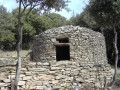
Discover the caravels of Faugères on the Pierres Sèches route.
 1.62 mi
+302 ft
-312 ft
1h 00
Moderate
Departure from Faugères (Hérault) (Hérault)
1.62 mi
+302 ft
-312 ft
1h 00
Moderate
Departure from Faugères (Hérault) (Hérault)
A discovery walk organised by the Association des Pierres Sèches en Faugérois.A short walk accessible to all, following forgotten paths rediscovered by the Association Pierres Sèches en Faugérois. It offers the chance to discover 15 carabelles – the local name for drystone shelters – among the many found in the Faugères area. The route is fully signposted in blue.
Les Trois Tours
 2.76 mi
+522 ft
-456 ft
1h 45
Easy
Departure from Faugères (Hérault) (Hérault)
2.76 mi
+522 ft
-456 ft
1h 45
Easy
Departure from Faugères (Hérault) (Hérault)
Leaving Faugères, climb up to the mill and cross the heath dotted with drystone shelters...
Cabrières Castle and Pic de Vissou
 9.18 mi
+2,300 ft
-2,277 ft
6h 15
Moderate
Departure from Cabrières (Hérault) (Hérault)
9.18 mi
+2,300 ft
-2,277 ft
6h 15
Moderate
Departure from Cabrières (Hérault) (Hérault)
During this hike in the heart of a listed site, rich in natural, geological and scenic discoveries, you can explore the ruins of the old village of Cabrières at the foot of the castle, then climb the ridges of Vissou before ascending the peak to discover a breathtaking viewpoint.This hike follows twoPR®® trails, the “Drovers' Roads of Crozes” and then the “Pic de Vissou”. Not difficult, but still a bit of a workout.
Les Mates Basses from Faugères
 3.59 mi
+745 ft
-755 ft
2h 20
Easy
Departure from Faugères (Hérault) (Hérault)
3.59 mi
+745 ft
-755 ft
2h 20
Easy
Departure from Faugères (Hérault) (Hérault)
Features of the route: heath, holm oak forests. Discover the heritage of dry stone buildings, testimony to the work of man. The art of dry stone has been listed as UNESCO cultural heritage since 2018. At the end of the route, visit the interpretive trail.
Pioch Farrus mine, Church of Saint-Gély-d'Arques from Cabrières
 9.51 mi
+1,368 ft
-1,381 ft
5h 35
Moderate
Departure from Cabrières (Hérault) (Hérault)
9.51 mi
+1,368 ft
-1,381 ft
5h 35
Moderate
Departure from Cabrières (Hérault) (Hérault)
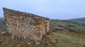
Hike with varied terrain and a beautiful view of the Pic de Vissou. The ruins of the Church of Saint-Gély d'Arques are a lovely spot for a picnic.Some sections are not marked and require the use of a GPS.
The Vissou ridges and the Estabel terrace
 7.04 mi
+1,529 ft
-1,519 ft
4h 35
Moderate
Departure from Cabrières (Hérault) (Hérault)
7.04 mi
+1,529 ft
-1,519 ft
4h 35
Moderate
Departure from Cabrières (Hérault) (Hérault)
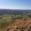
This trail winds through the heart of a listed site, rich in natural, geological and scenic discoveries. Leaving the village, the trail winds through the vineyards, climbs through the fragrant heath and reaches the impressive cliffs of the Pic de Vissou. This pleasant route offers many geological curiosities and, in particular, an amazing view of the Estabel terrace. In the background, the silhouette of Vissou serves as a landmark during this walk full of surprises.
This hike may be closed depending on the fire risk level. Be sure to check the map.
The Crozes drovers' roads
 9.55 mi
+1,909 ft
-1,880 ft
6h 05
Moderate
Departure from Cabrières (Hérault) (Hérault)
9.55 mi
+1,909 ft
-1,880 ft
6h 05
Moderate
Departure from Cabrières (Hérault) (Hérault)
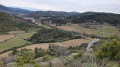
During this hike, you can discover the remains of the old village of Cabrières at the foot of the castle, the hamlet of Les Crozes, the Tiberet mills and the old paths, known as "drovers' roads" in Occitan.
Cabrières Castle and Les Pitrous
3.93 mi
+2,680 ft
-2,507 ft
4h 10
Moderate
Departure from Cabrières (Hérault) (Hérault)
A short but interesting walk to Cabrières Castle (3rd to 1st century BC), with fine views of the Pic de Vissou, the village, Mount Tibéret and the Pitrous valley. The route passes through the beautiful and renowned vineyards of the Cabrières Estabel AOC.
La Soureille d'Izarne
 8.06 mi
+1,348 ft
-1,319 ft
4h 55
Moderate
Departure from Cabrières (Hérault) (Hérault)
8.06 mi
+1,348 ft
-1,319 ft
4h 55
Moderate
Departure from Cabrières (Hérault) (Hérault)
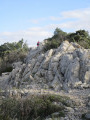
The path to the top of La Soureille d'Izarne is quite steep, but the effort is rewarded with a superb view of the Pyrenees on a clear day. Walking along the ridges requires a little care, but there are no vertiginous passages. The rest of the route is easy.
The Pas de Laïrette starting from Fozières
 7.41 mi
+1,348 ft
-1,339 ft
4h 35
Moderate
Departure from Fozières (Hérault)
7.41 mi
+1,348 ft
-1,339 ft
4h 35
Moderate
Departure from Fozières (Hérault)
A beautiful hike in the Parlatges forest. The entire climb is in the first part of the route. From Pas de Laïrette, the view is stunning, stretching as far as the Mediterranean and even the Pyrenees in good weather.The route sometimes follows unmarked paths. The large number of small trail junctions makes the use of a GPS device advisable.