Laval de Nize Circular

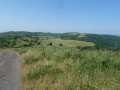
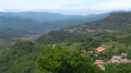
A lovely walk through the upper cantons: along the Ruisseau de Nize, then up through the boxwood trees towards the hamlet of Briandes and back via the postman’s path.

Details

7281047
Creation:
Last update:
Last review:
  • Walking
    Activity: Walking
  • ↔
    Distance: 3.77 mi
  • ◔
    Average duration: 2h 25 
  • ▲
    Difficulty: Easy

  • ⚐
    Back to start: Yes
  • ↗
    Ascent: + 827 ft
  • ↘
    Descent: - 827 ft

  • ▲
    Highest point: 1,955 ft
  • ▼
    Lowest point: 1,230 ft

Description of the walk

In Lunas, head towards Laval de Nize, pass the ‘Fontaine aux Yeux’ and, at the end of the road, before the bridge, park in the small car park. The path is marked in yellow.

(S/E) Take the small path at the end of the car park and follow the river along the left bank for about 100 metres.

(1) When you reach a small, dry stream bed, head down into it on the left and continue straight on until you reach the Nize, then turn right to follow the stream.

(2) Cross at a ford, then head up the sloping path which continues to follow the river along its right bank.

(3) After a gentle descent, cross a small stream, which is often dry. Continue straight on, passing under a power line, and cross another small stream, which is also often dry. Head back up through the boxwood.

(4) Take a sharp right-hand bend at the junction where you join theGRP®. Continue towards Briandes, heading north-west. The path passes under a power line again.

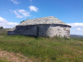
(5) Cross the hamlet along a small tarmac road and continue along the dirt track to the right after the lodge, towards Laval de Nize: this is the Sentier du Facteur, still marked in yellow. Continue down the slope, via a few stony hairpin bends, until you reach the road, which you follow to the right towards the car park a few metres away (S/E).

Waypoints

  1. S/E : mi 0 - alt. 1,230 ft - Car park before the bridge over the Ruisseau de Nize
  2. 1 : mi 0.1 - alt. 1,243 ft - The stream is often dry
  3. 2 : mi 0.55 - alt. 1,352 ft - Ford
  4. 3 : mi 0.67 - alt. 1,391 ft - Small stream
  5. 4 : mi 1.34 - alt. 1,923 ft - Hairpin bend
  6. 5 : mi 2.93 - alt. 1,834 ft - The hamlet of Briandes
  7. S/E : mi 3.77 - alt. 1,230 ft - Car park before the bridge over the Ruisseau de Nize

Notes

Warning! The route is impassable after heavy rain: fords cannot be crossed and the path running alongside the stream is difficult to follow.

Worth a visit

The ‘Fontaine aux Yeux’, between Lunas and Laval de Nize, is a curiosity: it is said to have the power to cure eye ailments by dipping a handkerchief in the water, applying it to the eyes and then hanging it on the side of the fountain.

Reviews and comments

3.9 / 5
Based on 4 reviews

Reliability of the description
3.5 / 5
Ease of following the route
4.3 / 5
Route interest
4 / 5
Bertrand Delpla
Bertrand Delpla

Overall rating : 4.3 / 5

Date of your route : Aug 01, 2023
Reliability of the description : ★★★★☆ Good
Ease of following the route : ★★★★★ Very good
Route interest : ★★★★☆ Good
Very busy route : No

A lovely walk with varied scenery. The signposting is clear from start to finish and the GPS route matches it perfectly. It climbs a bit at the start, but just the right amount . Thank you for sharing this.

Machine-translated

SKMP
SKMP

Overall rating : 4 / 5

Date of your route : Jul 03, 2023
Reliability of the description : ★★★★☆ Good
Ease of following the route : ★★★★☆ Good
Route interest : ★★★★☆ Good
Very busy route : No

Nothing to report

Machine-translated

francoise caussat
francoise caussat

Overall rating : 3.3 / 5

Date of your route : Jul 16, 2021
Reliability of the description : ★★★☆☆ Average
Ease of following the route : ★★★☆☆ Average
Route interest : ★★★★☆ Good
Very busy route : No

A few issues with the signposting......
And what’s the point of giving your opinion? The other day I asked a question and I’m still waiting for an answer. It’s been at least a month.

Machine-translated

cramsh
cramsh

Sorry... thank you for pointing that out – it’s helped me correct the mistake: :-)

Machine-translated

BriRandoMiRando
BriRandoMiRando

Overall rating : 4 / 5

Date of your route : May 17, 2021
Reliability of the description : ★★★☆☆ Average
Ease of following the route : ★★★★★ Very good
Route interest : ★★★★☆ Good
Very busy route : No

Be careful with the terms you use, because when you say ‘left’ and it’s actually to the right … and then you take the path on the left … it’s not the same thing.
A very pleasant path but very poorly signposted (no markings). In contrast, the Stevenson Trail is very, very well signposted, and we went the wrong way twice because of this.
Kind regards
Brigitte Cros BriRando MiRando

Machine-translated

Other walks in the area

For more walks, use our search engine .

The GPS track and description are the property of this route's author. Please do not copy them without permission.