Montagne de la Boutine and the Saint-Fulcran Chapel

This easy walk takes you to the Chapel of Saint-Fulcran, where tradition holds that Saint-Fulcran – Bishop of Lodève from 949 to 1006 – was born in the vicinity. You then climb along an old path to Mas de Pradels. The return journey takes you to the Montagne de la Boutine, from where you descend via a winding track.

Details

17522812
Creation:
Last update:
Last review:
  • Walking
    Activity: Walking
  • ↔
    Distance: 4.36 mi
  • ◔
    Average duration: 2h 35 
  • ▲
    Difficulty: Easy

  • ⚐
    Back to start: Yes
  • ↗
    Ascent: + 643 ft
  • ↘
    Descent: - 643 ft

  • ▲
    Highest point: 1,224 ft
  • ▼
    Lowest point: 581 ft

Photos

Description of the walk

The route starts from a car park on the left at the entrance to the Route du Moulinas. This road branches off the D8E3, which links La Lieude to Malavieille, 400 m before reaching this hamlet.

(S/E) Walk to the hamlet of Moulinas, then turn left onto the dirt track heading towards the bottom of the valley.

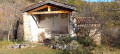
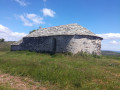
(1) After 650 m along this track, look out for an old building on the right: the Chapelle Saint-Fulcran. It is said to have served as a hermitage for the Bishop of Lodève around 949. Despite planned repairs, the building is in a poor state of repair.
Continue along the track towards the bottom of the valley.

(2) Keep to the right at the bend in the track.

(3) After a gate, the path – which is in a deteriorating condition due to erosion – winds upwards in three hairpin bends towards Mas Pradels. Cross the estate and follow the road for about 150 m.

(4) Take a path on the left, which may be blocked by a gate. Make sure to close the gate properly after passing through and follow the path, which turns right before curving back to the left in a circular loop. Follow the path straight on to the end of the Montagne de la Boutine, ignoring a track on the right.

(5) Turn left onto the track which winds downwards to reach the crossroads near the hermitage.

(2) Go through the gate and follow the same path as on the way out to return to the car park where you started (S/E).

Waypoints

  1. S/E : mi 0 - alt. 581 ft - Car park on Route du Moulinas
  2. 1 : mi 0.63 - alt. 725 ft - Junction towards the - Chapelle Saint-Fulcran (Mérifons)
  3. 2 : mi 0.75 - alt. 771 ft - Junction of the circular loop
  4. 3 : mi 0.95 - alt. 837 ft - Start of the hairpin bends
  5. 4 : mi 1.76 - alt. 1,175 ft - Turn left towards La Boutine
  6. 5 : mi 2.58 - alt. 1,119 ft - Start of the winding descent
  7. S/E : mi 4.36 - alt. 581 ft - Car park on Route du Moulinas

Notes

No water source.

The path after the bend in the track is very stony for 300 metres, but it improves after that.

Livestock gates are situated further on for the ascent and on the track on the way down. Please ensure you close them properly after passing through.

There may be a fence for horses near the chapel. Go under it if it is closed.

The path leading up to Mas Pradels is marked D8E4 on the 1:25,000 IGN map. It has therefore been classified as a departmental road!

Worth a visit

The Saint-Fulcran Chapel, a hermitage where Saint-Fulcran is said to have lived.

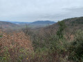
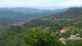
Lovely view of the Salagou valley from La Boutine.

Reviews and comments

4.4 / 5
Based on 3 reviews

Reliability of the description
4.3 / 5
Ease of following the route
5 / 5
Route interest
4 / 5
User 14131488

Overall rating : 4 / 5

Date of your route : Aug 11, 2025
Reliability of the description : ★★★★☆ Good
Ease of following the route : ★★★★★ Very good
Route interest : ★★★☆☆ Average
Very busy route : No

A pleasant short route with views of Lake Salagou in the second half of the route
Important information:
After the hamlet of Les Pradels, the barrier on the left leads to a pasture with livestock (cows with one calf and one bull). This section is not accessible if hikers have dogs. Please be careful.
Or if you are not experienced with cows, as it is essential not to approach the mothers and their young.

Machine-translated

User 3937458

Overall rating : 4.7 / 5

Date of your route : Jun 10, 2025
Reliability of the description : ★★★★★ Very good
Ease of following the route : ★★★★★ Very good
Route interest : ★★★★☆ Good
Very busy route : No

Nice little loop. Reasonable elevation gain. Beautiful views. The last part is on a DFCI trail.

Machine-translated

Traines savates
Traines savates

Overall rating : 4.7 / 5

Date of your route : Feb 01, 2023
Reliability of the description : ★★★★☆ Good
Ease of following the route : ★★★★★ Very good
Route interest : ★★★★★ Very good
Very busy route : No

At point 2, there is a barrier on the track, which you will use to head back down. Do not go past the barrier; instead, turn right onto a stony path that winds its way uphill.
The Mas Pradels, at the top of the path, is an ideal spot for a break. There’s a wooden table there and a lovely view.
Make sure you close the barrier on the track properly, as we came across a horse.
A lovely, very accessible walk

Machine-translated

Other walks in the area

For more walks, use our search engine .

The GPS track and description are the property of this route's author. Please do not copy them without permission.