Crossing the Orb and Mare valleys

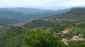
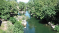
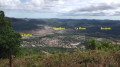
This route runs entirely within the Haut-Languedoc Regional Nature Park. Setting off from Dio, you look out over the Orb valley before rejoining the river at Lamalou-les-Bains after crossing its tributary, the Mare, via the Pont du Diable. At the foot of the Monts d’Orb, you can see the Montagne de l’Espinouse and the cliffs of the Caroux Plateau. The views of Dio Castle, the walk through purple-coloured rock formations and a visit to the medieval village of Boussagues make this walk a delight.

Details

3715637
Creation:
Last update:
Last review:
  • Walking
    Activity: Walking
  • ↔
    Distance: 13.44 mi
  • ◔
    Average duration: 7h 20 
  • ▲
    Difficulty: Difficult

  • ⚐
    Back to start: No
  • ↗
    Ascent: + 1,280 ft
  • ↘
    Descent: - 2,083 ft

  • ▲
    Highest point: 1,398 ft
  • ▼
    Lowest point: 577 ft

Description of the walk

Red and white markings

(S) With your back to the Lou Castellou stopover lodge in Dio, turn left onto the Promenade du Castel Viel (heading south-west). Continue along the Ancien Chemin de Bédarieux until you reach a Fork in the road.

(1) Head downhill to the left along the grassy path until you reach a cross.

(2) Continue down the path to the right. Walk alongside the purple-coloured clay pits of the Plaine d’Oulious and emerge onto the D8.

(3) Turn right, cross two bridges and, at the farm, take the small road on the left running alongside the fence. Cross the purple-coloured ruffes, pass under a high-voltage power line and cross a ford. Turn right.

(4) At the fork in the road, turn left along the vineyards. Continue straight ahead along Rue du Thym. At the crossroads, turn left onto Rue des Genévriers. You’ll come out onto a dirt track; take it to the right, then emerge onto a road in the hamlet of Boubals.

(5) Turn right onto this road. At the T-junction, turn left onto Rue des Frênes. At the Fork in the road, continue to the right and, at the crossroads, turn left onto Chemin de Saint-Pierre. At the greenhouse (cross), first turn right then left, then walk alongside the River Orb and the vineyards.

(6) At the T-junction, carry on straight ahead along the road. Pass the church of the Prieuré Saint-Pierre de Brousson, then a wayside cross in Mirande.

(7) At the fork in the road (signpost for the GR® 7 ‘La Tour-sur-Orb, Boussagues 2.5 km’), head down to the right along a path through the woods. Cross the bridge over the Orb, walk past a tennis court, then a housing estate, and emerge onto the D35. Take it to the left, walk past the town hall, then the church, and reach a T-junction.

(8) Turn right onto the Route de Boussagues (D23). After the railway bridge, continue left along the Route de Boussagues (D23E4). Pass under a viaduct and continue to the bottom of the Ruisseau des Hortes valley.

(9) At the fork in the road, leave the tarmac track to your left, head up to the right and reach Boussagues.

(10) At the GR® 7 signpost ‘Le Pradal 6.5 km’, turn left onto Rue du Bailli. Continue along Rue du Pont Levis. At the Fork in the road, head up to the left along Chemin du Château Fort and go round the cemetery. Continue across the Causse de Boussagues and, at a left-hand bend, reach the Croix de Clairac.

(11) Head down the road to the right. Walk alongside a vineyard, enter the forest and walk alongside a second vineyard.

(12) Take the path on the left at the edge of the forest. Walk alongside some vineyards and, at the Fork in the road, head down to the right. You’ll come out onto a road above Clairac.

(13) At the bend in the road, take the path on the hillside to the left. Continue along a footpath, come out onto a road and turn right onto it.

(14) At the entrance to the hamlet of Lagure, head down a road to the right, keeping the houses on your left. At the cross, go down the steps, then follow a footpath until you come out onto the D22E18. Follow it straight ahead until you reach a Fork in the road near a bridge over the Mare. Turn left onto the path alongside the river and head for the Pont du Diable.

(15) Cross the bridge over the Mare to the right. You’ll come out onto the D922; first turn left then right and head uphill along a footpath. You’ll come out onto the D22E5; take this to the right. At the Fork in the road, ignore the track to the left and continue straight ahead, following the road uphill.

(16) At the start of the second hairpin bend on the road, leave it via a footpath that climbs to the right. You’ll come out onto a track; pass the sewage treatment plant on your right and continue climbing to the left. You’ll come out onto the D22E5 again at the entrance to Le Pradal. Walk along it to the right via the landscaped promenade. Pass the boules court, turn left at Place de la Mairie and head towards a cross at La Blaquière.

(17) Turn left onto Chemin de la Sesquière, heading south-west. At the Fork in the road, continue to the right. Descend two hairpin bends through the vineyards, ignore a ford on the right and walk along the left bank of the Rieu Pourquié. At the Fork in the road, cross the stream to the right via a second ford and reach the Sesquière.

(18) Walk through the village, head uphill to the right and, at the Fork in the road, continue left onto the D13E11. You’ll come out onto the D13; follow it to the right for 50 metres.

(19) Head uphill to the left along the Route de Notre-Dame de Capimont. Pass a cross and reach a Fork in the road just before the chapel.

(20) Head down to the left along a path. At the fork in the road, take the path on the right, then turn left. Continue downwards towards the south-east, then south-west. The path widens into a track. At the fork in the road, head down to the left towards the south and reach the motorhome parking area at Lamalou-les-Bains.

(21) Turn right onto Avenue de Capimont. At the end of the descent, you’ll come out onto Boulevard Saint-Michel; turn right onto it. After the Esse roundabout, cross the ford of a tributary of the Orb on the left. You’ll come out onto Rue des Passerelles; turn left onto it and continue to the junction with Avenue Charcot (E).

Waypoints

  1. S : mi 0 - alt. 1,381 ft - Dio
  2. 1 : mi 0.27 - alt. 1,388 ft - Fork in the road – grassy path
  3. 2 : mi 0.38 - alt. 1,355 ft - Croix - Trail
  4. 3 : mi 1.25 - alt. 886 ft - D8 road
  5. 4 : mi 1.91 - alt. 807 ft - Fouche after the ford
  6. 5 : mi 2.6 - alt. 817 ft - Boubals
  7. 6 : mi 3.32 - alt. 738 ft - T-junction
  8. 7 : mi 3.8 - alt. 722 ft - La Tour-sur-Orb. Towards the bridge over the - Orb (fleuve)
  9. 8 : mi 4.23 - alt. 732 ft - Route de Boussagues
  10. 9 : mi 4.93 - alt. 869 ft - Ruisseau des Hortes
  11. 10 : mi 5.36 - alt. 1,066 ft - Boussagues
  12. 11 : mi 6.08 - alt. 1,266 ft - Croix de Clairac
  13. 12 : mi 6.83 - alt. 837 ft - Path along the edge of the forest
  14. 13 : mi 7.31 - alt. 876 ft - Road – Clairac
  15. 14 : mi 7.88 - alt. 843 ft - Lagure. Towards the - Mare (rivière)
  16. 15 : mi 8.42 - alt. 676 ft - Pont du Diable (Villemagne-l'Argentière)
  17. 16 : mi 9 - alt. 866 ft - Second hairpin bend on the D22E5 – Footpath
  18. 17 : mi 9.64 - alt. 1,007 ft - La Blaquière - Croix
  19. 18 : mi 10.42 - alt. 873 ft - La Sesquière
  20. 19 : mi 11.05 - alt. 978 ft - Route de Notre-Dame de Capimont
  21. 20 : mi 12.03 - alt. 1,194 ft - Église Notre-Dame de Capimont (Lamalou-les-Bains)
  22. 21 : mi 12.7 - alt. 702 ft - Motorhome parking area
  23. E : mi 13.44 - alt. 600 ft - Lamalou-les-Bains, after the - Bitoulet (rivière) - Affluent de de l'Orb

Notes

Walk completed by the author on 2 September 2020.

This route follows the GR® 7. A description of it can be found in the TopoGuides published by the French Hiking Federation:
- ‘Crossing the Massif Central through the Parks: from La Bastide-Puylaurent to Castelnaudary’, reference 7002,
- ‘Crossing the Haut-Languedoc’, reference 716.

The route involves ‘15.5 km of tarmac, representing over 70 per cent’. This was not the case when the GR® 7 was established in the 1950s. Today, it should be possible to link Dio (S) to Lamalou-les-Bains (E) via Boussagues (10) and the Pont du Diable (15) whilst reducing this percentage. Any suggestions for improving the route in this regard are welcome.

Several minor discrepancies between the map and the terrain:
- at (7), a path, signposted by a GR® 7 directional sign reading “La Tour-sur-Orb, Boussagues 2.5 km”, descends to the right through the woods and emerges at the bridge over the Orb.
- At the entrance to the hamlet of Lagure (14), the GR® 7 follows a road down to the right, passing the houses on the left without entering the hamlet.
- Between the two hairpin bends on the climb towards Le Pradal via the D22E5 at (16), do not take the red-and-white-marked path that descends to the right. Instead, the GR® 7 leaves the road via a path that climbs to the right at the start of the second hairpin bend.

Dio (S): stopover lodge.

Boubals: water between (4) and (5).

Cemetery of the Saint-Pierre de Brousson Priory: water between (6) and (7).

La Tour-sur-Orb: water, supermarket between (7) and (8).

Boussagues (10): water.

After crossing the Pont du Diable (15): picnic area.

La Sesquière: picnic area between (18) and (19).

Lamalou-les-Bains (E): spa resort, hotels, cafés, restaurants, guesthouses, all shops.

Worth a visit

Views of Dio Castle from (S) to (11).

Purple-coloured ruffes from (2) to (4): rocks formed by a combination of clayey sediments and iron oxides, hence their red or purple colour.

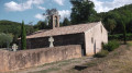
Church of the Priory of Saint-Pierre de Brousson between (6) and (7).

The medieval village of Boussagues (10).

Pont du Diable (15).

Notre-Dame de Capimont: offthe GR®® trail, about a hundred metres up the winding road; orientation board at (20).

Panoramic views of the Monts d’Orb, the Montagne de l’Espinouse and the cliffs of the Caroux Plateau.

Always be cautious and plan ahead when you're outdoors. Visorando and the author of this route cannot be held responsible for any accidents occurring on this route.

The GR® and PR® markings are the intellectual property of the Fédération Française de Randonnée Pédestre.

Reviews and comments

danielrollet
danielrollet

Yes, of course. It’s the only section of this walk for which I haven’t been able to download the IGN TOPO France base map.
Thank you
Daniel Rollet

Machine-translated

danielrollet
danielrollet

I can’t download the IGN France topographic map – every time I try, the OpenStreetMap is used instead!!!
Thanks
Daniel Rollet

Machine-translated

Other walks in the area

For more walks, use our search engine .

The GPS track and description are the property of this route's author. Please do not copy them without permission.