Mont Martels

A walk through the Levas forest including the ascent of Mont Martels (40 m)! Lovely view of Carlencas. Along the DFCI track and paths through the woods. Very easy but unmarked: a GPS is useful.

Details

n°19833549
Creation:
Last update:
Last review:
  • Walking
    Activity: Walking
  • ↔
    Distance: 3.19 mi
  • ◔
    Average duration: 1h 45 
  • ▲
    Difficulty: Easy

  • ⚐
    Back to start: Yes
  • ↗
    Ascent: + 354 ft
  • ↘
    Descent: - 341 ft

  • ▲
    Highest point: 1,604 ft
  • ▼
    Lowest point: 1,253 ft

Description of the walk

Park in the car park in the clearing 100 m from the entrance to Levas when approaching via the D908 road: large 30 km/h speed limit sign.

(S/E) Head towards Levas and, at the entrance to the hamlet, take the track on the right for about 700 m until you reach a large junction with another track.

(1) Follow the track to the right, which climbs gently whilst winding its way for 1.5 km; ignore the footpaths which are not suitable for vehicles. The view becomes increasingly unobstructed to the left and right, and you can see the antennas on Mont Martel.

(2) A gently sloping path on the right will take you up to the summit.

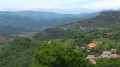
(3) Lovely view over Carlencas, the Rieu Sec valley and the D908. Retrace your steps.

(2) Head right towards the road. Cross carefully and take a good path opposite, heading left.

(4) At the T-junction, turn right onto a track heading south-east. The track curves to the right and descends for about 300 metres.

(5) Ignore a faint path on the right and follow the track to the left. After a right-hand bend, continue straight on towards the south-west until you reach the clearing where you started (S/E).

Waypoints

  1. S/E : mi 0 - alt. 1,263 ft - Clearing, car park
  2. 1 : mi 0.44 - alt. 1,257 ft - DFCI track junction
  3. 2 : mi 1.41 - alt. 1,470 ft - Crossroads: path to Mont Martels
  4. 3 : mi 1.67 - alt. 1,598 ft - Mont Martels
  5. 4 : mi 2.13 - alt. 1,437 ft - T-junction
  6. 5 : mi 2.75 - alt. 1,348 ft - Crossroads
  7. S/E : mi 3.19 - alt. 1,263 ft - Clearing, car park

Notes

No water source. The tracks are in very good condition. Apart from the climb up to Mont Martels, the entire route is accessible by a rugged vehicle.

Worth a visit

(3) The view from Mont Martels over Carlencas
Le Tantajo, a rocky peak above Bédarieux, the distinctly conical Le Courbézou (an ancient volcano) and Mont Martels are aligned eastwards at azimuth 240°.
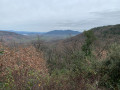
View over the Orb Valley and the Escandorgue Mountains.

Reviews and comments

4.3 / 5
Based on 2 reviews

Reliability of the description
4.5 / 5
Ease of following the route
4.5 / 5
Route interest
4 / 5
Azimut71
Azimut71
• Edited:

Overall rating : 5 / 5

Date of your route : Jun 17, 2023
Reliability of the description : ★★★★★ Very good
Ease of following the route : ★★★★★ Very good
Route interest : ★★★★★ Very good
Very busy route : No

A really lovely walk. Didn’t see a soul — no pedestrians, no cars.

Machine-translated

pierdugar
pierdugar

Overall rating : 3.7 / 5

Date of your route : Apr 19, 2022
Reliability of the description : ★★★★☆ Good
Ease of following the route : ★★★★☆ Good
Route interest : ★★★☆☆ Average
Very busy route : No

An easy walk, but not particularly interesting to me as there aren’t many panoramic views, except from the mast.

See you soon.

Machine-translated

Other walks in the area

For more walks, use our search engine .

The GPS track and description are the property of this route's author. Please do not copy them without permission.