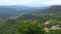
Villecun route via the Col de la Défriché and Lavalette

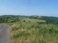
A pleasant walk, starting with unobstructed views of the highest peaks, then shaded after Lavalette. A short stretch of tarmac at the start and halfway along the route.

Details

4979624
Creation:
Last update:
Last review:
  • Walking
    Activity: Walking
  • ↔
    Distance: 9.80 mi
  • ◔
    Average duration: 5h 40 
  • ▲
    Difficulty: Moderate

  • ⚐
    Back to start: Yes
  • ↗
    Ascent: + 1,312 ft
  • ↘
    Descent: - 1,306 ft

  • ▲
    Highest point: 2,090 ft
  • ▼
    Lowest point: 853 ft

Description of the walk

Park in the hikers’ car park at Villecun.

(S/E) Head north, following the road that climbs up to the Col de la Défriche.

(1) Turn left onto theGR® and follow it until you reach a hairpin bend.

(2) Ignore a path on the right and take the bend to the left to continue along theGR® until you reach a fork in the path.

(3) Carry on straight ahead, following theGR® for a few kilometres until you reach another fork in the path after passing under an EDF power line three times.

(4) Ignore two paths on the right and continue along theGR® which veers sharply left beneath the EDF power line. Reach the junction of theGR® 653 andGR® 7: Poteau Puech Garde.

(5) Continue straight ahead on theGR®7, letting theGR® 653 branch off completely to the right.

(6) At the bottom of the slope, ignore the path on the right marked with a cross (GR®) and carry on straight ahead until you reach another junction.

(7) Turn left and begin the gradual descent, which is clearly marked in places, until you reach the junction with a tarmac road. Turn left onto this road for a few metres to join the D157E4 departmental road.

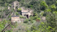
(8) Follow this road to the right as it winds down to the pretty village of Lavalette.

(8) On leaving the village, continue along the road to the bridge.

(10) Take the dirt track opposite the bridge, heading uphill. Continue along the shaded track through the holm oak woods, staying on the main path and ignoring any crossroads.

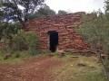
(11) Halfway along, on your left, you’ll come to a small cave chapel carved into a block of sandstone (Notre-Dame de Falgaret). Above the chapel, look out for an old beehive hollowed out of a tree trunk.

Continue on to Villecun to return to the car park (S/E).

Waypoints

  1. S/E : mi 0 - alt. 1,047 ft - Villecun car park
  2. 1 : mi 0.71 - alt. 1,191 ft - Start of the GR trail at the Col de la Défriche
  3. 2 : mi 0.95 - alt. 1,237 ft - Crossroads
  4. 3 : mi 1.71 - alt. 1,519 ft - Crossroads
  5. 4 : mi 3.53 - alt. 1,969 ft - Crossroads
  6. 5 : mi 4.12 - alt. 2,080 ft - The path splits into two GR routes
  7. 6 : mi 4.42 - alt. 1,988 ft - Crossroads
  8. 7 : mi 5.07 - alt. 2,031 ft - Crossroads
  9. 8 : mi 6.1 - alt. 1,371 ft - Road D157E4
  10. 9 : mi 7.37 - alt. 974 ft - Outing to Lavalette
  11. 10 : mi 7.58 - alt. 853 ft - Bridge
  12. 11 : mi 8.84 - alt. 1,138 ft - Notre-Dame de Falgaret
  13. S/E : mi 9.8 - alt. 1,043 ft - Villecun car park

Worth a visit

Do not venture onto the cross-country paths, as they may lead to the numerous electrified horse paddocks.

Notre-Dame de Falgaret Chapel (Lavalette hamlet)
A small rock-hewn chapel carved out of a block of stone in 1860 by the last parish priest of Villecun (out of devotion or boredom? Probably both).
It is said that the abundant ferns in the surrounding area gave it the name Falgaret (which is the name of the hill on which it stands).
Source: http://www.randodoc.fr/?page_id=22213.

Always be cautious and plan ahead when you're outdoors. Visorando and the author of this route cannot be held responsible for any accidents occurring on this route.

The GR® and PR® markings are the intellectual property of the Fédération Française de Randonnée Pédestre.

Reviews and comments

4.6 / 5
Based on 3 reviews

Reliability of the description
5 / 5
Ease of following the route
5 / 5
Route interest
3.7 / 5
etamine11
etamine11

Overall rating : 4.7 / 5

Date of your route : Mar 26, 2026
Reliability of the description : ★★★★★ Very good
Ease of following the route : ★★★★★ Very good
Route interest : ★★★★☆ Good
Very busy route : No

A lovely walk undertaken by a group of seasoned walkers. The highlights: the spring scenery and the views from the ridges. The downsides: best avoided in strong winds. Forest paths and tarmac sections. We’d all love to do it again.

Machine-translated

sabinelagardeval
sabinelagardeval

Overall rating : 4.7 / 5

Date of your route : Jan 02, 2024
Reliability of the description : ★★★★★ Very good
Ease of following the route : ★★★★★ Very good
Route interest : ★★★★☆ Good
Very busy route : No

A lovely walk to do again in the spring as there are some stunning views. No difficulties. Took 4 hours 45 minutes.

Machine-translated

Romy34
Romy34

Overall rating : 4.3 / 5

Date of your route : Sep 29, 2023
Reliability of the description : ★★★★★ Very good
Ease of following the route : ★★★★★ Very good
Route interest : ★★★☆☆ Average
Very busy route : No

This walk is particularly worth doing for the stunning views in the first section, up to point 5. However, the walk itself is mostly along roads or wide tracks… How boring! It’s actually more of a circular route to do by bike (it’s actually a mountain bike loop) than on foot.

Machine-translated

Other walks in the area

For more walks, use our search engine .

The GPS track and description are the property of this route's author. Please do not copy them without permission.