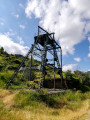
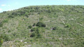
Campredon and Fontenilles, starting from the Bousquet d’Orb

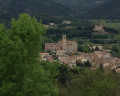
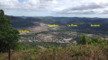
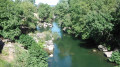
A circular route, following fairly wide paths, with a lovely view of the Bousquet d’Orb.

Details

2018833
Creation:
Last update:
Last review:
  • Walking
    Activity: Walking
  • ↔
    Distance: 2.97 mi
  • ◔
    Average duration: 2h 00 
  • ▲
    Difficulty: Easy

  • ⚐
    Back to start: Yes
  • ↗
    Ascent: + 741 ft
  • ↘
    Descent: - 741 ft

  • ▲
    Highest point: 1,604 ft
  • ▼
    Lowest point: 863 ft

Photos

Description of the walk

Park in the car park opposite 16 Avenue Lyon Caen at Le Bousquet d’Orb.

(S/E) Cross the road and head to the right, then turn left onto Rue de la Tine. Continue straight on along the old Chemin de Fontenilles until you reach the junction with a fairly wide track

.(1) . Turn right onto this track and head north, then west.

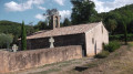
(2) Take in the view of the church at Saint-Martin d’Orb. Continue on and head down towards the hamlet of Fontenilles.

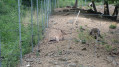
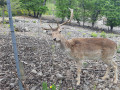
(3) At the three-way junction, take the path on the left and follow the track which passes in front of a farm with a deer herd.

(4) Turn right onto a small path that cuts across the circular loop via Fontenilles.

(5) Cross the Chemin de Sénégra and, opposite, rejoin the path that descends to the junction you passed on the way out.

(1) Turn right and then immediately left to go down the old Chemin de Fontenilles (which you took on the way there), then take Rue de la Tine, before turning right onto Avenue Lyon Caen and heading back to the car park (S/E).

Waypoints

  1. S/E : mi 0 - alt. 863 ft - Car park opposite 16 Avenue Lyon-Caen
  2. 1 : mi 0.62 - alt. 1,211 ft - View of the Bousquet d’Orb
  3. 2 : mi 0.9 - alt. 1,263 ft - View of the church of Saint-Martin d’Orb
  4. 3 : mi 1.65 - alt. 1,598 ft - Path on the left
  5. 4 : mi 2.01 - alt. 1,417 ft - Small path on the right
  6. 5 : mi 2.12 - alt. 1,348 ft - Crossing the Chemin de Sénégra
  7. S/E : mi 2.97 - alt. 863 ft - Car park opposite 16 Avenue Lyon-Caen

Reviews and comments

4.1 / 5
Based on 3 reviews

Reliability of the description
3.7 / 5
Ease of following the route
4 / 5
Route interest
4.7 / 5
viviane.bayonnove
viviane.bayonnove

Overall rating : 3 / 5

Date of your route : Feb 07, 2021
Reliability of the description : ★★☆☆☆ Disappointing
Ease of following the route : ★★★☆☆ Average
Route interest : ★★★★☆ Good
Very busy route : Yes

According to the map, the footpath went past Fontenille. We couldn’t find it, so we walked through the village instead. We also had a bit of trouble on the way back when trying to complete a circular route around Fontenille. Otherwise, it was great.

Machine-translated

Christian Pluviose
Christian Pluviose

Overall rating : 4.3 / 5

Date of your route : Jun 06, 2020
Reliability of the description : ★★★★☆ Good
Ease of following the route : ★★★★☆ Good
Route interest : ★★★★★ Very good
Very busy route : No

A very pleasant and easy route. Just a quick note regarding the description at point No. 3: according to the owner, it is not a deer farm but a fallow deer farm. We even witnessed the birth of a fawn.

Machine-translated

ABR
ABR

Overall rating : 5 / 5

Date of your route : May 19, 2019
Reliability of the description : ★★★★★ Very good
Ease of following the route : ★★★★★ Very good
Route interest : ★★★★★ Very good

A short, genuinely interesting, easy and varied circular loop, which I completed this Sunday as a complement to the neighbouring Serre loop starting from Boussagues

Machine-translated

Other walks in the area

For more walks, use our search engine .

The GPS track and description are the property of this route's author. Please do not copy them without permission.