Along the banks of the Orb, starting from La Tour

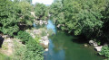
An easy walk along the banks of the Orb between La Tour-sur-Orb and Le Mas Blanc.

Details

1508421
Creation:
Last update:
Last review:
  • Walking
    Activity: Walking
  • ↔
    Distance: 3.21 mi
  • ◔
    Average duration: 1h 40 
  • ▲
    Difficulty: Easy

  • ⚐
    Back to start: Yes
  • ↗
    Ascent: + 177 ft
  • ↘
    Descent: - 190 ft

  • ▲
    Highest point: 860 ft
  • ▼
    Lowest point: 696 ft

Photos

Description of the walk

Park in the car park at La Tour-sur-Orb Town Hall.

(S/E) Cross the D35 and take thefirst street on the right, towards the Brousson Chapel. Walk past the municipal park.

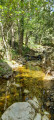
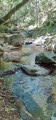
(1) Cross the Mirande bridge and admire the lovely view over the Orb. Take the path on the right, towards Bédarieux on theGRP®, and follow the banks of the Orb.

(2) Ignore the path on the left and take the path on the right leading to Le Mas Blanc.

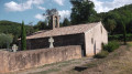
(3) Walk past the Church of Saint-Martin du Mas Blanc (17th–19th centuries) and take the road on the right. At the end of the street, turn right onto Rue du Bernoubrels towards the bridge and the D35.

(4) Cross the D35, follow it to the right and walk past the bus stop. After the stone outbuilding, take the path on the left heading towards the mountain.

(5) Take the path on the right which winds round in a hairpin bend. At the end of this path, turn right onto the track which leads back down towards La Tour-sur-Orb to the D35.

(6) Turn left, cross the D35 and take the side road leading to the “Vallée d’Orb” housing estate, walk past the bus stop and through the village to the town hall car park (S/E).

Waypoints

  1. S/E : mi 0 - alt. 738 ft - La Tour-sur-Orb Town Hall car park
  2. 1 : mi 0.14 - alt. 705 ft - Mirande Bridge - Orb (fleuve)
  3. 2 : mi 0.85 - alt. 709 ft - Path on the right towards Mas Blanc
  4. 3 : mi 1.25 - alt. 712 ft - Saint-Martin Church at Le Mas Blanc
  5. 4 : mi 1.48 - alt. 702 ft - Bridge and D35
  6. 5 : mi 1.73 - alt. 833 ft - Hairpin bend to the right
  7. 6 : mi 2.46 - alt. 715 ft - D35 on the left
  8. S/E : mi 3.21 - alt. 738 ft - La Tour-sur-Orb Town Hall car park

Worth a visit

Reviews and comments

4.1 / 5
Based on 3 reviews

Reliability of the description
3.7 / 5
Ease of following the route
5 / 5
Route interest
3.7 / 5
User 26636105

Overall rating : 4.7 / 5

Date of your route : Aug 18, 2025
Reliability of the description : ★★★★★ Very good
Ease of following the route : ★★★★★ Very good
Route interest : ★★★★☆ Good
Very busy route : Yes

Nice walk, shame the return loop is along a road

Machine-translated

skayna
skayna

Overall rating : 4.3 / 5

Date of your route : Aug 29, 2023
Reliability of the description : ★★★★★ Very good
Ease of following the route : ★★★★★ Very good
Route interest : ★★★☆☆ Average
Very busy route : No

We went on this walk with a child aged almost 6 and a 6-month-old baby in a front carrier. It took us longer than stated as we took plenty of breaks.
Not recommended with a pushchair.

The first part of the walk was brilliant! Pleasant paths and points of interest.
Then we were surprised to find we had to cross the D35 without any safety barriers; luckily there isn’t too much traffic.
The second part is a bit of a slog for a child from stage 6 onwards, as it runs alongside the road. (There’s a bench and a water point at stage 6.)

A good walk overall; we enjoyed passing by interesting landmarks such as the town hall, the Mirande Bridge and St Martin’s Church (just before the church there’s a small courtyard with tables, swings and a water point)

If it weren’t for having to cross the main road, we’d happily have done this walk again.
Thank you, Elise34, for this walk.

Machine-translated

françois dilonardo
françois dilonardo

Overall rating : 3.3 / 5

Date of your route : Sep 26, 2022
Reliability of the description : ★☆☆☆☆ Very disappointing
Ease of following the route : ★★★★★ Very good
Route interest : ★★★★☆ Good
Very busy route : No

A short walk to enjoy as a family

Machine-translated

Other walks in the area

For more walks, use our search engine .

The GPS track and description are the property of this route's author. Please do not copy them without permission.