Country:

 City:



Park at the Roque car park, about a hundred metres from the D156: a dirt car park accessible all year round.
(S/E) As you leave the car park, head right for about a hundred metres, following the old road that leads to the lake. Pass through a barrier (which may be open or closed to vehicles depending on the season), then leave this old road on the right to follow a path that leads closer to the lake.
(1) Take the path on the right, then turn right again onto the next path about twenty metres further on. You’ll reach a junction.
(2) Keep to the right, leaving the return path on your left.
(3) Take the hairpin bend to the right and continue almost level along the track. Do not take the path that goes straight ahead at the hairpin bend.
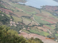
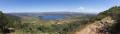
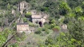
(4) Take a path that winds to the left and leads to the summit of La Sure. The fairly steep path offers unobstructed views of the western part of Lake Salagou, the Neck de la Roque – an ancient volcanic vent – and the village of Octon with its bell tower.
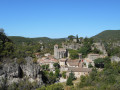
(5) Summit of La Sure: view of the village of Celles. Begin the descent.
(6) Take a sharp right-hand bend to leave the ridge. If you continue straight on at this point and walk 50 metres there and back, you’ll reach the viewpoint overlooking the lake, Mont Liausson and its village. The path becomes steeper and winds twice through the pine trees before reaching a junction with the track: the path is poorly marked in this area.
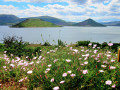
(7) Turn left towards the lake and follow the more well-trodden path which runs as close as possible to the banks and allows you to walk round Lake Sure from the north: there are several coves where you might be able to have a picnic by the water’s edge.
(8) Leave the path on your left that heads back up towards the Sure and continue along the lakeshore. You’ll come to a junction you passed on the way out.
(2) Take the path on the right and return to another fork in the path, which you also passed on the way out.
(1) Go straight on, then turn right to reach the Neck de la Roque.
(9) Retrace your steps, then turn right to return to the first section of the walk. Turn right again to reach the car park (S/E).
 Visorando Member

 Easy
 Difficult