


Refine your search for walks in Binic
Binic walks


 Circular loop along the River Ic
 Visorando Member
 12.77 mi
 +830 ft
 -830 ft
 6h 35
6h 35
 Difficult
 Departure from Binic (Côtes-d'Armor)
The Ic is a small river, 17 km long, which flows into the English Channel at Binic. After a short climb up the cliffs at the harbour exit, you reach a tributary of the Ic at Lantic, and rejoin the river at Notre-Dame de La Cour, from where it takes you back to Binic. Along the way, you’ll discover two tourist attractions: the Lantic Adventure Park and Trégomeur Zoo. This route takes you through the hinterland of South Goëlo.
The ‘Petit Tour du Coucou’ in Pordic
 Tourist office
 3.12 mi
+397 ft
-384 ft
1h 45
3.12 mi
+397 ft
-384 ft
1h 45
 Moderate
Departure from Pordic (Côtes-d'Armor)
Moderate
Departure from Pordic (Côtes-d'Armor)
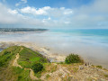
On one side, a coastline of steep cliffs forming numerous headlands, at the foot of which lie pebble beaches such as Le Petit Havre; on the other, peaceful countryside traversed by a long, green valley and fields – the Tour du Coucou thus follows in the footsteps of the fishermen of yesteryear. Its very name evokes them, as the ‘Coucou’ refers to the greeting that women used to give to sailors from the top of the cliff. As you pass the ruins and monuments that dot the route, the maritime history of Brittany unfolds.
Route around Trévenais
 4.78 mi
+404 ft
-374 ft
2h 35
Moderate
Departure from Lantic (Côtes-d'Armor)
4.78 mi
+404 ft
-374 ft
2h 35
Moderate
Departure from Lantic (Côtes-d'Armor)
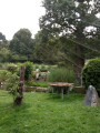
Set apart from the main roads, the village centre and its church, the chapel and its shops, lies the ‘village’ of Trévenais, which is home to nearly half of Lantic’s population. This route invites you to walk around it, without actually entering the centre. Featuring a few steep ascents and descents, narrow and winding paths, wooded sunken lanes and local tracks, this circular route will introduce you to the legend of the Chaise menhir, the history of the Fontaine aux Moines and the origins of the village’s ponds. A lovely circular route that partly overlooks the meandering course of the River Ic in the heart of the Lantic countryside.
Circular route between Saint-Quay and Binic
 11.86 mi
+1,020 ft
-1,007 ft
6h 20
Difficult
Departure from Saint-Quay-Portrieux (Côtes-d'Armor)
11.86 mi
+1,020 ft
-1,007 ft
6h 20
Difficult
Departure from Saint-Quay-Portrieux (Côtes-d'Armor)
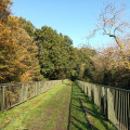
A short stretch on theGR®34at the start of the walk offers a glimpse of the pleasure of rediscovering these magnificent seascapes at the end of the route, which change with the tides. In between, the path takes you a little further inland, along small coastal rivers or following the old railway line of the Côtes du Nord narrow-gauge railway. A few examples of built heritage enhance this route: a mill, a wayside shrine, railway viaducts, a chapel and seaside villas.
Circular route starting from Saint-Quay-Portrieux
 4.83 mi
+315 ft
-312 ft
2h 30
4.83 mi
+315 ft
-312 ft
2h 30
 Easy
Departure from Saint-Quay-Portrieux (Côtes-d'Armor)
Easy
Departure from Saint-Quay-Portrieux (Côtes-d'Armor)
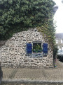
A hike to enjoy the sea views, but also the unique trails of the Breton countryside.
From Tournemine to Pointe de Bréhin
 6.62 mi
+712 ft
-692 ft
3h 40
Moderate
Departure from Plérin (Côtes-d'Armor)
6.62 mi
+712 ft
-692 ft
3h 40
Moderate
Departure from Plérin (Côtes-d'Armor)
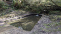
This circular route straddles the municipalities of Plérin and Pordic. The route follows the coastal path between Tournemine Beach and Pointe de Bréhin, offering beautiful views of Rosaires Beach and the port of Binic. The return journey is inland, mainly through valley bottoms.
Route du Bois de la Salle from Lantic
5.13 mi
+66 ft
-66 ft
2h 25
Easy
Departure from Lantic (Côtes-d'Armor)
Forest paths, often damp; intriguing and mysterious woodland that surely conceals ancient tales; secluded meadows; a fountain. This is a walk in the heart of nature that passes very close to the site of the old Cour, which has not yet revealed all its secrets, and a little further on, ‘la Maison de la Terre’, an educational centre dedicated to environmental protection.
The completely flat and very accessible route will take you to the Chapel of Pabu in the neighbouring commune of Tréguidel and back via the Bois de la Salle, ending at the Chapel of Notre-Dame-de-la-Cour.
The ‘Two Bell Towers’ route from Lantic
7.20 mi
+420 ft
-430 ft
3h 40
Moderate
Departure from Lantic (Côtes-d'Armor)
Just a stone’s throw from the Goëlo coast, this walk through time will introduce you to a rich and varied heritage. As you make your way through woods along narrow, winding and sometimes damp paths, you’ll learn about the history of the watercourses that have always been so important to the local people. This route, which is circular in nature and covers the north and south of the town, will take you from the 15th-century Chapel of Notre-Dame de la Cour to Saint-Oswald’s Church, on to the ponds, and then to the Sentier des Trois Fontaines.
An unusual discovery in Saint-Quay-Portrieux
 3.55 mi
+207 ft
-180 ft
1h 50
Easy
Departure from Saint-Quay-Portrieux (Côtes-d'Armor)
3.55 mi
+207 ft
-180 ft
1h 50
Easy
Departure from Saint-Quay-Portrieux (Côtes-d'Armor)
This route reveals a little-known side of Saint-Quay-Portrieux.The narrow streets, lined with old buildings or modern villas, link three monuments that have had their moments of glory: the Saint-Michel windmill, the circular Notre-Dame de la Garde Chapel and the Saint-Quay Fountain, which is said to be the origin of the town’s founding.Two parks offer a chance to take a break: the Parc de la Duchesse Anne and the Parc des Druides, where you’ll find yourself immersed in a setting steeped in legend.Superb views from theGR®®34.
Through moors, woods and cliffs in the Goelo region
 8.20 mi
+413 ft
-417 ft
4h 10
Moderate
Departure from Plourhan (Côtes-d'Armor)
8.20 mi
+413 ft
-417 ft
4h 10
Moderate
Departure from Plourhan (Côtes-d'Armor)
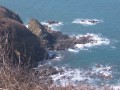
A lovely walk through the countryside and along the coast.
Stop off at the lovely Palus Beach for a refreshing swim and a delicious, energising crêpe!
From Plourhan to the sea
 7.02 mi
+371 ft
-371 ft
3h 35
Moderate
Departure from Plourhan (Côtes-d'Armor)
7.02 mi
+371 ft
-371 ft
3h 35
Moderate
Departure from Plourhan (Côtes-d'Armor)
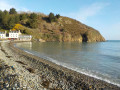
Apart from a few unavoidable sections on tarmac roads, most of the walk follows farm tracks, sometimes through woodland. The reward for this approach route is the walk along Palus Beach, followed by theGR®34 trail.
A somewhat steep route offering views of the cliffs at Plouha and the Pointe de Bec de Vir.
Circular route around Trémuson via Les Mines
6.40 mi
+587 ft
-600 ft
3h 25
Moderate
Departure from Plérin (Côtes-d'Armor)
This circular route around the village of Trémuson will first take you along the outskirts of the village via major tarmac roads, then dirt tracks and forest paths will guide you alongside streams and the Gouët, eventually leading you higher up to the site of the old mines.
Circular from Tréveneuc to Pointe du Bec de Vir
 4.50 mi
+407 ft
-407 ft
2h 25
Easy
Departure from Tréveneuc (Côtes-d'Armor)
4.50 mi
+407 ft
-407 ft
2h 25
Easy
Departure from Tréveneuc (Côtes-d'Armor)
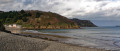
A short walk that allows you to discover the village of Tréveneuc and its coastline via the customs officers' path.
The four woods and the Pointe du Bec de Vir in Tréveneuc
 3.75 mi
+276 ft
-259 ft
2h 00
Easy
Departure from Tréveneuc (Côtes-d'Armor)
3.75 mi
+276 ft
-259 ft
2h 00
Easy
Departure from Tréveneuc (Côtes-d'Armor)
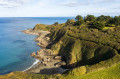
From Port Goret, follow the coastal path along the heights of the Goëlo coast. From the top of the steep cliff, breathe in the sea mist and the scents of unspoilt nature. Nestled between land and sea, the heart of the village, with its recent developments, retains its old-world charm. As you walk along the route, its old stones echo a calm and serene way of life, woven with local tales and legends.
Panoramic view of Pointe du Roselier
 1.95 mi
+279 ft
-269 ft
1h 10
Easy
Departure from Plérin (Côtes-d'Armor)
1.95 mi
+279 ft
-269 ft
1h 10
Easy
Departure from Plérin (Côtes-d'Armor)
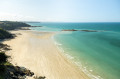
With a 360° view of Saint-Brieuc Bay, the Pointe du Roselier is a must-see viewpoint. The entire bay, stretching all the way to the end of the Anse d’Yffiniac – a designated National Nature Reserve – unfolds before your eyes. This breathtaking view has made the headland a strategic site since the Iron Age. From here, one could scan the horizon to defend against threats or communicate with sailors. Below, Martin’s Beach—a cove of rocks, pebbles and sand—is one of the local paradises for shore fishermen.
Keregal and the Corzic Valley
 Association / Club / Walk leader
 3.15 mi
+266 ft
-246 ft
1h 40
Moderate
Departure from Plouha (Côtes-d'Armor)
3.15 mi
+266 ft
-246 ft
1h 40
Moderate
Departure from Plouha (Côtes-d'Armor)
This route was used for the second edition of the Plouha 24-hour sports event. Starting from the superb Palus beach, it leads to Keregal Chapel and ends along the small coastal river of Plouhatin, the Corzic, which takes us back to the sea. The route is mainly through woodland.
Sunken paths and cliffs in Plouha
 3.21 mi
+436 ft
-430 ft
1h 50
Easy
Departure from Plouha (Côtes-d'Armor)
3.21 mi
+436 ft
-430 ft
1h 50
Easy
Departure from Plouha (Côtes-d'Armor)
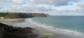
This route was used for the first edition of the 24h du Sport de Plouha. Starting from the superb Plage du Palus, it runs alongside Le Corzic and climbs gently up an old sunken path to Pointe de Plouha. From there, the view is magnificent. You then descend back to Palus via theGR®34.
Circular route in Plouha, from Palus to Gwin Zégal
5.18 mi
+817 ft
-820 ft
3h 05
Easy
Departure from Plouha (Côtes-d'Armor)
A lovely hike starting from Palus Beach, which will take you along the customs officers' path to the Port of Gwin Zégal with its distinctive mooring posts, which are almost unique in the region. The passage through Pointe de Plouha and Le Pommier offers magnificent views of the coast and the highest coastal cliffs in Brittany. The return journey is along rural roads through various typical hamlets and beautiful forest paths.
Circular of Palus via Pointe de Plouha
 5.46 mi
+545 ft
-535 ft
3h 00
Moderate
Departure from Plouha (Côtes-d'Armor)
5.46 mi
+545 ft
-535 ft
3h 00
Moderate
Departure from Plouha (Côtes-d'Armor)
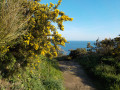
A hike that begins with a gentle climb on a tarmac road, allowing you to warm up before following the GR®34, which is more rugged. The last third of the hike offers breathtaking views of the sea as you pass by Pointe de Plouha (the highest cliff in Brittany).
Like any circular, it can also be done in the opposite direction, thus avoiding a descent down stairs that may be considered problematic. In this case, you will need to make a significant effort from the outset.
Saint-Brieuc: between the town and the valleys
 5.65 mi
+522 ft
-545 ft
3h 05
Easy
Departure from Saint-Brieuc (Côtes-d'Armor)
5.65 mi
+522 ft
-545 ft
3h 05
Easy
Departure from Saint-Brieuc (Côtes-d'Armor)
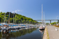
Set off to explore Saint-Brieuc, where nature and heritage intertwine to offer an unusual tour of the town.
This walk invites you to explore different facets of the town – its harbour and its upmarket neighbourhoods – before immersing yourself in its lush green valleys. Combining a rich heritage with the tranquillity of the natural landscape, this route reveals all the diversity and beauty of Saint-Brieuc!
Alternative route via Villa Rohannec’h Park.
Hollow ways and villages in Plouha
 3.95 mi
+138 ft
-164 ft
1h 55
Easy
Departure from Plouha (Côtes-d'Armor)
3.95 mi
+138 ft
-164 ft
1h 55
Easy
Departure from Plouha (Côtes-d'Armor)
Plouha is home to the highest cliffs in Brittany. You can explore them on theGR®®34. Very close to the village centre, starting from the town centre, the first half of this short route follows beautiful sunken paths typical of the Goëlo region and then passes through a few villages with lovely stone houses. Along the route, there are several granite wayside crosses.
Saint-Jean Chapel in Plouha
3.14 mi
+108 ft
-115 ft
1h 30
Easy
Departure from Plouha (Côtes-d'Armor)
Leave the village of Plouha and head for Saint-Jean Chapel along the country lanes. These are tarmac-surfaced, except for a short stretch which is a farm track but is easily passable.
Circular route between La Trinité and Le Palus
 6.33 mi
+699 ft
-715 ft
3h 30
Moderate
Departure from Plouha (Côtes-d'Armor)
6.33 mi
+699 ft
-715 ft
3h 30
Moderate
Departure from Plouha (Côtes-d'Armor)
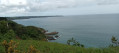
From the Chapel of La Trinité, the route quickly reaches the cliffs. It then follows theGR®34along a fairly rugged section, but with unobstructed views (from Bréhat to Saint-Quay) and numerous possible stopping points. At the lowest point, the beaches of Port Moguer and Gwin zegal are particularly enjoyable. You leave theGR®34before reaching Palus beach, and old sunken paths lead back to small roads that pass through pretty villages to return to the starting point.
The cliffs of Plouha
 9.81 mi
+1,083 ft
-1,056 ft
5h 25
Moderate
Departure from Plouha (Côtes-d'Armor)
9.81 mi
+1,083 ft
-1,056 ft
5h 25
Moderate
Departure from Plouha (Côtes-d'Armor)
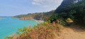
This walk can be split into two sections: a 9km circular route to the north-west, which takes in Bonaparte Beach, and a second 6.5km circular route to the south, offering views of Plouha Head.Both circular loops follow theGR®®34along the coast and each includes ascents and descents that may prove challenging for less experienced walkers.