The ‘Petit Tour du Coucou’ in Pordic

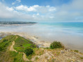
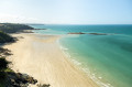
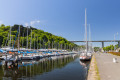
On one side, a coastline of steep cliffs forming numerous headlands, at the foot of which lie pebble beaches such as Le Petit Havre; on the other, peaceful countryside traversed by a long, green valley and fields – the Tour du Coucou thus follows in the footsteps of the fishermen of yesteryear. Its very name evokes them, as the ‘Coucou’ refers to the greeting that women used to give to sailors from the top of the cliff. As you pass the ruins and monuments that dot the route, the maritime history of Brittany unfolds.

Details

66884012
Creation:
Last update:
Last review:
  • Walking
    Activity: Walking
  • ↔
    Distance: 3.12 mi
  • ◔
    Average duration: 1h 45 
  • ▲
    Difficulty: Moderate

  • ⚐
    Back to start: Yes
  • ↗
    Ascent: + 397 ft
  • ↘
    Descent: - 384 ft

  • ▲
    Highest point: 295 ft
  • ▼
    Lowest point: 43 ft
  • ⚐ Country: France
  • ⚐ City: Pordic (22590)
  • ⚑
    Start/End: N 48.583322° / W 2.786415°
  • ❏
    IGN map(s): Ref. 0916OT
  • Hour-by-hour weather

Photos

Description of the walk

Park at the Havre beach car park on Rue du Petit Havre.

(S/E) Walk down towards the sea and take the GR®34 on the left. Continue to the Rocher du Coucou.

(1) The rocky promontory in front of you is a place steeped in history and emotion. Carry on to the next junction.

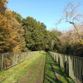
(2) Turn left towards the Vau Madec Valley and walk for about 500 m. At the three-way junction, keep right, then keep left until you reach the junction at the end of the valley.

(3) Take the steep path on the right and follow it to the junction with a station on your left.

(4) Turn left (Rue des Grèves), then take the first track on the right. Carry on along the tarmac road past the housing estate until you reach a crossroads at the end of Rue du Vau Rio.

(5) Continue left onto Rue Duguay-Trouin until the fork at the Notre-Dame de la Garde Chapel.

(6) Turn left onto Rue Surcouf and head for number 25.

(7) Immediately afterwards, take the grassy path on the left and head straight on to the car park at Le Havre beach (S/E).

Waypoints

  1. S/E : mi 0 - alt. 102 ft - Le Havre beach car park
  2. 1 : mi 1.19 - alt. 230 ft - The Cuckoo Rock
  3. 2 : mi 1.38 - alt. 43 ft - Junction of the GR34 and the Vau Madec Valley
  4. 3 : mi 2.05 - alt. 226 ft - Crossroads
  5. 4 : mi 2.2 - alt. 262 ft - Rue des Grèves
  6. 5 : mi 2.55 - alt. 276 ft - Junction of Rue Vau Rio and Rue Duguay-Trouin
  7. 6 : mi 2.68 - alt. 295 ft - Junction of Rue Duguay-Trouin and Rue Surcouf
  8. 7 : mi 2.86 - alt. 282 ft - Junction with Rue Surcouf
  9. S/E : mi 3.12 - alt. 102 ft - Le Havre beach car park

Notes

(S/E) Transport:
Line 10 (TUB) – ‘L’Herminier’ stop – approximately 30 minutes from Saint-Brieuc (does not run on Sundays)
At the beach car park, turn left onto the path (yellow markings). When you reach Rue du Port, turn right onto Rue de la Pointe. At the roundabout, the stop is on the left, on Rue du Commandant L’Herminier.

A free route guide is available from the Baie de Saint-Brieuc Tourist Office.

Worth a visit

Pointe de Pordic
Pointe de Pordic offers unobstructed views over the Bay of Saint-Brieuc (orientation board). Its height, at over 80 metres, made it a strategic defensive asset. Here you’ll find the remains of the guardhouse which, from the 18th century onwards, housed two 36-calibre cannons and a powder magazine.
It can be reached on foot by following the second section of the Tour du Coucou (signpost in the Petit Havre car park).

Pointe de la Béchue
From the top of the cliff, the view is spectacular: you look out over the beaches of Tournemine and Les Rosaires. Industrialists such as Lucien Rosengart (who had been based at the Port du Légué since 1915) began frequenting the Anse des Rosaires and gradually developed it into plots. It then became a holiday destination for intellectuals and artists throughout the 20th century (Cécil Saint Laurent, Jacques Tati, Tino Rossi, Tristan Bernard).
1 km one way from Pointe de Pordic.

Always be cautious and plan ahead when you're outdoors. Visorando and the author of this route cannot be held responsible for any accidents occurring on this route.

The GR® and PR® markings are the intellectual property of the Fédération Française de Randonnée Pédestre.

Reviews and comments

4.5 / 5
Based on 2 reviews

Reliability of the description
5 / 5
Ease of following the route
4.5 / 5
Route interest
4 / 5
kartavan
kartavan

Overall rating : 4.7 / 5

Date of your route : Aug 23, 2026
Reliability of the description : ★★★★★ Very good
Ease of following the route : ★★★★★ Very good
Route interest : ★★★★☆ Good
Very busy route : No

A lovely route, mostly along the very rugged GR 34.
It involves a fair bit of climbing, but offers some lovely views.
The return journey is easier.

Machine-translated

cpoulhes
cpoulhes
• Edited:

Overall rating : 4.3 / 5

Date of your route : Aug 04, 2025
Reliability of the description : ★★★★★ Very good
Ease of following the route : ★★★★☆ Good
Route interest : ★★★★☆ Good
Very busy route : No

Circuit running along the coast with fairly steep ascents and descents.

Machine-translated

Other walks in the area

For more walks, use our search engine .

The GPS track and description are the property of this route's author. Please do not copy them without permission.