


Refine your search for walks in Belleville (Rhône)
Belleville (Rhône) walks


 Around Belleville-en-Beaujolais Sud
 Association / Club / Walk leader
 4.99 mi
 +39 ft
 -33 ft
 2h 20
2h 20
 Easy
Easy
 Departure from Belleville (Rhône) (Rhône)
An easy walk from Belleville-en-Beaujolais in the south to the north of Saint-Georges-de-Reneins, passing by Lac des Sablons.
The Croix du Paradis route in Guéreins
 Tourist office3.50 mi
+148 ft
-148 ft
1h 45
Easy
Departure from Guéreins (Ain)
Tourist office3.50 mi
+148 ft
-148 ft
1h 45
Easy
Departure from Guéreins (Ain)
This walk will take you to the Croix du Paradis and the lovely viewpoint over the Saône and the Monts du Beaujolais. You will also pass by private châteaux before heading back down to the banks of the Saône.
Route des Minimes au Paradis in Montmerle-sur-Saône
7.55 mi
+315 ft
-318 ft
3h 45
 Moderate
Departure from Montmerle-sur-Saône (Ain)
Moderate
Departure from Montmerle-sur-Saône (Ain)
From the Minimes site to the Croix du Paradis in Guéreins, walk along the heights of the Val de Saône with views of the Monts du Beaujolais before returning along the towpath by the river.
Route from Bois de Vavres to Montceaux
 7.26 mi
+272 ft
-289 ft
3h 35
Moderate
Departure from Montceaux (Ain)
7.26 mi
+272 ft
-289 ft
3h 35
Moderate
Departure from Montceaux (Ain)
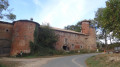
This hike takes you through the woods around the village of Montceaux. Along the way, discover the ponds, the ruins of an oil mill and the private castle of La Bâtie.
Walk around Montceaux
 Visorando Member3.73 mi
+194 ft
-207 ft
1h 55
Easy
Departure from Montceaux (Ain)
Visorando Member3.73 mi
+194 ft
-207 ft
1h 55
Easy
Departure from Montceaux (Ain)
Starting from the leisure area (Montceaux stadium), this circular route takes you through meadows and woodland around the village of Montceaux. You can explore the Calonne, a stream that runs through the village, and the ruins of the oil mill.
The Chapel of Amareins and the Saône from Lurcy
7.47 mi
+302 ft
-289 ft
3h 40
Moderate
Departure from Lurcy (Ain)
From Lurcy to Messimy-sur-Saône via the banks of the Saône, this walk gives you the chance to discover, along the way, the small chapel of Amareins, which dates back to the 11th century.
Route of heritage along the towpath in Mogneneins
8.51 mi
+154 ft
-141 ft
4h 05
Moderate
Departure from Mogneneins (Ain)
From the 16th-century wayside cross in front of the church to the banks of the Saône, via the hamlet of Flurieux and its little chapel, let yourself be guided along the paths of the village of Mogneneins.
Route from the Château de Fléchères to Messimy-sur-Saône
 5.34 mi
+89 ft
-105 ft
2h 30
Easy
Departure from Messimy-sur-Saône (Ain)
5.34 mi
+89 ft
-105 ft
2h 30
Easy
Departure from Messimy-sur-Saône (Ain)
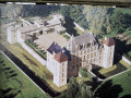
This hike will take you to the Grange du Diable (on the Rhône side) and past the Château de Fléchères.
The castles of Vataneins and Tavernost
4.73 mi
+144 ft
-144 ft
2h 20
Easy
Departure from Francheleins (Ain)
This short walk will allow you to discover, from the road, the private châteaux of Tavernost and Vataneins.
Discovering Mont Brouilly
 5.92 mi
+843 ft
-853 ft
3h 25
Easy
Departure from Odenas (Rhône)
5.92 mi
+843 ft
-853 ft
3h 25
Easy
Departure from Odenas (Rhône)
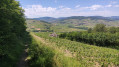
Discover the vineyards of Brouilly and Côte De Brouilly and enjoy a splendid view of the Ain plain and, on a clear day, catch a glimpse of Mont Blanc. You will also pass close to some of the châteaux that are the pride of our region.
The Cimes circuit in Odenas
 9.22 mi
+1,775 ft
-1,775 ft
5h 45
Moderate
Departure from Odenas (Rhône)
9.22 mi
+1,775 ft
-1,775 ft
5h 45
Moderate
Departure from Odenas (Rhône)
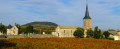
This hike follows the Rouge d'Odenas trail. Through the vineyards, it leads to Mont Brouilly and its chapel overlooking the Saône valley, offering a beautiful panorama of the Beaujolais mountains, the Bresse, the Dombes and the Monts d'Or. The second climb leads to the Beaujolais moors and offers beautiful views of the green Beaujolais region and, on clear days, the Alps.
Route north of Thoissey
6.13 mi
+26 ft
-26 ft
2h 50
Easy
Departure from Thoissey (Ain)
This walk follows the banks of the Saône and passes through the village of Saint-Didier-sur-Chalaronne and the town of Thoissey. You will pass, in particular, the private Château de Challes.
Route south of Thoissey
3.05 mi
+13 ft
-13 ft
1h 25
Easy
Departure from Thoissey (Ain)
Here is a walk that starts in the town of Thoissey and takes you across fields to the banks of the Saône. The return journey to Thoissey, which follows the canal beneath the plane trees, will be particularly pleasant.
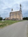
 In the heart of the Beaujolais vineyards
 24.70 mi
+2,651 ft
-2,664 ft
4 hrs
Moderate
Departure from Régnié-Durette (Rhône)
24.70 mi
+2,651 ft
-2,664 ft
4 hrs
Moderate
Departure from Régnié-Durette (Rhône)
This is a cycle route along a hilly route set amongst vineyards. A few châteaux dot the route. You’ll enjoy both the scenic views and the pleasure of cycling in a welcoming environment.
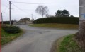
Family walk in Saint-Didier-sur-Chalaronne
 3.68 mi
+79 ft
-79 ft
1h 45
Easy
Departure from Saint-Didier-sur-Chalaronne (Ain)
3.68 mi
+79 ft
-79 ft
1h 45
Easy
Departure from Saint-Didier-sur-Chalaronne (Ain)
Walk organised by the parents’ association of Saint-Joseph Secondary School.
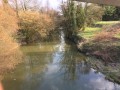
APEL 2013 family walk 10 km
 6.30 mi
+125 ft
-125 ft
3h 00
Easy
Departure from Saint-Didier-sur-Chalaronne (Ain)
6.30 mi
+125 ft
-125 ft
3h 00
Easy
Departure from Saint-Didier-sur-Chalaronne (Ain)
Family walk for the APEL association of Saint Joseph secondary school.
Long route: 2½ hours.
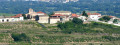
From the lower Beaujolais to the upper ridges
 11.07 mi
+1,952 ft
-1,942 ft
6h 45
Moderate
Departure from Saint-Étienne-la-Varenne (Rhône)
11.07 mi
+1,952 ft
-1,942 ft
6h 45
Moderate
Departure from Saint-Étienne-la-Varenne (Rhône)
Walk among the vineyards of the lower Beaujolais, the forests and the ridges above.
Paths and trails marked in yellow with signs.
Loop of Saint-Étienne-la-Varenne via Sainte-Marie
 4.69 mi
+873 ft
-896 ft
2h 55
Moderate
Departure from Saint-Étienne-la-Varenne (Rhône)
4.69 mi
+873 ft
-896 ft
2h 55
Moderate
Departure from Saint-Étienne-la-Varenne (Rhône)
Climb up to the plateau of the Sainte-Marie farm, starting from the centre of the village of Saint-Étienne-la-Varenne and passing through the Trou du Loup. The hike returns to the starting point through the vineyards.
Route de la Mâtre to Chaleins
 4.73 mi
+82 ft
-82 ft
2h 15
Easy
Departure from Chaleins (Ain)
4.73 mi
+82 ft
-82 ft
2h 15
Easy
Departure from Chaleins (Ain)
Explore the area around Chaleins and the banks of the Mâtre for a countryside walk.
Boucle Bleue in Chiroubles
 6.55 mi
+1,260 ft
-1,243 ft
4h 05
Moderate
Departure from Chiroubles (Rhône)
6.55 mi
+1,260 ft
-1,243 ft
4h 05
Moderate
Departure from Chiroubles (Rhône)
11 km loop in the commune of Chiroubles. Alternating paths through the vineyards, meadows and woods. Magnificent views. Blue markings.
Circular Chiroubles via La Madone de Fleurie
 7.49 mi
+1,194 ft
-1,178 ft
4h 30
Moderate
Departure from Chiroubles (Rhône)
7.49 mi
+1,194 ft
-1,178 ft
4h 30
Moderate
Departure from Chiroubles (Rhône)
This hike will take you from Chiroubles to the Chapel of the Madonna of Fleurie and then back to Chiroubles via the Col des Labourons.
Red Loop in Chiroubles
 10.24 mi
+1,929 ft
-1,923 ft
6h 25
Moderate
Departure from Chiroubles (Rhône)
10.24 mi
+1,929 ft
-1,923 ft
6h 25
Moderate
Departure from Chiroubles (Rhône)
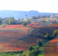
17 km loop in the commune of Chiroubles. Alternating paths through the vineyards, meadows and woods. Magnificent views over the Saône plain and as far as Mont Blanc.
From Chiroubles to the Col de Durbize
 3.88 mi
+758 ft
-764 ft
2h 25
Easy
Departure from Chiroubles (Rhône)
3.88 mi
+758 ft
-764 ft
2h 25
Easy
Departure from Chiroubles (Rhône)
A short walk to get in shape through the Beaujolais vineyards.
Route du Val de Chalaronne in Saint-Étienne-sur-Chalaronne
7.43 mi
+397 ft
-397 ft
3h 45
Moderate
Departure from Saint-Étienne-sur-Chalaronne (Ain)
This bucolic hike will take you from hamlet to hamlet around the village of Saint-Étienne-sur-Chalaronne.
Route de la Madone in the commune of Blacé
 3.58 mi
+545 ft
-548 ft
2h 05
Easy
Departure from Blacé (Rhône)
3.58 mi
+545 ft
-548 ft
2h 05
Easy
Departure from Blacé (Rhône)
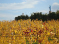
In the commune of Blacé, discover this 5 km trail, the Madone, built to protect the harvests, and enjoy the orientation table offering a panoramic view of the Monts du Lyonnais on the border with Burgundy and, on a clear day, Mont Blanc.
Les Béragnons route in the commune of Blacé
 6.25 mi
+312 ft
-312 ft
3h 10
Moderate
Departure from Blacé (Rhône)
6.25 mi
+312 ft
-312 ft
3h 10
Moderate
Departure from Blacé (Rhône)
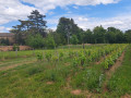
A 10 km circular that winds through the vineyards of Blacé and along the old Voie du Tacot road, passing through the village of Saint-Julien and near the Claude Bernard Museum.
Le grand circuit de Blacé
15.59 mi
+2,073 ft
-2,057 ft
9h 00
 Difficult
Departure from Blacé (Rhône)
Difficult
Departure from Blacé (Rhône)
Randonnez sur ce sentier de 25 km et partez à la découverte du patrimoine blacéen, sa viticulture, ses panoramas, ses vieilles demeures. Ce circuit est une synthèse des trois autres circuits de la commune de Blacé et reprend en partie ces derniers (la Madone 5 km, les Béragnons 10 km et les Têtières 16 km).
Les Têtiéres route in the commune of Blacé
 9.98 mi
+1,873 ft
-1,857 ft
6h 15
Moderate
Departure from Blacé (Rhône)
9.98 mi
+1,873 ft
-1,857 ft
6h 15
Moderate
Departure from Blacé (Rhône)
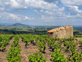
Overlooking the Saône valley, the trail crosses the Beaujolais vineyards and climbs the Col du Failly through a forest of deciduous and coniferous trees. A break at the Chapelle de Saint-Bonnet chapel will reveal the beauty of the panorama over the Saône Valley and the Beaujolais region.
Circuit le Sallerin / le Sovarin de la commune de Blacé
12.55 mi
+2,306 ft
-2,287 ft
7h 45
Difficult
Departure from Blacé (Rhône)
Surplombant la vallée de la Saône, le sentier traverse les vignes du Beaujolais et passe par le bas du vallon de Rochefolle pour rejoindre l'acrobranche de Blacé, en traversant le ruisseau le Sallerin / le Sovarin et traverse une forêt de feuillus et de résineux. Une pause à la Chapelle de Saint-Bonnet révélera la beauté du panorama sur le Val de Saône et le Beaujolais.
Salles - Arbuissonnas
 6.32 mi
+699 ft
-709 ft
3h 30
Moderate
Departure from Salles-Arbuissonnas-en-Beaujolais (Rhône)
6.32 mi
+699 ft
-709 ft
3h 30
Moderate
Departure from Salles-Arbuissonnas-en-Beaujolais (Rhône)
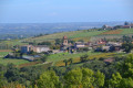
This is a pleasant, easy walk through the vineyards, the Caudalies Rouges.
Chanteins Chapel
7.38 mi
+66 ft
-66 ft
3h 25
Moderate
Departure from Ain
Set off to discover a hidden treasure in a lush green setting!
Route des Jonquilles in Garnerans
4.00 mi
+66 ft
-75 ft
1h 55
Easy
Departure from Garnerans (Ain)
Enjoy this short hike in the bucolic countryside behind the village of Garnerans.
Over hills and through Vauxrenard
 13.06 mi
+2,385 ft
-2,385 ft
8h 05
Difficult
Departure from Vauxrenard (Rhône)
13.06 mi
+2,385 ft
-2,385 ft
8h 05
Difficult
Departure from Vauxrenard (Rhône)
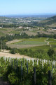
Vauxrenard is one of the most beautiful sites in the Beaujolais region. The village clings to the edge of a natural amphitheatre, sloping towards Juliénas and the Saône valley. This hike offers a varied route through sloping vineyards, magnificent forests and panoramic views stretching as far as the Alps on a clear day.