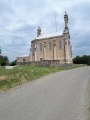
Haut Beaujolais route

A walk through the Haut Beaujolais that is completely different from the wine-growing Beaujolais we’ve been talking about. In this part of the Haut Beaujolais, there are no vineyards, just pastures with herds of cows or goats. You’ll find some excellent goat’s cheeses here.

Details

n°611934
Creation:
Last update:
Last review:
  • Touring/Gravel
    Activity: Touring/Gravel
  • ↔
    Distance: 30.37 mi
  • ◔
    Duration according to the author: 4 hrs 
  • ▲
    Difficulty: Moderate

  • ⚐
    Back to start: Yes
  • ↗
    Ascent: + 2,808 ft
  • ↘
    Descent: - 2,785 ft

  • ▲
    Highest point: 2,480 ft
  • ▼
    Lowest point: 801 ft

Photos

Description of the route

Park in the car park near the “Voie Verte” cycle path. This car park is situated in the village of Saint-Vincent at a place called Durette.

(S/E) Join the D337 road (Belleville-sur-Saône / Beaujeu) and follow it to the right. Immediately turn left onto the road leading to the village of Quincié-en-Beaujolais (D9).
Pass through the village of Quincié-en-Beaujolais towards Marchampt

(1) Pass through the hamlets of Le Champ and then Vitry.

(2) Pass beneath the beautiful Château de Varenne. Continue along the D9 and reach the three-way junction, 200 metres further on.

(3) Take the road uphill to the right towards the Col de la Casse Froide. The climb up the pass begins and continues for around 8 kilometres.

(4) Pass through the hamlet of Bonnevay.

(5) At the Col de la Casse Froide, turn right towards Vernay via the D645. Follow this road as it winds along the green hillsides.

(6) At the three-way junction, turn left towards Chenelette and join the D139.

(7) Turn left onto this small road, which climbs initially, then levels out before descending towards Chenelette and joining the D23.

(8) Turn right.

(9) In Chenelette, at the junction between the D23 and D337, carry on straight ahead towards the Col de Crie. You’ll reach this pass after about 7 km.

(10) At the Col de Crie roundabout, take the second exit on the right towards Ouroux / Avenas and continue for about 200 metres to the next junction.

(11) Turn right, still heading towards Avenas and Ouroux (D32).

(12) There is another three-way junction where you should turn right towards Avenas onto the D18E.

(13) In Avenas, at the large junction, go straight on along the D18 towards the Col du Fût d’Avenas (towards Villié-Morgon / Belleville-sur-Saône).

(14) At the Col du Fût d’Avenas, turn right onto the D136 towards Beaujeu. This road winds down through the town for 9 km. Drive through the town and, on the outskirts, join the Voie Verte (heading broadly to the left).

(15) Turn left and follow this path to the car park at the start (S/E).

Waypoints

  1. S/E : mi 0 - alt. 801 ft - Car park at Saint-Vincent (locality known as Durette)
  2. 1 : mi 1.8 - alt. 1,109 ft - Le Champ / Vitry
  3. 2 : mi 2.93 - alt. 1,211 ft - Varennes Castle
  4. 3 : mi 3.08 - alt. 1,237 ft - Turn right towards the Col de la Casse Froide
  5. 4 : mi 6.1 - alt. 2,283 ft - Bonnevay
  6. 5 : mi 6.91 - alt. 2,434 ft - Col de la Casse Froide (745m)
  7. 6 : mi 9.8 - alt. 2,215 ft - Sign for Chenelette
  8. 7 : mi 10.11 - alt. 2,323 ft - D139 road
  9. 8 : mi 11.38 - alt. 2,149 ft - D23 road
  10. 9 : mi 11.87 - alt. 2,159 ft - D23 / D337 junction
  11. 10 : mi 16.15 - alt. 2,047 ft - Roundabout - Col de Crie
  12. 11 : mi 16.27 - alt. 2,057 ft - Head towards the D32 Ouroux / Avenas
  13. 12 : mi 17.67 - alt. 2,320 ft - Towards the D18E Avenas
  14. 13 : mi 20.8 - alt. 2,238 ft - Avenas
  15. 14 : mi 21.45 - alt. 2,428 ft - Col du Fût d'Avenas (743m)
  16. 15 : mi 27.82 - alt. 958 ft - Beaujeu. Follow the - Ardière (rivière) - Affluent de la Saône
  17. S/E : mi 30.37 - alt. 801 ft - Car park at Saint-Vincent (locality known as Durette)

Reviews and comments

5 / 5
Based on 1 review

Reliability of the description
5 / 5
Ease of following the route
5 / 5
Route interest
5 / 5
pm747
pm747

Overall rating : 5 / 5

Date of your route : Jun 30, 2020
Reliability of the description : ★★★★★ Very good
Ease of following the route : ★★★★★ Very good
Route interest : ★★★★★ Very good
Very busy route : No

Stunning mountain scenery and views of the Saône Valley

Machine-translated

For more walks, use our search engine .

The GPS track and description are the property of this route's author. Please do not copy them without permission.