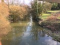
Here is a walk that starts in the town of Thoissey and takes you across fields to the banks of the Saône. The return journey to Thoissey, which follows the canal beneath the plane trees, will be particularly pleasant.
(S/E) Continue along Rue de la Grande Mademoiselle, passing in front of the MJC.
(1) At the end of this street, enter Parc du Général Marchand, where you’ll find a children’s playground and animals (fallow deer, ducks, hens). Cross the park along the banks of the Chalaronne, leave the park and cross the footbridge on the left.
(2) Turn right and continue along the tarmac road; this very quickly turns into a footpath.
As you leave the small vegetable gardens, turn left. Carry on straight ahead for 1.3 km until you reach a crossroads where four paths meet (there is a small wooden hut for horses here). Turn right to reach the banks of the Saône.
(3) Head up the towpath on the right for nearly 1.5 km until you reach the Thoissey Port embankment. Then cross the bridge over the Chalaronne.
(4) Turn right just after the restaurant to join the D7. Then follow the Chalaronne along the path running parallel to the road. When you reach the Square de la Galandière, continue to the right, pass by a pretty little stone bridge (do not cross it) and take Rue Louis Marchand to reach the (S/E)..
Waypoints
S/E : mi 0 - alt. 571 ft - Place du Collège Royal, opposite the town hall
1 : mi 0.11 - alt. 571 ft - Entrance to the Parc du Général Marchand
2 : mi 0.32 - alt. 564 ft - Footbridge. Exit from Parc Marchand
S/E : mi 3.05 - alt. 571 ft - Place du Collège Royal, opposite the town hall
Notes
Nearby picnic areas along the walk are situated at the campsite on Avenue du Port, near the Tourist Office chalet, at Marchand Municipal Park and at Square de la Galandière.
Public toilets are located on Avenue du Port, at the northern entrance to the municipal park and along the footpath on Place du Duc du Maine. The water point (excluding public toilets) is located on Place du Collège Royal.
This walk is organised by the Val de Saône Centre Tourist Office in collaboration with the Ain branch of the FFRandonnée.
38% tarmac.
Worth a visit
The Apothecary’s House
Built between 1731 and 1734, it is adorned with magnificent walnut panelling, weathered by time, the work of Jean Noblet, a joiner from Villefranche. The series of Tuscan-inspired loggias perfectly showcase the cobalt blue of the 18th-century Nevers earthenware pots that adorn these Renaissance-style sideboards. The ceiling is decorated with a magnificent water-based trompe-l’œil painted by Jean Lugnot.
The Ursuline Convent
Whilst the first convent founded in 1666 in Thoissey was occupied by nuns until the Revolution, the Ursulines’ cellar has finally been brought back to life after decades of neglect.
Now a permanent exhibition space, it houses photographs, paintings, vintage postcards and historical documents that trace the town’s history. It also provides a platform for contemporary and regional artists through temporary exhibitions.
Reviews and comments
4 / 5
Based on 3 reviews
Reliability of the description 4 / 5
Ease of following the route 3.7 / 5
Route interest 4.3 / 5
ODILEPAPIN
Overall rating :
3.7 / 5
Date of your route : Dec 30, 2024 Reliability of the description : ★★★☆☆ Average Ease of following the route : ★★★☆☆ Average Route interest : ★★★★★ Very good Very busy route : No
Please note that dogs are strictly prohibited in Général Marchand Park, so you’ll need to walk alongside the park along the road that crosses the Chalaronne and turn right towards the stadium to reach the footbridge
Machine-translated
omega69
Overall rating :
4 / 5
Date of your route : Oct 04, 2023 Reliability of the description : ★★★★☆ Good Ease of following the route : ★★★★☆ Good Route interest : ★★★★☆ Good Very busy route : No
A pleasant, well-shaded towpath, with more cyclists than walkers.
From the start to the harbour along the Chalaronne – absolutely brilliant!
Machine-translated
gerlandais
Overall rating :
4.3 / 5
Date of your route : Sep 30, 2023 Reliability of the description : ★★★★★ Very good Ease of following the route : ★★★★☆ Good Route interest : ★★★★☆ Good Very busy route : No
A very well-written description, but the horse shelter between points 2 and 3 seems to have disappeared...
To open this route on your smartphone, you must have the Visorando app installed. If not, got to the Apple Store (iPhone) or Google Play Store (Android) to download the app.



 Country:
 City:
City:



 Tourist office
 Visorando Member
 Moderate