Family walk in Saint-Didier-sur-Chalaronne

Walk organised by the parents’ association of Saint-Joseph Secondary School.

Details

20236
Creation:
Last update:
Last review:
  • Walking
    Activity: Walking
  • ↔
    Distance: 3.68 mi
  • ◔
    Average duration: 1h 45 
  • ▲
    Difficulty: Easy

  • ⚐
    Back to start: Yes
  • ↗
    Ascent: + 79 ft
  • ↘
    Descent: - 79 ft

  • ▲
    Highest point: 659 ft
  • ▼
    Lowest point: 561 ft

Photos

Description of the walk

(S/E) Setting off from the secondary school, walk past the town hall, follow the D7 towards Thoissey (on the right), then turn left onto Rue des Illards and head for the campsite.

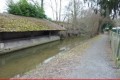
(1) At the entrance, after the bridge over the canal, turn left onto the footpath which passes the six-basin wash house and winds its way along the Canal des Échudes. It leads to the leisure park, which you must cross.

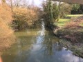
(2) After the footbridge, turn right and cross the new aluminium bridge over the Chalaronne, heading towards the Moulin de Saint-Julien equestrian centre (a former 17th-century mill).
Turn left, just past the sign for Vannans, onto the “Voie des 1400 ans”, a small, shaded path on the hillside (it passes a 19th-century brick château topped by a viewing platform, with a park and century-old trees).

(3) On the tarmac road, head downhill to the right. Turn left onto the D100 for 50 metres and take the path on the right.

(4) Cross the D933 and follow the D28 for 100 metres, then take the path on the left.

(5) At the T-junction, follow the track on the right, walk alongside and then cross the Chalaronne, then continue straight on along Rue de l’Hôpital, which leads to the centre of Thoissey.

(6) Turn right onto Rue Faubourg des Dombes, towards Saint-Didier; at the roundabout, continue straight on along Rue de Crénans and, at the next roundabout, turn left towards the secondary school (S/E).

Waypoints

  1. S/E : mi 0 - alt. 581 ft - Saint-Joseph Secondary School
  2. 1 : mi 0.32 - alt. 577 ft - Campsite
  3. 2 : mi 0.66 - alt. 587 ft - Aluminium footbridge over the - Chalaronne (rivière - affluent de la Saône)
  4. 3 : mi 1.23 - alt. 659 ft - Junction
  5. 4 : mi 1.63 - alt. 581 ft - D933
  6. 5 : mi 2.2 - alt. 561 ft - Junction
  7. 6 : mi 2.87 - alt. 574 ft - Route towards the secondary school
  8. S/E : mi 3.68 - alt. 581 ft - Saint-Joseph Secondary School

Notes

Refreshments are available along the route; this is a junction with the main route.

Worth a visit

Canal des Échudes. A leat running parallel to the Chalaronne, dug before the12th century over a distance of 5.5 km, from the Tallard pond to the Saône, for irrigation and to power 12 mills and numerous wash houses. It was also used for tanning, retting and basket-making.

Reviews and comments

3.5 / 5
Based on 4 reviews

Reliability of the description
3.8 / 5
Ease of following the route
4 / 5
Route interest
2.8 / 5
TotoB
TotoB
• Edited:

Overall rating : 4 / 5

Date of your route : Apr 02, 2024
Reliability of the description : ★★★★☆ Good
Ease of following the route : ★★★★★ Very good
Route interest : ★★★☆☆ Average
Very busy route : No

An easy route (and of little interest other than the stroll itself, but that’s true of all the walks in the area), which we extended, in our case, by taking the route north of Thoissey (walk no. 21012402), which was also easy but of little interest (the Ursuline convent was closed, Thoissey church was nothing to write home about, and Challes Castle was out of sight!!!).
Nearly 15 kilometres in total, easy and not at all tiring.

Machine-translated

Maoui
Maoui
• Edited:

Overall rating : 3 / 5

Date of your route : Feb 11, 2022
Reliability of the description : ★★★☆☆ Average
Ease of following the route : ★★★☆☆ Average
Route interest : ★★★☆☆ Average
Very busy route : Yes

Please note: at the start of the walk, if you follow the route shown on the map and try to walk alongside the Chalaronne, you will end up at the campsite, where walking is not permitted; you must turn left immediately after the entrance, at the canal.
After walking through the fields, to avoid going through the centre of Thoissey, we turned right after the bridge to follow the Chalaronne again (Rue de la Chalaronne) and take a small, well-maintained path which then leads back to the campsite.
As a result, we preferred the second part, which involved less road walking than the first.

Machine-translated

chevauxdominique
chevauxdominique

Overall rating : 2.3 / 5

Date of your route : Jun 07, 2020
Reliability of the description : ★★★☆☆ Average
Ease of following the route : ★★★☆☆ Average
Route interest : ★☆☆☆☆ Very disappointing
Very busy route : No

It was very pleasant for the first few kilometres, with narrow, shaded paths, but then we found ourselves on the tarmac of a small road and later on a main road, where there were no facilities provided for walkers. WARNING: DANGER with children. As for the return journey, it’s along a pavement that’s barely wide enough for one person.
Very disappointed with this very short walk, which isn’t even 6 km as advertised....

Machine-translated

MH Servan
MH Servan

Overall rating : 4.7 / 5

Date of your route : Mar 09, 2020
Reliability of the description : ★★★★★ Very good
Ease of following the route : ★★★★★ Very good
Route interest : ★★★★☆ Good

We really enjoyed this easy, not-too-long walk.
The route is very pleasant in the first half, less so in the second; so we cut it short by going via Les Sablons

Machine-translated

Other walks in the area

For more walks, use our search engine .

The GPS track and description are the property of this route's author. Please do not copy them without permission.