


 Country:

 City:
City:


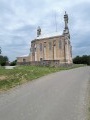
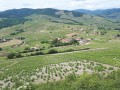
Park in the car park near the “cycle path” reserved for bicycles. This car park is situated in the village of Saint-Vincent at a place called Durette.
(S/E) Join the D337 road (Belleville-sur-Saône/Beaujeu) by turning right onto it. Immediately turn left onto the road leading to the village of Quincié-en-Beaujolais (D9).
Drive through the village of Quincié-en-Beaujolais towards Marchampt.
(1) Pass through the hamlets of Le Champ and then Vitry.
(2) Pass beneath the beautiful Château de Varennes. Continue on the D9.
(3) At the three-way junction, turn right towards the Col de la Croix Marchampt.
Carry on for several kilometres until you finally reach the Col de la Croix Marchampt.
(4) At the pass, turn left (D621) towards the Col de la Croix Rosier.
(5) At the Col de la Croix Rosier, take the descent on the left, and within 100 metres, take a hairpin bend towards Le Pérréon (D88). Take a long descent of several kilometres.
(6) Pass through the village of La Creuse and continue towards Le Pérréon.
(7) In this village, at the three-way junction, leave the D88 by taking the road on the left (Route de Laprat, D133).
(8) At the next three-way junction (at the start of the village of Laprat), turn left onto the D646 towards Saint-Étienne-la-Varenne.
(9) After a slight climb, at the junction, turn left onto the D62, which leads downhill.
(10) After passing through the village of Odenas, at the northern roundabout on the D43 heading towards Cercié and Quincié-en-Beaujolais, turn right onto the D68E towards Saint-Lager.
(11) After driving a few kilometres, at a place called La Croix Catillat, turn left onto a small road that climbs towards Mont Brouilly. Please note that the sign is only visible when approaching from the opposite direction.
(12) Take the road that climbs to the right towards Mont Brouilly (signposted ‘Route de La Chapelle’).
(13) A good kilometre further on, you’ll reach a viewing platform offering a lovely vista. A geological timeline of the Beaujolais region explains how the landscape has evolved over millennia.
(14) A little further on (less than 1 km), you’ll reach the Mont Brouilly Chapel, which is sometimes open to visitors. Walk past the chapel and head back down towards Saint-Lager.
(15) Just after passing the cemetery, you’ll come to a three-way junction. Turn left.
(16) Turn left onto the Route des Ravatys, which will take you past the château of the same name.
Carry on towards Cercié.
(17) At the junction with traffic lights, carry on straight ahead, then veer slightly to the left, still following the main road.
(18) 200 metres further on, take the cycle path on the left.
After 3 km on the cycle path, return to the car park where you started (S/E).


