Route from Les Peloux to Les Communaux in Peyzieux-sur-Saône

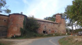
Dovecotes, old farmhouses, carriage gates… Amidst woodland and historic buildings, take a stroll through the village of Peyzieux-sur-Saône.

Details

n°21014544
Creation:
Last update:
Last review:
  • Walking
    Activity: Walking
  • ↔
    Distance: 7.23 mi
  • ◔
    Average duration: 3h 30 
  • ▲
    Difficulty: Moderate

  • ⚐
    Back to start: Yes
  • ↗
    Ascent: + 177 ft
  • ↘
    Descent: - 184 ft

  • ▲
    Highest point: 843 ft
  • ▼
    Lowest point: 659 ft

Description of the walk

Park in the town hall car park.

(S/E) After noticing the statue of the Virgin Mary in the square, head towards the cemetery. Once you’ve passed the cemetery, turn immediately left onto the path. At the first junction, carry straight on. Then turn left and then right as the path winds in an S-shape through the fields.

(1) At the entrance to the woods, turn right onto the grassy path which leads into the undergrowth and, 200 metres further on, joins a crossroads in the heart of the Bois de la Serve. There, take the path furthest to the right and follow it to a clear, stony track.

(2) Start along the long straight stretch on the left and cross the TGV line bridge. Leave the Bois de Grenouillat and reach the four-way crossroads.

(3) Turn right, cross the farmland and reach the D100 near a rammed-earth farmhouse.

(4) Turn right towards the houses and pass through the hamlet of Simandre. After crossing another bridge over the TGV line, you’ll arrive near the Couant farm. Then, just past it, leave the D100 by taking the first road on the left and continue to the next crossroads.

(5) Turn right onto the tarmac road and head for the hamlet of Maisons Neuves. Turn left at the Y-junction, then carry on straight ahead until you reach the beautiful Fatier farm (dovecote, main building, pedestrian gate and carriage entrance). Continue to the four-way junction.

(6) Turn right, and after crossing the Petite Calonne bridge, begin the Montée du Rapillon (on the right is a public washhouse built in 1913). You’ll reach a four-way junction.

(7) Turn left to begin a U-shaped route that will allow you to explore the village. Ignore the first two streets on the right and follow thethird, then turn right at the next junction. You can admire a beautiful adobe dovecote, some old façades and a cross. When you reach the church, turn left and, at the ‘Stop’ sign, turn right to return to the town hall car park (S/E).


Waypoints

  1. S/E : mi 0 - alt. 745 ft - Town hall car park
  2. 1 : mi 1.14 - alt. 768 ft - Bois de la Serve
  3. 2 : mi 1.8 - alt. 771 ft - Grenouillat Wood
  4. 3 : mi 2.82 - alt. 823 ft - Crossroads
  5. 4 : mi 3.39 - alt. 840 ft - D100
  6. 5 : mi 4.59 - alt. 801 ft - Junction
  7. 6 : mi 5.95 - alt. 715 ft - Crossroads of the four roads
  8. 7 : mi 6.41 - alt. 745 ft - Crossroads of the four roads
  9. S/E : mi 7.23 - alt. 745 ft - Town hall car park

Notes

The public toilets and the village’s only water point are located on Place de l’Eglise, near the cemetery.
The nearest picnic areas to Peyzieux are outside the walking route and are located one in Port de Mûre and the other in Genouilleux, both on the banks of the Saône.

This walk is organised by the Val de Saône Centre Tourist Office in collaboration with the FF Randonnée de l’Ain.

57% tarmac.

Worth a visit

Vernacular heritage:
Vernacular heritage refers to the characteristic features of popular culture and everyday life: wash houses, wayside crucifixes, or small rural structures such as mills. Peyzieux-sur-Saône is a typical example of a village where vernacular heritage remains very much in evidence thanks to the numerous dovecotes in the commune. Following the Revolution, they became emblematic of peasant dwellings because, no longer reserved for the nobility, they symbolised the end of seigneurial rights.

Earthen dwellings:
Many of the houses in the Val de Saône are built using rammed earth, a method of construction using raw earth.
Rammed earth houses are built using compacted raw earth, sometimes mixed with hay or straw (in which case the term ‘bauge’ or ‘torchis’ is used), and supported by a wooden framework.
A foundation of stone, ‘carron’ (red brick) or pebbles – the material chosen depending on the area – acts as insulation against ground damp. Depending on the financial means of the future inhabitants, this foundation is of varying height.
On the main façade, facing the street, it may be more or less elaborately finished and serve a decorative purpose.

Reviews and comments

3.7 / 5
Based on 3 reviews

Reliability of the description
4 / 5
Ease of following the route
4 / 5
Route interest
3 / 5
Pasquie22
Pasquie22

Overall rating : 4.3 / 5

Date of your route : Jan 28, 2024
Reliability of the description : ★★★★★ Very good
Ease of following the route : ★★★★☆ Good
Route interest : ★★★★☆ Good
Very busy route : No

A lovely route that presents no difficulty and offers a pleasant stroll through fields and woodland. Whilst it certainly isn’t of great historical interest, it is nonetheless very enjoyable for a walk – best done before the summer heat sets in, as there isn’t much shade along the route. Not to be missed: the beautiful Fatier farm. At point 5, birdwatchers should head left towards the Vavres pond (signposted), which is once again full of water and lies just a few metres to the right, then return to the junction and head towards the hamlet of Maisons-Neuves.

Machine-translated

TotoB
TotoB

Overall rating : 3 / 5

Date of your route : Dec 10, 2023
Reliability of the description : ★★★☆☆ Average
Ease of following the route : ★★★★☆ Good
Route interest : ★★☆☆☆ Disappointing
Very busy route : No

As is usual in this area (and in the Dombes too…), there isn’t much to see. The only attraction of this walking route is the minimal elevation gain, which makes it suitable for frail or convalescing people.
Otherwise, most of the route follows footpaths; only the last 3–4 kilometres are along quiet country lanes.

Machine-translated

omega69
omega69

Overall rating : 3.7 / 5

Date of your route : Sep 01, 2023
Reliability of the description : ★★★★☆ Good
Ease of following the route : ★★★★☆ Good
Route interest : ★★★☆☆ Average
Very busy route : No

The long stretch of road on this route isn’t very interesting.
The route has been fully signposted in accordance with the FFrandonnée guidelines, so you can follow it without any doubt...!
Omega69

Machine-translated

Other walks in the area

For more walks, use our search engine .

The GPS track and description are the property of this route's author. Please do not copy them without permission.