Route of heritage along the towpath in Mogneneins

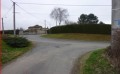
From the 16th-century wayside cross in front of the church to the banks of the Saône, via the hamlet of Flurieux and its little chapel, let yourself be guided along the paths of the village of Mogneneins.

Details

21014733
Creation:
Last update:
Last review:
  • Walking
    Activity: Walking
  • ↔
    Distance: 8.51 mi
  • ◔
    Average duration: 4h 05 
  • ▲
    Difficulty: Moderate

  • ⚐
    Back to start: Yes
  • ↗
    Ascent: + 154 ft
  • ↘
    Descent: - 141 ft

  • ▲
    Highest point: 751 ft
  • ▼
    Lowest point: 558 ft
  • ⚐ Country: France
  • ⚐ City: Mogneneins (01140)
  • ⚑
    Start/End: N 46.1408° / E 4.81005°
  • ❏
    IGN map(s): Ref. 3029SB
  • Hour-by-hour weather

Description of the walk

Park in the town hall car park.

(S/E) On leaving the car park, turn right and continue straight on at thefirst junction.
In front of the church, you can walk around the famous 16th-century (Gothic-style) calvary.
Almost immediately after the church, turn left onto the road (Rue de la Croix Goyet) which descends into a small valley. Cross the Jorfond stream, then climb back up onto the plateau and continue straight on to the cross (viewpoint over the Beaujolais). At the entrance to the hamlet of Les Avaneins, turn right. Let the road pass on your right and continue to a crossroads.

(1) Take the dirt track on the right, which leads to the D75d; follow this to the left until you reach the edge of the woods. Turn right onto the grassy path (be careful as it’s not very visible); 350 metres further on, still in the woods, turn onto the path on the left, passing a large pond. At the edge of the forest, turn left again and follow the edge of the woods until you reach the D75d.

(2) Turn right onto this road and continue to the TGV bridge. Just before the bridge, turn left onto the dirt track that runs alongside the TGV line for 350 m. Continue to the left to pass through the woodland.

(3) Carry on to the left and, 400 m further on, take the path to the right, then to the left, which joins a tarmac road; follow this to the right until you reach the next junction. Go straight on along the gravel path (towards the pylon) to reach a junction directly beneath a power line.

(4) Turn left towards the houses to enter Flurieux. At thefirst junction, take the street on the left and, 100 metres further on, after admiring the shell-shaped well and the wine press, take the street that slopes down to the right.
On the left, you can see a restored dovecote and the old Saint-Claude Chapel (17th century).

(5) When you reach the cross, take the tree-lined road opposite towards Les Couchoux. Let a road on the right pass you as you go downhill, and you’ll reach the D933 (caution: dangerous crossing). Continue straight on for 400 m, then take the path on the right. Next, take the first path on the left, which leads to the banks of the Saône.

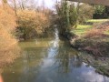
(6) Take the towpath on the left for 2.2 km (keep an eye out for local flora and fauna).

(7) At Port de Mure, turn left and head up the road to cross the D933 again (take care), heading towards Peyzieux-sur-Saône. Continue for 50 m, then take the first path on the left which climbs up the hillside. Pass two successive paths on the right until you reach a chestnut tree, then continue straight on. At the next junction, take the grassy path on the left. Return to the road on the right after the first houses, then, in front of the church, turn left and head back to the car park (S/E).

Waypoints

  1. S/E : mi 0 - alt. 686 ft - Town hall car park
  2. 1 : mi 1.05 - alt. 725 ft - Les Picardières
  3. 2 : mi 2.46 - alt. 748 ft - Bois Dieu
  4. 3 : mi 3.63 - alt. 699 ft - The Vierre
  5. 4 : mi 4.55 - alt. 696 ft - Flurieux
  6. 5 : mi 4.97 - alt. 702 ft - Cross
  7. 6 : mi 6.11 - alt. 561 ft - La Saône
  8. 7 : mi 7.49 - alt. 561 ft - Port de Mûre
  9. S/E : mi 8.51 - alt. 686 ft - Town hall car park

Notes

There is a picnic area at Port de Mûre, on the banks of the Saône. There are no public toilets or drinking water points nearby along the walk.

This walk is organised by the Val de Saône Centre Tourist Office in collaboration with the FF Randonnée de l’Ain.

43% tarmac.

Worth a visit

The 16th-century calvary:
A monument situated on the church forecourt, this Calvary is one of the rarest recorded in the department. Dating from the 16th century and built in the Flamboyant Gothic style, it is constructed from limestone. Its four sides are richly and finely carved, featuring, in particular, Christ on the cross on the east side, the Virgin and Child on the west side, and
the symbols of the four Evangelists at the ends of the cross. It is crowned by a bird devouring its own heart to feed its young, a symbol of Christ’s sacrifice in the Catholic faith.

The former Saint Claude Chapel and the restored dovecote at Flurieux:
This rural chapel was built at a crossroads around 1629 by the Sandelion brothers, following an outbreak of the plague. It is said to have been built over the graves of local residents who had perished from the disease. In the 20th century, the chapel seemed doomed to fall into disrepair until a small team of volunteers decided to restore it, which was completed in 1977. The stained-glass windows were designed and crafted in 1977 using blown glass from Saint-Just. Baptisms and weddings are still held there today.
The dovecote has been owned by the local council since 2002. It has been fully restored, retaining its hipped roof of glazed flat tiles and its ridge finial topped with a weather vane. It is now used as a venue for occasional exhibitions.
The chapel and the dovecote form a beautifully lit ensemble once night falls.

The old dam:
Built in 1870 and decommissioned in 1975, the old ‘needle’ dam consisted of a lock whose gates were operated manually by the lock-keepers. It was replaced by the dam 1 km to the north, at Thoissey.
The lock-keepers’ house is not open to visitors but still stands opposite the old lock.
Nowadays, the lock serves as a shelter for small boats on windy days.

Reviews and comments

4.3 / 5
Based on 3 reviews

Reliability of the description
4.7 / 5
Ease of following the route
5 / 5
Route interest
3.3 / 5
User 28617303

Overall rating : 4 / 5

Date of your route : Apr 26, 2026
Reliability of the description : ★★★★☆ Good
Ease of following the route : ★★★★★ Very good
Route interest : ★★★☆☆ Average
Very busy route : No

An easy walk with very clear signposting. Not much of cultural interest, which is a shame.

Machine-translated

TotoB
TotoB

Overall rating : 4.7 / 5

Date of your route : Sep 16, 2024
Reliability of the description : ★★★★★ Very good
Ease of following the route : ★★★★★ Very good
Route interest : ★★★★☆ Good
Very busy route : No

..

Machine-translated

Pat01600
Pat01600

Overall rating : 4.3 / 5

Date of your route : Aug 21, 2022
Reliability of the description : ★★★★★ Very good
Ease of following the route : ★★★★★ Very good
Route interest : ★★★☆☆ Average
Very busy route : No

A route without any particular difficulties, offering the chance to explore small country villages.
The road sections are a bit monotonous, but there isn’t much traffic.

Machine-translated

Other walks in the area

For more walks, use our search engine .

The GPS track and description are the property of this route's author. Please do not copy them without permission.