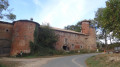
Walk around Montceaux

Starting from the leisure area (Montceaux stadium), this circular route takes you through meadows and woodland around the village of Montceaux. You can explore the Calonne, a stream that runs through the village, and the ruins of the oil mill.

Details

93674390
Creation:
Last update:
Last review:
  • Walking
    Activity: Walking
  • ↔
    Distance: 3.73 mi
  • ◔
    Average duration: 1h 55 
  • ▲
    Difficulty: Easy

  • ⚐
    Back to start: Yes
  • ↗
    Ascent: + 194 ft
  • ↘
    Descent: - 207 ft

  • ▲
    Highest point: 758 ft
  • ▼
    Lowest point: 597 ft
  • ⚐ Country: France
  • ⚐ City: Montceaux (01090)
  • ⚑
    Start/End: N 46.094814° / E 4.79773°
  • ❏
    IGN map(s): Ref. 3029SB
  • Hour-by-hour weather

Description of the walk

Parking: La Madone car park, 50 m from the leisure area.

(S/E) From the leisure area after the school, head down Chemin de Betheneins and carefully cross Route de Belleville D17 to follow Chemin de l’Église for about 30 m.

(1) Take the path on the right then head down to the left. Cross the Calonne via a footbridge and arrive at a cross path.

(2) Follow the path on the right, which runs alongside the stream, and at the crossroads, follow the road to the left towards the hamlet of Charlet.

(3) Turn left, then, on leaving the hamlet, take the path on the right, which joins a PR® trail.

(4) Follow it to the left for about 400 m (elevation 226 m).

(5) At the crossroads, turn left and walk along the Bois de Combe until you reach a road.

(6) Follow this road to the right and, at the 90° bend, leave the road and turn left into a wooded area. Continue due south, cross the Calonne again and arrive at a road after Moulin Crozet.

(7) Turn left and continue to the Fork in the road at the sewage treatment plant.

(8) At the crossroads, take Chemin de la Poipe on the right and continue along Chemin de l’Église.

(1) Turn right and, following the route back in the opposite direction, return to the Madone car park (S/E).

Waypoints

  1. S/E : mi 0 - alt. 709 ft - La Madone car park - Église Saint-Philippe et Saint-Jacques (Montceaux)
  2. 1 : mi 0.15 - alt. 696 ft - Crossroads of the circular loop
  3. 2 : mi 0.5 - alt. 623 ft - Footbridge. Fork to the right - Callonne (rivière) - Affluent de la Saône
  4. 3 : mi 0.93 - alt. 735 ft - Le Charlet hamlet
  5. 4 : mi 1.41 - alt. 755 ft - PR junction
  6. 5 : mi 1.74 - alt. 741 ft - Junction towards the Bois de la Combe
  7. 6 : mi 2.33 - alt. 627 ft - Road junction
  8. 7 : mi 3.01 - alt. 607 ft - Road after Moulin Crozet
  9. 8 : mi 3.17 - alt. 607 ft - Junction near the sewage treatment plant
  10. S/E : mi 3.73 - alt. 709 ft - La Madone car park - Église Saint-Philippe et Saint-Jacques (Montceaux)

Notes

From this junction (8), you can continue on to the ruins of the oil mill: follow the stream to the right at the edge of the woods and take a path on the right to the ruins and back: see on OSM (sign).

Worth a visit

Montceaux Church.

Always be cautious and plan ahead when you're outdoors. Visorando and the author of this route cannot be held responsible for any accidents occurring on this route.

The GR® and PR® markings are the intellectual property of the Fédération Française de Randonnée Pédestre.

Other walks in the area

For more walks, use our search engine .

The GPS track and description are the property of this route's author. Please do not copy them without permission.