Route des moulins in Saint-Didier-sur-Chalaronne

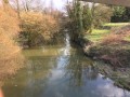
This walk will take you through the countryside to the east of Saint-Didier-sur-Chalaronne up to the higher ground above the village. It passes by private mills and right in front of the Jardins Aquatiques tourist attraction.

Details

n°22096317
Creation:
Last update:
Last review:
  • Walking
    Activity: Walking
  • ↔
    Distance: 7.59 mi
  • ◔
    Average duration: 3h 40 
  • ▲
    Difficulty: Moderate

  • ⚐
    Back to start: Yes
  • ↗
    Ascent: + 200 ft
  • ↘
    Descent: - 184 ft

  • ▲
    Highest point: 702 ft
  • ▼
    Lowest point: 577 ft

Description of the walk

Starts from Place des Huguets in Saint-Didier-sur-Chalaronne.

(S/E) From Place des Huguets, turn right onto Rue des Huguets, then right onto Rue du Marché. Continue to a roundabout, then take Rue de Crenans. Follow this road towards Thoissey and, when you reach Place Georges Agniel, head towards the campsite. Turn left in front of the wash house to walk alongside the Canal des Échudes and the campsite. Cross the leisure area.

(1) Before the D933, turn right onto the old road, then cross the old bridge over the Chalaronne. Walk for 200 m until you reach the rest area. Cross the D933 (take care) towards the riding centre; in front of the Vannans sign, take the path on the left and walk through the entire hamlet of Vannans. At the end, continue left along the D100 to the Rollets cross.

(2) Head uphill to the left and pass through Les Rollets. Continue along the path that descends through the woods and leads onto the tarmac road; follow this to the left until you reach the 90° left-hand bend.

(3) Take the path on the right and cross the Chalaronne via the footbridge. Head towards the Moulin des Vernes. Continue along the small road, then follow the D7 to the left, and reach the junction with the D64 (take care). Carry on straight ahead to reach Valenciennes, then Les Brocatières.

(4) At the entrance to this hamlet, turn right onto the sunken track which climbs up onto the plateau and crosses farmland (panoramic view). Take the D66a to the right for 250 m.

(5) Turn left onto the track. At the end of this, take the road on the left for a few metres, then the track that descends to the right for 400 m.

(6) Take the small tarmac road on the left and follow it to the cross at the entrance to Haut Mizériat. Turn right and head downhill for 150 m, then take the path on the hillside to the left (panoramic view) which leads to Belle-Vue Castle. Continue for 1 km to Onjard (Stop sign). Carry on towards Valenciennes for 500 m.

(7) Turn right onto the path which passes through the housing estates and leads back to Saint-Didier-sur-Chalaronne. When you reach the D933, turn left, then leave it by turning right onto Rue du Marché and head right to Place des Huguets (S/E).

Waypoints

  1. S/E : mi 0 - alt. 581 ft - Les Huguets car park
  2. 1 : mi 0.65 - alt. 587 ft - Moulin Neuf Leisure Centre - Chalaronne (rivière - affluent de la Saône)
  3. 2 : mi 1.67 - alt. 653 ft - Les Rollets
  4. 3 : mi 2.45 - alt. 597 ft - Moulin des Vernes
  5. 4 : mi 3.67 - alt. 646 ft - Les Brocatières
  6. 5 : mi 4.47 - alt. 702 ft - Silos
  7. 6 : mi 5.31 - alt. 669 ft - Les Fontanettes
  8. 7 : mi 6.92 - alt. 591 ft - Valenciennes
  9. S/E : mi 7.59 - alt. 581 ft - Les Huguets car park

Notes

Nearby picnic areas are located at the Moulin Neuf lake – Rue de la Libération,
at the Moulin Neuf Leisure Centre – Rue de la Libération and Impasse de la Passerelle de Saint Julien.
The drinking fountain is on Place de l’Église (near the wayside cross, opposite the tobacconist’s) and public toilets are on Place Georges Agniel and near the Moulin Neuf Leisure Centre.

This walk is organised by the Val de Saône Centre Tourist Office in collaboration with the FF Randonnée de l’Ain.

53% tarmac.

Worth a visit

Water Gardens:
A park dedicated to local biodiversity, featuring water features, native plant species and wildlife.
Also known as the Living Museum of Aquatic Plants, this park offers nearly 35,000 m² of landscaped grounds to explore, featuring a multitude of waterfalls, streams and ponds where genuine Japanese koi carp swim amongst water lilies and lotus flowers, as well as ‘The Bamboo Garden’.

The History of Saint Didier:
The village was formerly known as Prisciniacum. Saint Didier was a bishop of Vienne who was murdered on 23 May 608 by a Burgundian queen jealous of his influence.
Tradition has it that Didier, attacked at Cormoranche-sur-Saône, breathed his last where the Vannans spring flows, in Saint-Didier-sur-Chalaronne. His body was buried in the cemetery near the church, and the spring is said to have become miraculous. Following his canonisation, the parishioners of Prisciniacum named their parish after him in the 10th century.

A heritage linked to water:
The Saône Valley is characterised by the presence of water.
Whilst the Saône has shaped its landscapes, the area is also criss-crossed by numerous rivers, leats, canals and small tributaries.
People have made the most of this abundance and built numerous mills and wash houses, which can still be seen in the hamlets and in the heart of the village. Traces of this can also be found in place names. It is a rich local heritage that bears witness to these activities, which have now disappeared.

Reviews and comments

3.4 / 5
Based on 3 reviews

Reliability of the description
3 / 5
Ease of following the route
3.3 / 5
Route interest
4 / 5
madydou
madydou ★

In the app, simply tap the ‘Go to start’ tab.

Machine-translated

Martin6926
Martin6926

Overall rating : 3.3 / 5

Date of your route : Feb 11, 2025
Reliability of the description : ★★★☆☆ Average
Ease of following the route : ★★★☆☆ Average
Route interest : ★★★★☆ Good
Very busy route : No

The start of the walk at the “Parking des Huguets” was hard to find (Mappy and GPS didn’t recognise it), so we set off from the car park by the church

Machine-translated

Riosalbe
Riosalbe

Overall rating : 4 / 5

Date of your route : Oct 24, 2023
Reliability of the description : Not used / Not applicable
Ease of following the route : ★★★★☆ Good
Route interest : ★★★★☆ Good
Very busy route : No

A lovely walk despite the rainy weather. The end of the route was a bit monotonous.

Machine-translated

TotoB
TotoB

Overall rating : 3.3 / 5

Date of your route : Aug 03, 2023
Reliability of the description : ★★★☆☆ Average
Ease of following the route : ★★★☆☆ Average
Route interest : ★★★★☆ Good
Very busy route : No

An interesting walk for the first 5 kilometres; the rest is unremarkable apart from the walk itself.
The route description is very vague (incorrect street name, starting point unknown to locals – you have to search for it and find it by instinct...) and the map isn’t detailed enough to find your way around. A GPS is essential if you want to follow the route.

Machine-translated

Other walks in the area

For more walks, use our search engine .

The GPS track and description are the property of this route's author. Please do not copy them without permission.