


Refine your search for walks in Anould
Anould walks


 Walk to the Roche du Sphinx in Anould
 Visorando Member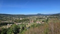
 1.21 mi
 +135 ft
 -148 ft
 0h 40
0h 40
 Easy
Easy
 Departure from Anould (Vosges)
A very easy little walk that takes you along a fully shaded forest path to the Roche du Sphinx, a natural site situated at an altitude of around 560 m above Anould. As an added bonus, there’s a lovely picnic area where you can relax and enjoy the surroundings.
Gerbepal-Boslimpré-Osseux-Roche des Chiens-Gerbepal
 12.59 mi
+1,604 ft
-1,578 ft
7h 10
12.59 mi
+1,604 ft
-1,578 ft
7h 10
 Difficult
Departure from Gerbépal (Vosges)
Difficult
Departure from Gerbépal (Vosges)
This route was chosen for the Popular Walk on 18 June 2017 in Gerbepal.
The Champ de Roches from Corcieux
10.12 mi
+991 ft
-961 ft
5h 30
 Moderate
Departure from Corcieux (Vosges)
Moderate
Departure from Corcieux (Vosges)
The Champ de Roches is located in the municipality of Barbey-Seroux, near the Col des Arrentès between the Neuné and Vologne valleys. This "river" of rocks stretches between conifer plantations for 400 metres long and 40 metres wide. The existence of such chaos is surprising and has given rise to numerous legends in which the presence of the Devil is never far away.Although most of this hike takes place on forest trails and paths, the relatively long but easy loop includes a few stretches of road that allow you to discover the town of Corcieux at the start and finish, as well as the charming hamlets in the surrounding area. There are beautiful, idyllic landscapes throughout this circuit.
The memorial walls of Fraize
 2.31 mi
+318 ft
-318 ft
1h 20
Easy
Departure from Fraize (Vosges)
2.31 mi
+318 ft
-318 ft
1h 20
Easy
Departure from Fraize (Vosges)
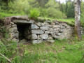
The La Costelle heritage conservation association, volunteers from the Haute-Meurthe branch of the Club Vosgien, the tourist development organisation (ATEHM) and the municipality of Fraize have joined forces to breathe new life into this heritage site. The route has been redesigned, the site cleared and the walls showcased. The information board at the start provides all the details on the history of these walls (see QR code) and on walks in the area.
The beautiful rocks of the Kemberg massif
10.28 mi
+2,238 ft
-2,221 ft
6h 40
Moderate
Departure from Saulcy-sur-Meurthe (Vosges)
Hike in the Kemberg massif and its pink sandstone rocks. Developed by the Club Vosgien, with footbridges and protective railings, these rocks offer magnificent views of Saint-Dié and its surroundings.
Col de Noirmont, Le Chastel and Pierre de la Roche
 3.25 mi
+768 ft
-784 ft
2h 10
Moderate
Departure from Taintrux (Vosges)
3.25 mi
+768 ft
-784 ft
2h 10
Moderate
Departure from Taintrux (Vosges)
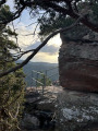
A figure-of-eight route to explore a Druidic archaeological site and then the Pierre de la Roche, which is used as a climbing spot.
La Tête de Nayemont and Champ de Roches
 8.36 mi
+1,138 ft
-1,138 ft
4h 50
Moderate
Departure from Arrentès-de-Corcieux (Vosges)
8.36 mi
+1,138 ft
-1,138 ft
4h 50
Moderate
Departure from Arrentès-de-Corcieux (Vosges)
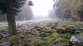
A few viewpoints and the discovery of a geological curiosity. A variant without the climb to the Tête de Nayemont reduces the route to 13 km and 240 m of elevation gain (see description).
Important: following comments received, the route of this hike has been modified to avoid paths that have disappeared into the vegetation.
This hike includes a paved section at the beginning and end of the route, as well as a few forest roads that cannot be avoided.
The Sagard Trail in the Straiture Gorge
 2.88 mi
+545 ft
-518 ft
1h 50
Easy
Departure from Ban-sur-Meurthe-Clefcy (Vosges)
2.88 mi
+545 ft
-518 ft
1h 50
Easy
Departure from Ban-sur-Meurthe-Clefcy (Vosges)
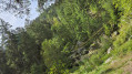
A very pleasant family trail that winds its way between the river and stands of beech and fir trees, taking you on a journey of discovery through this ancient glacial valley. Enjoy the surprisingly cool atmosphere of the area; head up the Route Forestière Louis François to admire a majestic scree slope before a final descent down the mountainside to reach the Lançoir sawmill.
Rocks and viewpoints in the Kemberg massif
 6.99 mi
+1,227 ft
-1,220 ft
4h 15
Moderate
Departure from Saulcy-sur-Meurthe (Vosges)
6.99 mi
+1,227 ft
-1,220 ft
4h 15
Moderate
Departure from Saulcy-sur-Meurthe (Vosges)
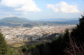
The Kemberg massif offers numerous vantage points: Roche Saint-Martin, Kiosque, Anozel and Enclume; add to these the paragliding launch sites at Col du Kiosque and Kemberg. You will enjoy the panoramic views over Saint-Dié, the Meurthe valley, and the Ormont and Bure massifs.
 The Tour du Kemberg
 8.64 mi
+367 ft
-371 ft
1 hr
Easy
Departure from Saulcy-sur-Meurthe (Vosges)
8.64 mi
+367 ft
-371 ft
1 hr
Easy
Departure from Saulcy-sur-Meurthe (Vosges)
The Kemberg massif is well known to the people who live nearby. The Tour du Kemberg is well shaded with fairly wide paths.
Simply follow the blue circles and signs. Ideal for getting back into shape or for families, with no major difficulties.
The Champ de Roches
 1.11 mi
+92 ft
-92 ft
0h 35
Easy
Departure from Barbey-Seroux (Vosges)
1.11 mi
+92 ft
-92 ft
0h 35
Easy
Departure from Barbey-Seroux (Vosges)
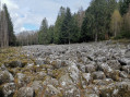
In the middle of a dense pine forest, huge granite boulders are piled up to a depth of 7 to 8 metres over a length of 400 metres and a width of 40 metres. The Barbey-Seroux Rock Field remains a mystery to scientists. A one-kilometre marked nature trail allows visitors to explore this astonishing rock chaos. An easy and pleasant walk suitable for young children.
Kemberg Massif in Saint-Dié-des-Vosges
 3.59 mi
+1,142 ft
-1,106 ft
2h 40
Moderate
Departure from Saint-Dié-des-Vosges (Vosges)
3.59 mi
+1,142 ft
-1,106 ft
2h 40
Moderate
Departure from Saint-Dié-des-Vosges (Vosges)
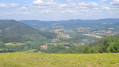
Hiking in the Kemberg massif in Saint-Dié-des-Vosges, covered with fir trees and offering two superb viewpoints: La Roche du Kiosque and La Roche de Saint-Martin.
Marmonfosse Forest Loop
 Tourism professional1.47 mi
+98 ft
-108 ft
0h 45
Easy
Departure from La Houssière (Vosges)
Tourism professional1.47 mi
+98 ft
-108 ft
0h 45
Easy
Departure from La Houssière (Vosges)
A nice little hike starting from the Marmonfosse lodges!
A short, very easy loop, ideal for a leisurely stroll.
A pretty section in the forest with little elevation gain, perfect for recharging your batteries without too much effort.
Rudlin Waterfall
 1.47 mi
+404 ft
-404 ft
1h 00
Easy
Departure from Plainfaing (Vosges)
1.47 mi
+404 ft
-404 ft
1h 00
Easy
Departure from Plainfaing (Vosges)
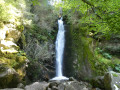
By making a loop from the Étang des Dames, you can quickly reach the Rudlin Waterfall. This is a pretty waterfall about ten metres high, accessible via a path through the woods from the bottom of the valley.
Le Gazon du Faing from Rudlin
 7.61 mi
+2,008 ft
-1,982 ft
5h 15
Moderate
Departure from Plainfaing (Vosges)
7.61 mi
+2,008 ft
-1,982 ft
5h 15
Moderate
Departure from Plainfaing (Vosges)
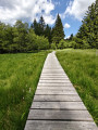
This hike takes you to the Hautes Chaumes in the Tanet-Gazon du Faing Nature Reserve, starting on the Vosges side via the Ruhlock trail along a stream and returning via the Rudlin waterfall.There are beautiful views from the ridges over Lac Blanc and Lac des Truites or Lac du Forlet.
The TGV or Tour du Grand Valtin
 4.51 mi
+794 ft
-794 ft
2h 45
Easy
Departure from Ban-sur-Meurthe-Clefcy (Vosges)
4.51 mi
+794 ft
-794 ft
2h 45
Easy
Departure from Ban-sur-Meurthe-Clefcy (Vosges)
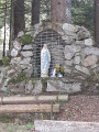
A good climb to get you warmed up as you start this tour in the woods, with several sumptuous panoramic views of the Haute Meurthe woods, before continuing on through the Rupt Frémiat and finishing your route at the Vierge de Haute Suisse.
Saprée Vadrouille in the footsteps of Saint Déodat in Saint-Dié
 Association / Club / Walk leader
 2.50 mi
+72 ft
-72 ft
1h 15
Easy
Departure from Saint-Dié-des-Vosges (Vosges)
2.50 mi
+72 ft
-72 ft
1h 15
Easy
Departure from Saint-Dié-des-Vosges (Vosges)
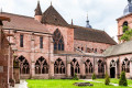
With the Jubilee Year of Hope, since November 2024, our Catholic Church in the Vosges has developed a proposal: "Saprée Vadrouille, travel journal for paths of hope", with three issues per year focusing on liturgical times and the saints of the Vosges.Several itineraries are proposed in the Vosges as local pilgrimages and paths of hope. This is an opportunity to rediscover our region and our local saints throughout the Vosges department. Each itinerary can be done independently of the others, at any time of year. "In the footsteps of Saint Déodat" is the route proposed in the very first "Saprée Vadrouille", which you can discover here.
The rocks of the Kemberg sandstone massif in Saint-Dié
 10.47 mi
+1,929 ft
-1,916 ft
6h 30
Moderate
Departure from Saint-Dié-des-Vosges (Vosges)
10.47 mi
+1,929 ft
-1,916 ft
6h 30
Moderate
Departure from Saint-Dié-des-Vosges (Vosges)
Discover the Kemberg sandstone massif starting from the Saint-Dié SNCF railway station. This hike passes by numerous rocks offering beautiful views of Saint-Dié, the Bure, Ormont and Madeleine massifs and the Meurthe valley.
The five rocks of Kemberg
 8.08 mi
+1,617 ft
-1,611 ft
5h 05
Moderate
Departure from Saint-Dié-des-Vosges (Vosges)
8.08 mi
+1,617 ft
-1,611 ft
5h 05
Moderate
Departure from Saint-Dié-des-Vosges (Vosges)
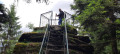
A day hike to discover the Kemberg massif. Several viewpoints from the rocks, secured by railings.
The Schlitteurs climb to Roche du Sapin Sec
 7.25 mi
+1,818 ft
-1,827 ft
4h 55
Moderate
Departure from Saint-Dié-des-Vosges (Vosges)
7.25 mi
+1,818 ft
-1,827 ft
4h 55
Moderate
Departure from Saint-Dié-des-Vosges (Vosges)
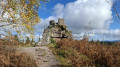
This route invites you to discover the Montée des Schlitteurs, as it is offered to sports enthusiasts every Christmas Eve. It will take you to Roche du Sapin Sec, then to other beautiful rocks with magnificent views, before beginning the descent to Saint-Dié-des-Vosges, its cathedral and the banks of the Meurthe.
Route panoramique autour du Valtin
 3.91 mi
+1,109 ft
-1,122 ft
2h 45
Moderate
Departure from Le Valtin (Vosges)
3.91 mi
+1,109 ft
-1,122 ft
2h 45
Moderate
Departure from Le Valtin (Vosges)
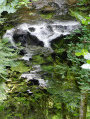
Start by walking through this typical Vosges village. Continue up a challenging climb which, once reached the top, offers a breathtaking panorama of the Valtin glacial valley. Next, literature takes centre stage with over a dozen information panels featuring quotations from great authors: Hugo, Baudelaire, Chateaubriand, Musset and others, leading you to the banks of the Meurthe, which, at this point, is a veritable little torrent. Finish with a peaceful return to the town hall and the village church.
The Three Lakes Route via the Gazon du Faing
9.53 mi
+1,896 ft
-1,900 ft
6h 00
Difficult
Departure from Le Valtin (Vosges)
Starting from the car park at the Auberge du Gazon du Faing, this circular route links three glacial lakes, each with its own distinct character: Lac Blanc, the largest, dominated by the Rocher du Hans and the Belmont Observatory; Lac Noir, wilder and more enclosed; and Lac du Forlet (or Lac des Truites), nestled in a spectacular glacial cirque at an altitude of over 1,060 metres, the highest lake in the Vosges. Between the three lakes, the trail crosses the Gazon du Faing, a nature reserve of tall grasslands and peat bogs, offering breathtaking panoramic views of the Vosges ridges. Around ten kilometres of varied trails, through woodland, along ridges and over rocky outcrops, making for one of the most beautiful hikes in the region.
Circular walk around the three lakes starting from Dreieck
 9.46 mi
+1,617 ft
-1,614 ft
5h 45
Moderate
Departure from Soultzeren (Haut-Rhin)
9.46 mi
+1,617 ft
-1,614 ft
5h 45
Moderate
Departure from Soultzeren (Haut-Rhin)
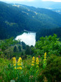
Starting from the Route des Crêtes between the Col du Calvaire and the Col de la Schlucht, this walk begins with a panoramic view of Lac du Forlet from the Crête du Gazon du Faing. The route continues, alternating between woodland and open terrain, taking you to discover Lac Noir, Lac du Forlet (also known as Lac des Truites) and Lac Vert.
Le Tanet and Lac Vert
 4.55 mi
+902 ft
-912 ft
2h 55
Moderate
Departure from Soultzeren (Haut-Rhin)
4.55 mi
+902 ft
-912 ft
2h 55
Moderate
Departure from Soultzeren (Haut-Rhin)
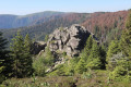
This easy loop allows you to discover Tanet, one of the most beautiful peaks in the Vosges, with stunning views and the Haut-Fourneau stone cairns. In late June or early July, you can also enjoy the mountain flowers. The return journey is sheltered by Lac Vert.
The Belmont viewpoint and Lacs Blanc, Noir and Forlet as seen from the Dreieck
8.90 mi
+1,824 ft
-1,827 ft
5h 40
Moderate
Departure from Soultzeren (Haut-Rhin)
A walk along the ridges of the Hautes-Vosges, taking in both well-known and lesser-known paths. The route passes near three lakes and offers magnificent views of the Alsace plain, the Black Forest and the Alps on clear days. Plenty of blueberries in season.
Four Lakes Circuit
 8.94 mi
+1,860 ft
-1,860 ft
5h 45
Moderate
Departure from Soultzeren (Haut-Rhin)
8.94 mi
+1,860 ft
-1,860 ft
5h 45
Moderate
Departure from Soultzeren (Haut-Rhin)
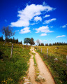
A magnificent circuit on the Vosges ridges with views of the Black Forest and, on clear, dry days, the Alps.
400 m of paved road, the rest on trails or wide paths.
Lac Vert and Lac du Forlet
 Tourist office
 5.24 mi
+1,299 ft
-1,299 ft
3h 35
Moderate
Departure from Soultzeren (Haut-Rhin)
5.24 mi
+1,299 ft
-1,299 ft
3h 35
Moderate
Departure from Soultzeren (Haut-Rhin)
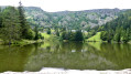
Lac Vert (1,044 m) owes its name to the colour it takes on in summer due to the proliferation of algae. Lac des Truites (or Forlet) is the highest lake in the Vosges mountains at 1,066 m.
Both are located in former glacial cirques dominated by the Hautes Chaumes.