Les Huttes, Col de la Croisette and Roche Pinaud

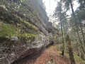
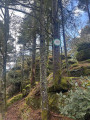
A route taking in the Huttes ponds and their biodiversity, passing through the Vosges forest and exploring Roche Pinaud.

Details

70116749
Creation:
Last update:
Last review:
  • Walking
    Activity: Walking
  • ↔
    Distance: 6.29 mi
  • ◔
    Average duration: 3h 35 
  • ▲
    Difficulty: Moderate

  • ⚐
    Back to start: Yes
  • ↗
    Ascent: + 804 ft
  • ↘
    Descent: - 784 ft

  • ▲
    Highest point: 2,172 ft
  • ▼
    Lowest point: 1,457 ft

Photos

Description of the walk

Start on the Route de Vanémont. Park opposite the farm. 

Red Ring markings

(S/E) Opposite the farm, head right towards Marmonfosse until you reach a three-way junction.

(1) Turn right onto the small road, pass between the houses and continue to another three-way junction.

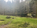
(2) Keep left to walk alongside the two Huttes ponds and discover their biodiversity. Continue along the Route Forestière des Huttes, past the picnic area 

(3) Take the right-hand bend, staying on the forest track and ignoring the paths branching off to the left.

(4) Do the same at the hairpin bend to the right, go round another bend – to the left this time – and reach a T-junction. 

Signpost: Green Rectangle with a white cross

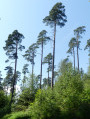
(5) Turn right, then right again at the junction about a hundred metres further on, where the signposting changes. Cross a pine forest and reach the Col de la Croisette. 

(6) Take the path straight ahead, towards La Roche Pinaud, and reach the junction with the Route Forestière d’Érival.

Yellow Ring markings

(7) Head slightly to the right onto the Route Forestière des Hauteurs and follow it for about 1 km. 

Green Triangle signposting

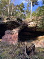
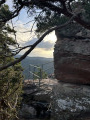
(8) Take the path on the left, heading towards Roche Pinaud. 

(9) Turn back until you reach the junction.

Yellow Ring signpost

(8) Head left until you reach the first junction.

End of signposting

(10) Turn right and continue to a crossroads about a hundred metres further on. Cross the forest track and take a downhill path which quickly turns northwards at the bottom of the valley. Continue straight on to return to the car park (S/E). 

Waypoints

  1. S/E : mi 0 - alt. 1,457 ft - Car park opposite the farm
  2. 1 : mi 0.24 - alt. 1,486 ft - Marmonfosse - Mortagne (rivière)
  3. 2 : mi 1.17 - alt. 1,565 ft - Three-way junction, left
  4. 3 : mi 1.95 - alt. 1,749 ft - Right-hand bend
  5. 4 : mi 2.52 - alt. 1,946 ft - Right-hand bend
  6. 5 : mi 3.25 - alt. 2,172 ft - T-junction
  7. 6 : mi 3.92 - alt. 2,034 ft - Col de la Croisette (623m)
  8. 7 : mi 4.1 - alt. 2,070 ft - Route Forestière des Hauteurs
  9. 8 : mi 4.77 - alt. 2,001 ft - Junction. Roche Pinaud round trip
  10. 9 : mi 4.99 - alt. 1,932 ft - Roche Pinaud (600m)
  11. 10 : mi 5.33 - alt. 1,965 ft - Crossroads
  12. S/E : mi 6.29 - alt. 1,476 ft - Car park opposite the farm

Worth a visit

Ponds and Roche Pinaud. 

Reviews and comments

3.8 / 5
Based on 3 reviews

Reliability of the description
3.7 / 5
Ease of following the route
4 / 5
Route interest
3.7 / 5
jeannebertha
jeannebertha

Overall rating : 2.7 / 5

Date of your route : Oct 19, 2025
Reliability of the description : ★★☆☆☆ Disappointing
Ease of following the route : ★★★☆☆ Average
Route interest : ★★★☆☆ Average
Very busy route : No

Description lacks details regarding the starting point and, above all, the end of the hike.
A local we met told us he was sceptical about the final descent, which we never found!
We had to retrace our steps... swearing, but a little too late, that we would never do that again!

Machine-translated

Philarmer
Philarmer

Overall rating : 4.3 / 5

Date of your route : Sep 15, 2025
Reliability of the description : ★★★★☆ Good
Ease of following the route : ★★★★★ Very good
Route interest : ★★★★☆ Good
Very busy route : No

Shortly after point No. 10 at approximately 8.6 km, it was difficult to find the downhill path leading to the finish line. It is somewhat hidden by branches.

Machine-translated

jlucvosgien
jlucvosgien

Overall rating : 4.3 / 5

Date of your route : Apr 10, 2025
Reliability of the description : ★★★★★ Very good
Ease of following the route : ★★★★☆ Good
Route interest : ★★★★☆ Good
Very busy route : No

A pleasant and varied walk.

Machine-translated

Other walks in the area

For more walks, use our search engine .

The GPS track and description are the property of this route's author. Please do not copy them without permission.