Col de Noirmont, Le Chastel and Pierre de la Roche

A figure-of-eight route to explore a Druidic archaeological site and then the Pierre de la Roche, which is used as a climbing spot.

Details

65991176
Creation:
Last update:
Last review:
  • Walking
    Activity: Walking
  • ↔
    Distance: 3.25 mi
  • ◔
    Average duration: 2h 10 
  • ▲
    Difficulty: Moderate

  • ⚐
    Back to start: Yes
  • ↗
    Ascent: + 768 ft
  • ↘
    Descent: - 784 ft

  • ▲
    Highest point: 2,146 ft
  • ▼
    Lowest point: 1,729 ft

Photos

Description of the walk

Park in front of the cross at the Col de Noirmont.

S/E) Head due east along the path opposite and, after 20 m, follow the path leading uphill to the right: marked with a Red Ring. Reach the Col du Chastel. 

(1) At the junction, take the path on the right for a few dozen metres, then turn left to climb up to Le Chastel.

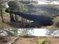
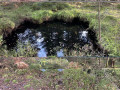
(2) Walk around the archaeological site, including the sacred basin and the southern dolmen, then return to the Col du Chastel.

(1) Opposite, follow the Red Ring markings again; this leads onto a tarmac road, which you should follow to the left to return to the Col de Noirmont.

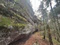
(S/E) Just before reaching the car park, take the path leading uphill to the right, marked with a Yellow Triangle. Cross a forest track and continue straight ahead to reach the Pierre de la Roche.

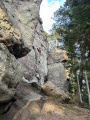
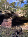
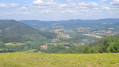
(3) Walk around the site and climb the ladder to admire the view. Then continue to the forest track, which you’ll reach just before the Croix de la Bolle. 

(4) Turn left to return to the Col de Noirmont (S/E).

Waypoints

  1. S/E : mi 0 - alt. 1,785 ft - Col de Noirmont (542m)
  2. 1 : mi 0.55 - alt. 1,909 ft - Col du Chastel (580m)
  3. 2 : mi 0.79 - alt. 2,142 ft - Chastel (648m)
  4. 3 : mi 2.45 - alt. 2,136 ft - Pierre de la Roche (652m)
  5. 4 : mi 2.62 - alt. 1,893 ft - Forest track
  6. S/E : mi 3.25 - alt. 1,781 ft - Return to the Col de Noirmont

Reviews and comments

4.7 / 5
Based on 2 reviews

Reliability of the description
4.5 / 5
Ease of following the route
5 / 5
Route interest
4.5 / 5
jumachris
jumachris

Overall rating : 5 / 5

Date of your route : May 17, 2026
Reliability of the description : ★★★★★ Very good
Ease of following the route : ★★★★★ Very good
Route interest : ★★★★★ Very good
Very busy route : No

A lovely walk with plenty to see... some lovely short climbs... stunning views... honestly, I could have gone on and on 🥰

Machine-translated

lolo54122
lolo54122

Overall rating : 4.3 / 5

Date of your route : May 02, 2025
Reliability of the description : ★★★★☆ Good
Ease of following the route : ★★★★★ Very good
Route interest : ★★★★☆ Good
Very busy route : No

A stunning view from the rock – those with a fear of heights should take care

Machine-translated

Other walks in the area

For more walks, use our search engine .

The GPS track and description are the property of this route's author. Please do not copy them without permission.