


Randobriot

 Visorando Member
 Premium user
 - Gender: man
Sign up:
Published route(s)
 Pointe d'Orsière circular loop from Gutary
 6.45 mi
 +2,717 ft
 -2,740 ft
 5h 20
5h 20
 Difficult
 Departure from Manigod (Haute-Savoie)
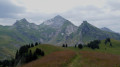
This hike provides access to a panoramic summit without too much difficulty. The trail winds its way through forest and pastures that are full of flowers in spring. At the summit, there is a 360° view of La Tournette, Sulens, Bargy, Aravis (l'Étale), etc. A beautiful, well-marked hike, suitable for families, even if the start is a little steep.
Circular loop of Pointe de Chombas from Les Troncs
 6.81 mi
+4,206 ft
-4,229 ft
7 hrs
6.81 mi
+4,206 ft
-4,229 ft
7 hrs
 Very difficult
Departure from Le Grand-Bornand (Haute-Savoie)
Very difficult
Departure from Le Grand-Bornand (Haute-Savoie)
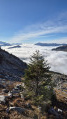
Pointe de Chombas is beautifully situated between Pointe Percée and Mont Charvet. It is a fairly long and technical circular hike, but one that offers exceptional views. You may spot ibex, chamois, or even a wolf.
Tête de l’Arpettaz via the Passage de la Bourse
6.74 mi
+4,311 ft
-4,311 ft
6h 50
Difficult
Departure from La Balme-de-Thuy (Haute-Savoie)
It is a varied hike, part of which takes place through woodland, whilst another section crosses a large cliff face – the Passage de la Bourse – and, after passing through the Ablon mountain pasture, the final stretch leads to a breathtaking panorama, which one would never have suspected during the long ascent. From Lake Geneva to Mont Blanc, from the Chablais to the Bauges and from the Aravis to the Grand Combin, nothing will escape your view.Please read the practical information and the safety warning regarding the Passage de la Bourse carefully.
Chez Liadet - CAF Gros Morond Refuge
 12.78 mi
+1,998 ft
-1,266 ft
7h 35
Difficult
Departure from Mouthe (Doubs)
12.78 mi
+1,998 ft
-1,266 ft
7h 35
Difficult
Departure from Mouthe (Doubs)
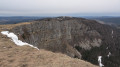
This third stage leads to Mont d'Or, from where the view stretches across the French and Swiss Alps. The route passes by the source of the Doubs, winds through forests and mountain pastures, and climbs to the summit of Mont d'Or before descending to the CAF refuge at Gros Morond.
Pointe de Mandallaz circular route
 6.30 mi
+3,786 ft
-3,780 ft
7 hrs
Very difficult
Departure from Manigod (Haute-Savoie)
6.30 mi
+3,786 ft
-3,780 ft
7 hrs
Very difficult
Departure from Manigod (Haute-Savoie)
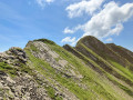
This circular loop circumnavigates the Aiguille de Manigod and takes in varied terrain, ranging from woodland to magnificent flower-filled mountain pastures and a long, demanding ridge. The panorama takes in the local Bornes Aravis massifs and the entire Alpine range from La Meije to the Swiss Alps, via the Mont Blanc massif.
The two peaks of the Roc des Charmieux
 3.95 mi
+2,123 ft
-2,116 ft
3h 40
3.95 mi
+2,123 ft
-2,116 ft
3h 40
 Moderate
Departure from Le Grand-Bornand (Haute-Savoie)
Moderate
Departure from Le Grand-Bornand (Haute-Savoie)
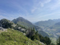
A lovely, easy hike, suitable for children used to walking on mountain trails. It is a round trip. You can simply head for the northern summit, which is the highest. The 360° view from the summits stretches, on one side, across the Aravis with Mont Blanc in the background, and, on the other, across Lake Geneva and the Jura.
Pointe de Talamache circular
 5.98 mi
+3,694 ft
-3,688 ft
6h 00
Difficult
Departure from Thônes (Haute-Savoie)
5.98 mi
+3,694 ft
-3,688 ft
6h 00
Difficult
Departure from Thônes (Haute-Savoie)
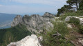
This beautiful circular hike begins in a beech forest that may seem quite steep but is well marked. The alpine pastures, which are full of flowers until mid-summer, quickly come into view. You may encounter ibex on the Crête des Trévelles. The summit is easily reached and offers a beautiful 360° panorama. The descent to Pas de l'Aulp can be daunting but is very well protected.
The Charvin circular loop from Sous l’Aiguille
 8.06 mi
+5,564 ft
-5,607 ft
8h 35
Difficult
Departure from Manigod (Haute-Savoie)
8.06 mi
+5,564 ft
-5,607 ft
8h 35
Difficult
Departure from Manigod (Haute-Savoie)
Mont Charvin is the southernmost peak of the Aravis range. The hike described is quite long and demanding. From the Pas de l’Ours onwards, there is a stunning panorama. The full 360° view takes in the entire Mont Blanc massif, the Chablais, the Oisans and as far as the Vanoise, and even further towards the Gran Paradiso. The summit is hard-earned but well worth the effort. This hike is not recommended for those who are afraid of heights.
⚠️ A user wrote:
> For your information, the via ferrata is ‘open’ from 30 June to 15 October. Outside these dates, the cables are taken down. This was the case on that particular day (17 June).
Saint-Rhémy-en-Bosses - Grand Saint-Bernard Hospice
 3.03 mi
+2,487 ft
-36 ft
3h 35
Moderate
Departure from Saint-Rhémy-en-Bosses (Aosta Valley)
3.03 mi
+2,487 ft
-36 ft
3h 35
Moderate
Departure from Saint-Rhémy-en-Bosses (Aosta Valley)
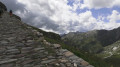
An easy warm-up walk in preparation for a 3/4 tour of Les Combins. From the car park located after Saint-Rhémy, in a hairpin bend at an altitude of 1,730 m, coming from Saint-Rhémy-en Bosses, on Route 27 of the Col du Grand Saint-Bernard. The route follows the Via Alpina Red R117.
Liddes - Cabane de Mille
 3.40 mi
+3,927 ft
-33 ft
5h 00
Difficult
Departure from Liddes (Valais)
3.40 mi
+3,927 ft
-33 ft
5h 00
Difficult
Departure from Liddes (Valais)
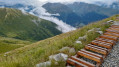
For this second stage, take the bus from the Grand Saint-Bernard Pass Hospice to the village of Liddes. Depart from Liddes and walk through large forest areas and flower-filled mountain pastures to reach the Cabane du Col de Mille.
Cabane de Mille - Cabane Brunet
 4.53 mi
+686 ft
-1,909 ft
2h 40
Moderate
Departure from Liddes (Valais)
4.53 mi
+686 ft
-1,909 ft
2h 40
Moderate
Departure from Liddes (Valais)
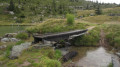
This stage was shortened due to bad weather. The plan was to go via Mont Rogneux. This is a short stage that allows you to avoid Mont Rogneux when it is in thick fog. However, if the weather improves in the afternoon, it is possible to climb from the Cabane Brunet to the Goli des Otanes. You will then walk alongside pastures where Herens cows graze.
Brunet Hut - Panossière Hut
 4.16 mi
+2,815 ft
-1,070 ft
4h 20
Moderate
Departure from Bagnes (Valais)
4.16 mi
+2,815 ft
-1,070 ft
4h 20
Moderate
Departure from Bagnes (Valais)
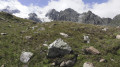
The route passes through the Col des Avouillons before descending to the rest of the Corbassière glacier, which is crossed via a spectacular 200 m long footbridge over a 70 m drop. The high mountains reveal themselves after the pass in a grandiose setting.
Panossière Hut - Chanrion Hut
 9.72 mi
+3,921 ft
-4,501 ft
7h 55
Very difficult
Departure from Bagnes (Valais)
9.72 mi
+3,921 ft
-4,501 ft
7h 55
Very difficult
Departure from Bagnes (Valais)
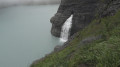
This is a fairly long stage but set against a magnificent backdrop. The Mauvoisin dam is impressive, as are all the waterfalls along the right bank of the lake. The route passes through the easy and beautiful Tsofeiret Pass.
Cabane de Chanrion - Crête Sèche refuge
 5.24 mi
+2,218 ft
-2,448 ft
4h 20
Difficult
Departure from Bagnes (Valais)
5.24 mi
+2,218 ft
-2,448 ft
4h 20
Difficult
Departure from Bagnes (Valais)
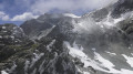
This description differs from the classic Combins tour. This route is not recommended in bad weather. It offers an alternative off the beaten track via the Refuge de Crête Seiche. The atmosphere is alpine, requiring a good level of experience on stony paths and snowfields. The distance may seem short and the elevation gain low, but it is a difficult stage.
Crête Sèche Refuge - Ollomont
 7.76 mi
+2,713 ft
-6,086 ft
5h 55
Very difficult
Departure from Bionaz (Aosta Valley)
7.76 mi
+2,713 ft
-6,086 ft
5h 55
Very difficult
Departure from Bionaz (Aosta Valley)
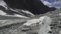
This last stage takes place in an alpine setting. It justifies the choice of this alternative to the classic Tour des Combins. Unfortunately, the consequences of climate change are evident. The glaciers mentioned on the map no longer exist. Only rock piles remain. From the Col du Mont Gelé, the highest point of this trek, you must pay close attention to the path marked by cairns to follow on the descent. The position of these cairns is sometimes erratic. The end of this stage ends with a long and very steep descent, which can be avoided by staying on the pastoral road.
A route around the Combins massif
46.50 mi
+18,724 ft
-19,944 ft
7 days
Difficult
Departure from Saint-Rhémy-en-Bosses (Aosta Valley)
This seven-stage trek around Les Combins differs in a few ways from the classic tour. It allows you to hike in complete tranquillity in a sumptuous and diverse setting between the mid- and high-mountain ranges, where you will climb to over 3,000 metres. You will encounter dozens of marmots, ibex and herds of Herens cows. A few remnants of glaciers add to the alpine atmosphere of this trek, whose highest point is the Col du Mont Gelé at 3,144 metres.
Important note.Plan for two bus journeys on this route.
Day 2: to reach Liddes on thesecond day from the Grand-Saint-Bernard Pass, see the timetable hereDay 7: for the return journey from Ollemont to Saint-Rhémy-en-Bosses, see the bus timetable here
La Roche Parnal and Sous Dîne loop from Les Glières
 11.63 mi
+4,098 ft
-4,094 ft
8h 55
Very difficult
Departure from Le Petit-Bornand-les-Glières (Haute-Savoie)
11.63 mi
+4,098 ft
-4,094 ft
8h 55
Very difficult
Departure from Le Petit-Bornand-les-Glières (Haute-Savoie)
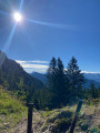
This loop crosses La Roche Parnal and the Sous Dîne mountain. The hike passes through alpine pastures, cools off in the forest and crosses a few rocky passages, but without difficulty. You will encounter ibex, but above all, you will have a 360° panorama almost the entire time, stretching from the Jura to the Aravis and Mont Blanc ranges. However, this is a demanding route due to its length and elevation gain, although there are no technical difficulties. You can also choose to walk in the opposite direction to the one suggested here.
(!) Please read the paragraphs (5): poorly visible trail and (6) cliffs, cables, ridges, ladder, rocky outcrops.
A circular at Le Suet
 4.28 mi
+2,703 ft
-2,703 ft
4h 20
Moderate
Departure from Saint-Jean-de-Sixt (Haute-Savoie)
4.28 mi
+2,703 ft
-2,703 ft
4h 20
Moderate
Departure from Saint-Jean-de-Sixt (Haute-Savoie)
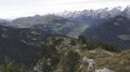
This is a pleasant, easy circular, except for a few steep slopes. It follows forest paths and alpine pastures, with some stony sections. The reward is at the top, where you can enjoy a 360° view: a perfect view of the Aravis and all the snow-capped mountains beyond.
Circular at Pointe Chombas
 7.80 mi
+3,281 ft
-3,307 ft
6h 25
Very difficult
Departure from Le Grand-Bornand (Haute-Savoie)
7.80 mi
+3,281 ft
-3,307 ft
6h 25
Very difficult
Departure from Le Grand-Bornand (Haute-Savoie)
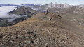
The Aravis valleys are among the classic hiking destinations in Haute-Savoie. Pointe Chombas is a little less well known. Here is a circular route through pastures, forests and rocky areas. Some sections can be dizzying, others involve a bit of climbing but are not difficult. The reward is a little-visited summit offering panoramic views of the Alps, the Jura and, of course, the Mont Blanc range in the foreground.
(!) Please note: some parts of the route are challenging.
 Fenêtre de Sereina
 6.17 mi
+2,930 ft
-2,930 ft
5 hrs
Difficult
Departure from Saint-Rhémy-en-Bosses (Aosta Valley)
6.17 mi
+2,930 ft
-2,930 ft
5 hrs
Difficult
Departure from Saint-Rhémy-en-Bosses (Aosta Valley)
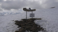
The route starts from the car park at the Saint-Rhémy-en-Bosses ski resort, which is easily reached from Aosta.
You quickly reach the mountain pastures after an initial climb through a larch forest. You pass a group of stone houses with slate roofs at the Arp du Bois Desot. Then, the landscape opens out onto the ridge of a vast mountain pasture which leads easily to the Fenêtre de Serena, where the view stretches across the French and Italian Alps as far as the eye can see.
The pass between Mont Flassin and Testa Cordellaz
 7.97 mi
+4,154 ft
-4,157 ft
6 hrs
Very difficult
Departure from Saint-Rhémy-en-Bosses (Aosta Valley)
7.97 mi
+4,154 ft
-4,157 ft
6 hrs
Very difficult
Departure from Saint-Rhémy-en-Bosses (Aosta Valley)
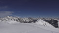
A superb route that begins in a larch forest and continues over a succession of hilltops. The arrival at the pass beneath Mont Flassin offers a phenomenal view. From Gran Paradiso to the Grandes Jorasses, via the Matterhorn and so many others. The panorama is exceptional.
Porte des Aravis
 4.05 mi
+3,507 ft
-3,510 ft
5 hrs
Difficult
Departure from La Clusaz (Haute-Savoie)
4.05 mi
+3,507 ft
-3,510 ft
5 hrs
Difficult
Departure from La Clusaz (Haute-Savoie)
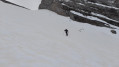
This hike is only worthwhile when the La Clusaz resort is closed, as parts of the route follow groomed and busy ski runs. It is a demanding hike rated 2.3 with gradients of around 35° over the final 200 metres. The view opens up to the Mont Blanc range on one side and the Jura on the other. You may spot a few chamois along the route.
The Col de la Forclaz from Entremont to Le Petit Bornand
 7.27 mi
+3,100 ft
-3,707 ft
6h 05
Difficult
Departure from Entremont (Haute-Savoie)
7.27 mi
+3,100 ft
-3,707 ft
6h 05
Difficult
Departure from Entremont (Haute-Savoie)
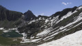
In the commune of Glières-Val-de-Borne, in the Bargy massif, Lac de Lessy is a true gem at the foot of the Pic de Jalouvre. The walk takes you through forests and mountain pastures. It features a short rocky section. The start from La Joux and the return via Montagne de Paradis and Cocogne are what make this walk unique. You pass the two-hundred-year-old hamlet of Les Chalets de Mayse. The Chalet de Lessy is nestled on the lakeside after the Col de la Forclaz.
A circular walk around Lake Lessy and the Aiguille Verte de Chinaillon from La Culaz
 7.05 mi
+3,241 ft
-3,228 ft
6h 05
Difficult
Departure from Le Grand-Bornand (Haute-Savoie)
7.05 mi
+3,241 ft
-3,228 ft
6h 05
Difficult
Departure from Le Grand-Bornand (Haute-Savoie)
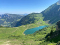
The circular route described here follows trails that are less frequented than the traditional ascents to Lac de Lessy or L’Aiguille Verte. Setting off early in the morning allows you to reach the area above the Chalets de Mayse whilst enjoying the coolness of the forest. The arrival at the Col de la Forclaz may also be in the shade. The Aiguille Verte and the Pointe de Domingit offer a panoramic view of the Aravis range, with the Mont Blanc massif visible in the background. The descent to the La Gaudunière junction is busier, but further on you’ll find greater solitude – the price you pay being a fairly steep descent before returning to the starting point.
The Trou de la Mouche circular loop via three valleys
 6.30 mi
+3,593 ft
-3,586 ft
6h 00
Very difficult
Departure from La Clusaz (Haute-Savoie)
6.30 mi
+3,593 ft
-3,586 ft
6h 00
Very difficult
Departure from La Clusaz (Haute-Savoie)
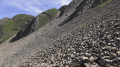
This hike is challenging, but it takes you off the beaten track between the Tardevant and Paccaly valleys. You’ll cross three valleys: Tardevant, Paccaly and Grand Crêt. And, of course, you’ll be treated to panoramic views of the Mont Blanc range on one side and the Jura on the other. In early summer, the flora here is extremely varied, helping you to forget a few tricky sections on the scree slopes.
Pointe Dzérat
 3.33 mi
+2,303 ft
-2,310 ft
3h 30
Very difficult
Departure from Le Reposoir (Haute-Savoie)
3.33 mi
+2,303 ft
-2,310 ft
3h 30
Very difficult
Departure from Le Reposoir (Haute-Savoie)
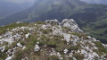
This hike is very demanding and requires good navigational skills. The Pointe Dzérat is usually reached by climbing, but the route followed here is manageable for experienced hikers. The reward is a 360° panorama at the summit. It is a round trip from the Col de la Colombière.